
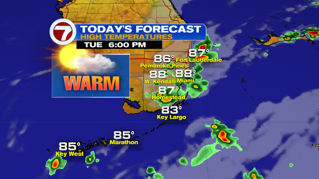
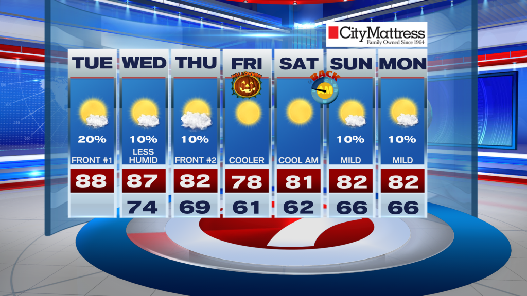
We have one last humid day on tap for South Florida before a series of fronts usher in a “Fall Feel” for the rest of the week.
For your Tuesday, expect a mix of sun & clouds with highs back in the lower upper-80s. A few showers are possible this afternoon as our first front pushes across the Sunshine State.
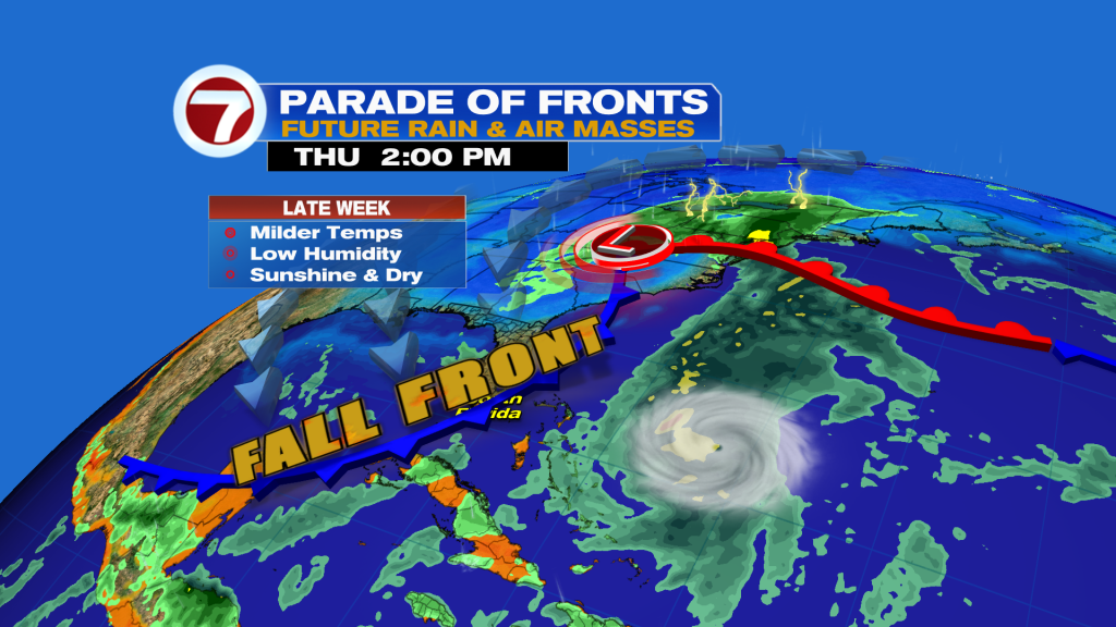
The strongest cold front so far this Fall will sweep across South Florida on Thursday. Behind it, it will feel amazing with low humidity and lots of sun.
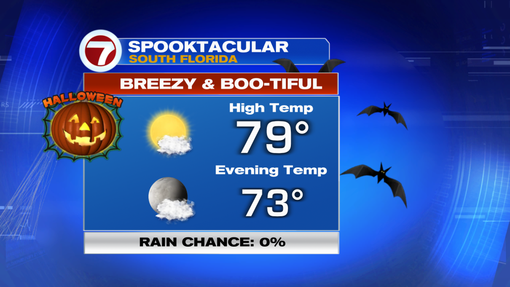
Highs will dip in the 70s for Halloween and lows will fall into the lower 60s with 50s inland!
Gorgeous weather will continue through this weekend and into early next with cool and clear mornings, and warm & sunny afternoons.
 Tropical Update
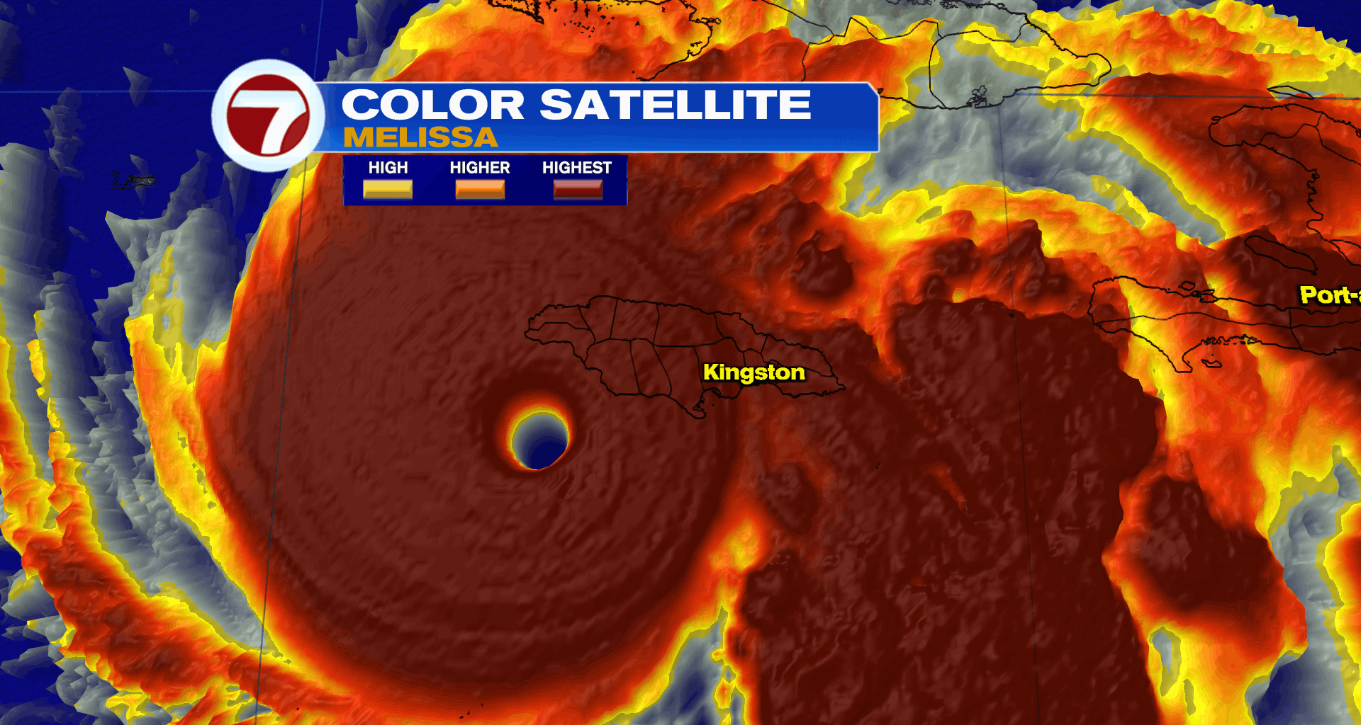
The big story today is Hurricane Melissa.
As of this morning, Melissa remains a catastrophic Category 5 hurricane with 175 MPH winds.
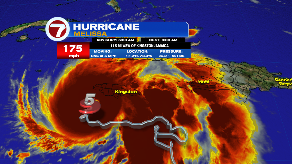
Melissa is forecast to being a historic hurricane strike to Jamaica later today. Life-threatening flooding and mudslides, hurricane force winds, and storm surge will cause widespread devastation across the Island Nation.
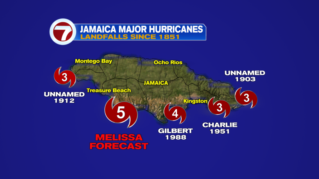
Melissa is forecast to be the strongest hurricane to ever hit Jamaica as a Category 5 hurricane today. The last major hurricane to make landfall in Jamaica was Hurricane Gilbert in 1988.
After Jamaica, Melissa is forecast to strike eastern Cuba tonight, and then impact the Bahamas as a significant hurricane on Wednesday.
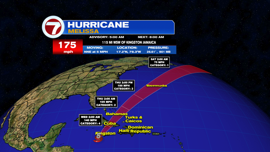
Melissa is also forecast to bring hurricane conditions to Bermuda Thursday into Friday before heading out to sea.
Join our Newsletter for the latest news right to your inbox