Rainfall deficits of 10–15 inches and extreme drought conditions are impacting water levels, fire danger and the region’s landscape.
TAMPA, Fla. — A prolonged dry stretch is fueling a significant drought across the Tampa Bay area, with conditions now ranking among the most impactful in more than a decade.
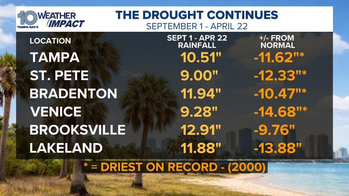
Since Sept. 1, Tampa has recorded just 10.51 inches of rain — more than 11 inches below normal. Similar deficits of 10 to nearly 15 inches are being reported across the region, with some locations seeing their driest start to the dry season on record.
Last year’s rainy season ended on a drier note, with rainfall deficits beginning to develop in September and persisting through the fall and winter months continuing right through April. That extended dry pattern has helped set the stage for the current drought conditions now firmly in place across the region.
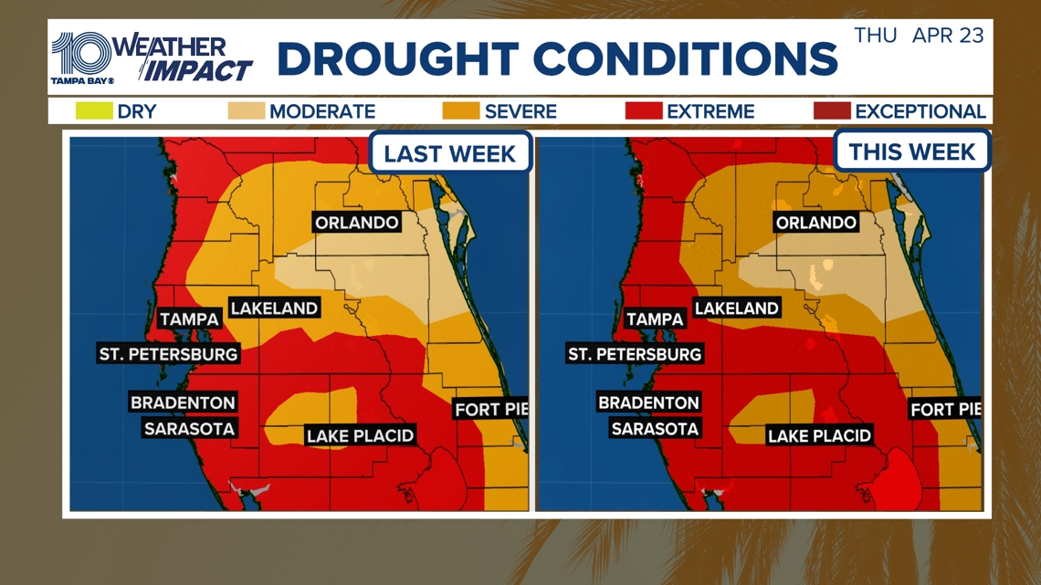
According to the latest data from the National Weather Service and U.S. Drought Monitor, moderate to extreme drought now covers much of west-central and southwest Florida. This is the highest coverage of extreme drought in the Tampa Bay area since 2012.
The impacts are becoming more visible. Rivers, lakes and ponds remain well below normal levels, and groundwater in some areas is near record lows for this time of year. In parts of the Withlacoochee River Basin, seasonal wetlands have dried up entirely.
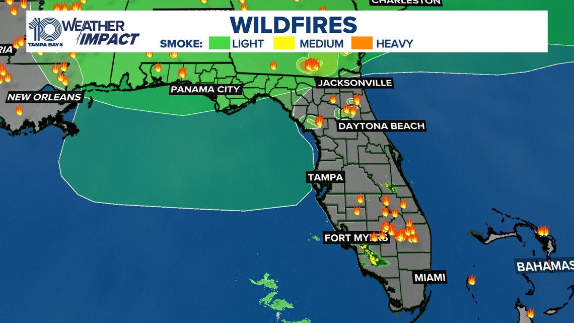
The drought is also increasing wildfire risk. Dry vegetation, warm temperatures, and occasional gusty winds, combined with the naturally dry time of year, have led to ongoing brush fires and burn bans across multiple counties. This period represents the peak of fire season in West Central and Southwest Florida, when fuels are most dry and any ignition can spread quickly.
Even with a few recent showers, meaningful relief has been limited. Much of the rainfall is quickly absorbed by dry soils and vegetation, doing little to erase the long-term deficit.
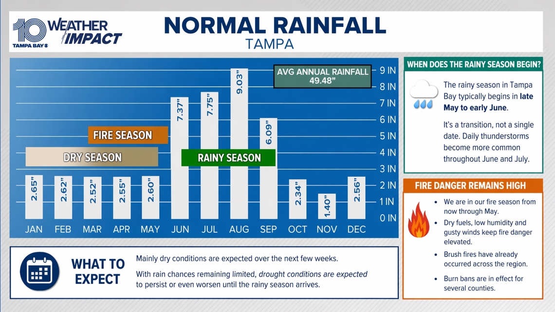
Looking ahead, mainly dry conditions are expected to continue in the coming weeks. In general, the region’s rainy season does not reliably begin until mid-to-late May, with Southwest Florida typically starting around May 15 and the rest of West Central Florida around May 25. However, the transition is gradual, and some years take longer than others for daily thunderstorms to become established.
The most consistent rainfall usually arrives by early to mid-June, when tropical moisture, sea breeze interactions and increased atmospheric humidity support near-daily storm development. Until then, drought conditions can persist, and in some cases worsen, before seasonal recovery begins.