
ORLANDO, Fla. – After a comfortable start to the morning, today begins what will be the first leg of sweltering temperatures this week.
Plan for afternoon highs to warm into the upper 80s and low 90s along the coast, and into the mid 90s inland.
CLICK TO DOWNLOAD THE FOX LOCAL APP
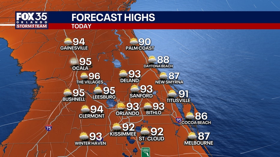
While it will be unseasonably hot, today’s temperatures will still be a few degrees below previous record highs.
It’s also worth noting that humidity and moisture levels won’t be nearly as high as what’s normally seen during the summer months. That means our heat indices (feels-like temperatures) won’t be nearly as uncomfortable, though you’ll probably still break a sweat if you spend more than just a few minutes outdoors.
Stay hydrated and stay cool!
SIGN-UP FOR FOX 35’S BREAKING NEWS, DAILY NEWS NEWSLETTERS
Partly cloudy skies overnight. Temperatures will be mild, dipping down into the upper 60s and low 70s.
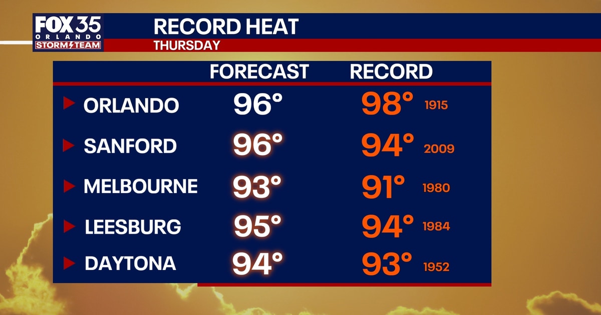
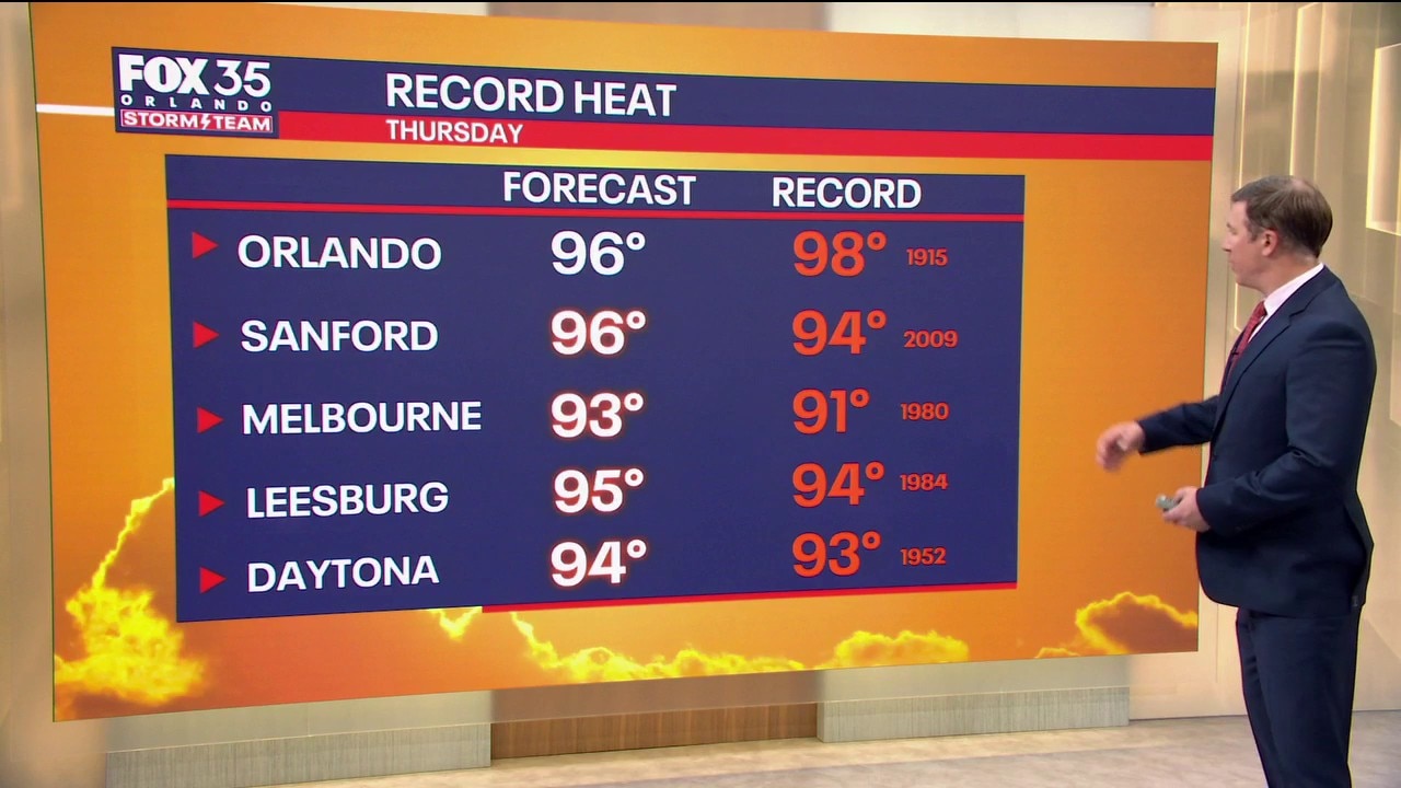
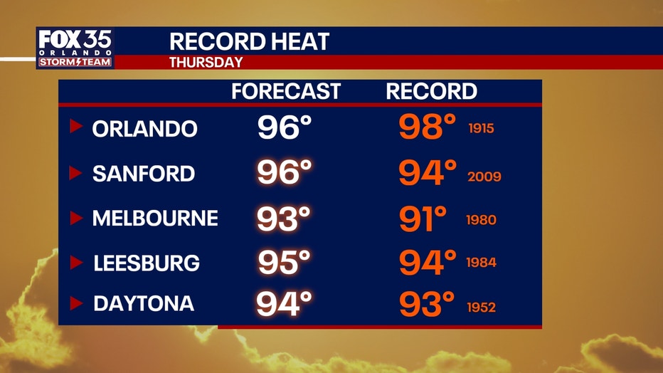
Record heat is likely across Central Florida Thursday, which is what’s set to be the hottest of the next several days.
Highs will soar into the mid and upper 90s tomorrow afternoon.
The mid-90 temperatures will continue Friday, with a slim (20%) chance of a few isolated afternoon showers and downpours.
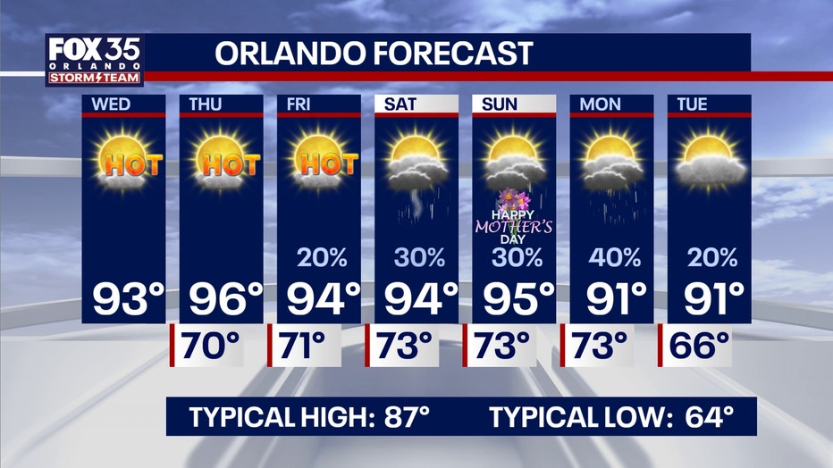
By this weekend, a cold front will stall to our north, allowing the heat and low amounts of moisture to build into the region. This will keep high temperatures in the 90s through early next week.
Isolated to scattered afternoon sea breeze-driven showers and storms are in the cards for both Saturday and Sunday. While it won’t be a washout, pockets of heavy rain and frequent lightning are possible.
Higher chances of rain will exist Monday as a weak cold front shifts into the region, bringing highs back down to the mid 90s.
The Source: Information used in this story was provided by the FOX 35 Storm Team.