
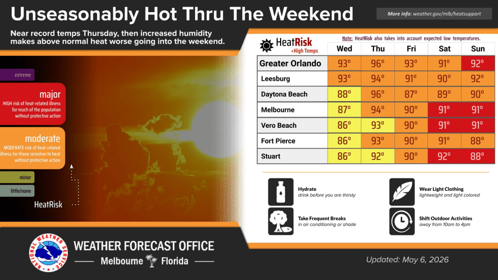
Very hot weather is on its way to Central Florida.
Wednesday’s skies are mostly sunny with a high near 93 degrees, according to NWS Melbourne.
Winds are blowing south to southeast at 5 to 10 mph.
There is a moderate risk for rip currents at all Central Florida beaches.
In the evening, temperatures will cool into the 70s, skies will be partly cloudy and winds will blow south at 5 to 10 mph.
Looking ahead, all Central Florida counties are on a fire weather watch from 12 p.m. to 8 p.m. on Thursday, according to NWS Melbourne.
Winds are expected to blow southwest at 15 mph with gusts up to 25 mph. Humidity is expected to be down to 25 percent to 35 percent, contributing to critical fire weather conditions.
Temperatures are also expected to increase the next few days, peaking in the 90s and near records on Thursday.
The heat will result in widespread moderate HeatRisk impacts across the region.
Weekend temperatures will be slightly cooler but thanks to increased moisture, localized areas will have major HeatRisk.