
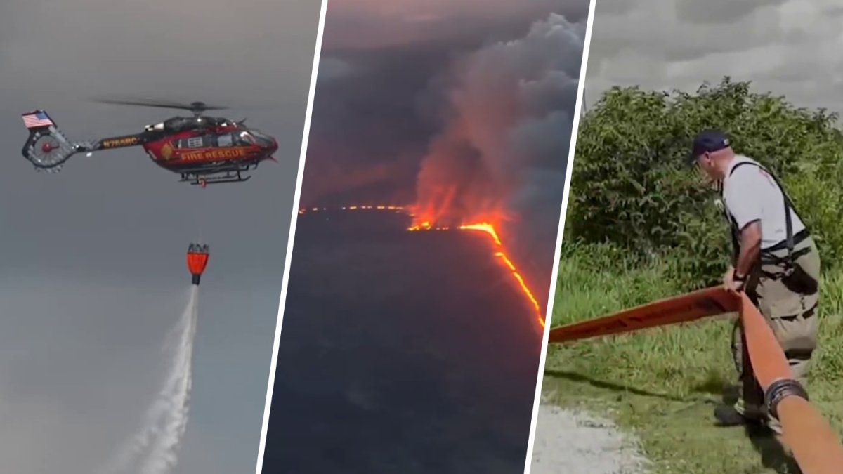
Tuesday may bring some much needed rainfall as the firefight continues to contain a blaze that has burned thousands of acres in western Miami-Dade and Broward counties.
Fire rescue crews have been working to put out the Max Road fire, located west of U.S. 27. As of Tuesday night it had burned 11,090 acres and was 60% contained, according to the Florida Forest Service.
Miami-Dade Fire Rescue officials said they first received reports of a brush fire near North Krome Avenue and Northwest 186th Street on Sunday. More than 12 of their units arrived at the scene, and air rescue began water drops.
Agencies including MDFR, the Florida Forest Service and Broward Sheriff’s Fire Rescue are working together to protect nearby properties and surrounding areas. Residents are encouraged to monitor road closures.
With a frontal boundary approaching the area today, scattered to numerous thunderstorms are expected this afternoon into evening. A few storms may be strong to severe. Heavy rain may also result in localized flooding across the east coast metro. #FLwx pic.twitter.com/zasqyw8C55
— NWS Miami (@NWSMiami) May 12, 2026
No injures have been reported.
Meanwhile, officials warned that another blaze in Florida City caused low visibility on U.S. 1. It was 300 acres and 50% contained as of Monday afternoon.
Smoky conditions and much-needed rain
Hot and humid conditions continue across South Florida, with a round of afternoon thunderstorms expected Tuesday and Wednesday.
“While the rainfall may assist in firefighting efforts,” Miami-Dade Fire Rescue’s Public Information Officer Erika Benitez warned on Monday, “it may also cause smoke and haze to settle closer to the ground, potentially impacting some of the nearby communities.”
The National Weather Service urges caution for sensitive groups such as children, the elderly and those with compromised immune systems, as exposure to air pollutants can cause headaches, difficulty breathing, irritate eyes and sinuses, and more.
The breeze is expected to pick up in the afternoon and push north, which could lead to smoky conditions in areas like Weston, NBC6 meteorologist Adam Berg said.
Additionally, the storms could be on the strong side, with damaging wind gusts looking like the primary impact. Residents should watch for frequent lightning and heavy rain.
NBC6’s Adam Berg has your forecast for today, Tuesday, May 12, 2026.
Neighbor readies for emergency evacuation
Audrey Gonzalez has lived in Holly Lake Mobile Park, a neighborhood west of Pembroke Pines, for 35 years. She said wildfires in the area are not unusual, but this one felt different.
“This is one of the worst we’ve had so far in the time I’ve been here,” she said Monday. “Normally there are smaller ones, and they’ll do what they have to do and they put themselves out. But this one moved pretty fast, and that’s what was concerning.”
Gonzalez shared video from her backyard, showing flames visible in the distance as helicopters monitored the fire from above. Police said fire crews were stationed along the perimeter of the Holly Lake community to monitor conditions.
Gonzalez said she already has an evacuation plan.
“The first thing I do as you can see, I have a hose, I go out there and water everything down like I did this morning,” she said. “And then I have all my papers and everything that’s important in a certain spot, where if I do have to go, it’s just a matter of picking it up and going.”
Resident Miyra Snyder said she’s concerned for her vulnerable neighbors.
“The situation is very worrisome because the majority of the community is an elderly community. A lot of them have been living here for decades, and some of them were crying, and they were worried,” she said.
She said firefighters reassured residents that there are currently no evacuation orders in place, but many are still remaining cautious.
“However wind can change anytime,” Snyder said.