
ORLANDO, Fla. – Our Sunday morning begins on a summer-like note across Central Florida. It’s already a warm and muggy start to the day and these conditions will continue throughout the day.
High temperatures today will climb into the upper 80s along the coast and closer to the low 90s inland. By mid to late afternoon, shower and storm chances will be on the rise, a few of which could be on the strong side.
Isolated downpours will begin to pop up on the radar by 2-3pm near the Gulf coast, with the highest chances of storms taking place from 4pm-8pm. After sunset, the storms will weaken and lose their steam, becoming disorganized.
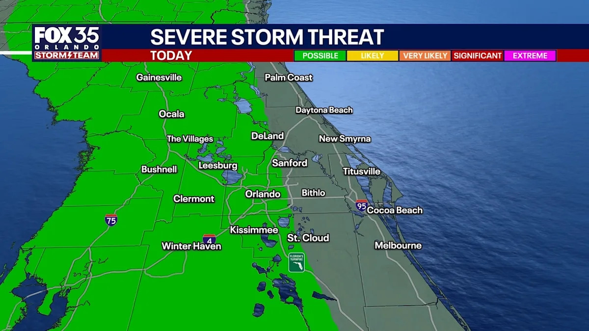
By midnight, any lingering showers or storms will quickly fade. Not everyone will see the rain and storms today, either. The highest chances will be, once again, near and along the I-75 corridor and points east to roughly Florida’s Turnpike corridor.
That means most areas along the Atlantic coastline will stay on the drier side most of the day. In terms of strong and severe storms, a low level 1 out of 5 risk exists for areas west of the I-95 corridor. Strong winds of 50–60 mph will be the primary impact, with pockets of small hail possible.
The risk of any rotating storms leading to weak tornadoes will be very low.
What will the weather look like tonight?
What to Expect
Any lingering showers and storms will fade around midnight. It will be very muggy and mild overnight, especially for those who see the rain. Plan for Monday morning lows to fall into the low to middle 70s.
Looking ahead
What to Expect
The new work week features hot and seasonal temperatures with highs near 90 degrees just about each and every day this week.
With daily afternoon downpours and storms on the way as well, this seems to be the gradual switch and changeover to more of a rainy-season pattern across Central Florida.
The Source
This story was written based on information provided by FOX 35 meteorologist Jessica Dobson on May 17, 2026.