
WEST PALM BEACH, Fla. (WPEC) — South Florida will continue to see a typical late-spring pattern through the holiday weekend, with scattered to numerous afternoon showers and thunderstorms focused mainly across the interior.
A steady east to southeast breeze will push storms inland each afternoon, keeping rain chances lower along the east coast metro while increasing activity farther west. The highest coverage of storms will be across inland communities, where rain chances climb as high as 40-50%.
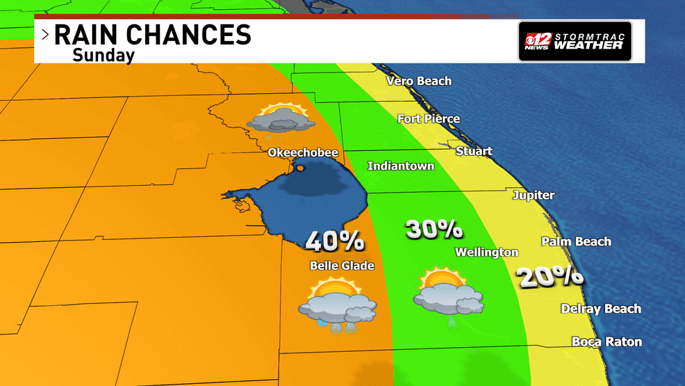
Stormier afternoons ahead as tropical moisture builds across South Florida. (WPEC)
While widespread severe weather is not expected, stronger storms could still produce gusty winds, frequent lightning, and brief heavy downpours. Storm activity will gradually fade during the evening hours each day.
Heat and humidity remain another major concern. Afternoon temperatures will rise into the upper 80s near the coast and the low to mid-90s across inland communities. Combined with humidity, heat index values will climb into the upper 90s and lower 100s each afternoon through early next week.
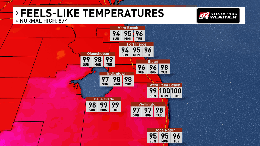
Stormier afternoons ahead as tropical moisture builds across South Florida. (WPEC)
At the beaches, a high risk of rip currents continues along Atlantic beaches through at least early next week, creating dangerous swimming conditions.
The next weathermaker
The weather pattern becomes increasingly active during the middle of next week as deeper tropical moisture moves into the region. This could lead to periods of heavier rainfall and more widespread thunderstorm coverage across South Florida.
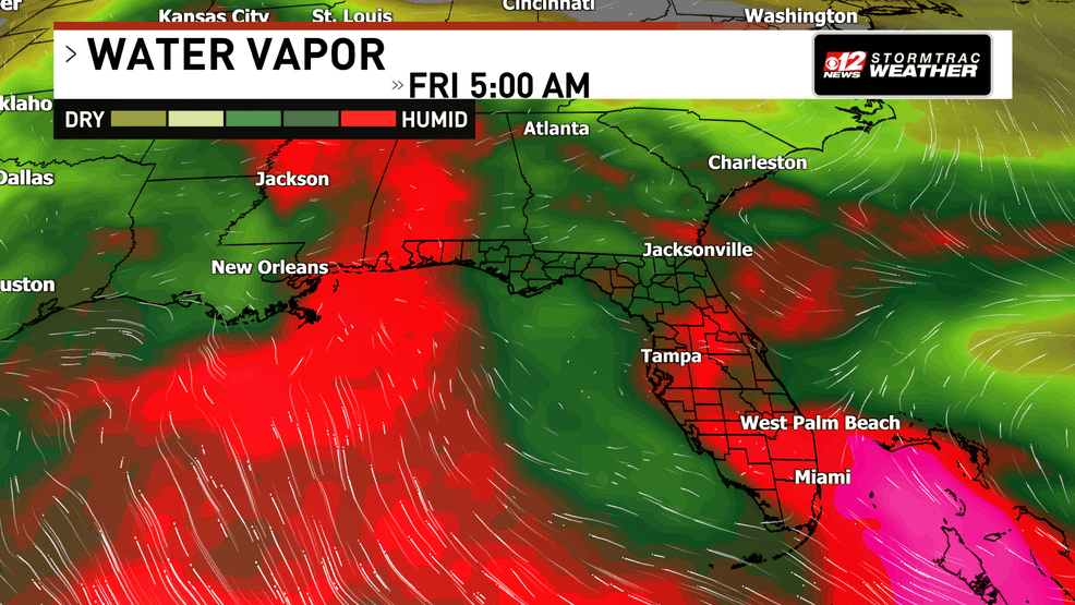
Stormier afternoons ahead as tropical moisture builds across South Florida. (WPEC)
There is some chatter about the chances for this area to develop into a tropical system. The chances for this area to see any development into a tropical system are very low.
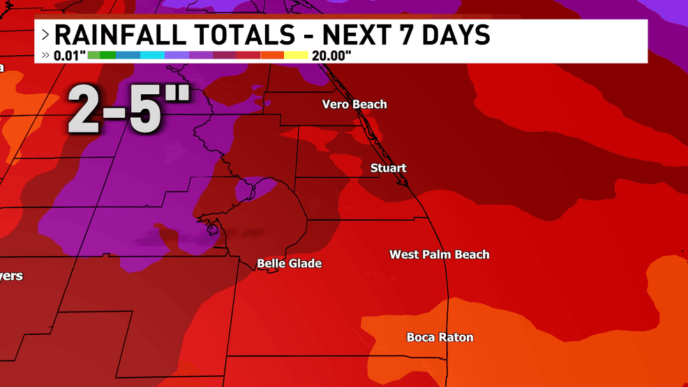
7 day rainfall totals. (WPEC)
Even if those chances materialized, the area of low pressure wouldn’t see any development until off of the Florida coast, traveling north towards the Carolinas.