
Off-and-on rain showers through Thursday across Central Florida
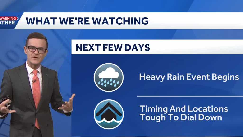
SHINE THE LIGHT FOR ALL OF US. OKAY. BECAUSE, YEAH, WE. THIS FORECAST IS NOT THAT GREAT. I LOVE IT BECAUSE WE’RE LIKE, YAY! SUMMER RAIN. HERE WE ARE. OKAY, THE NEXT SEVEN DAYS, I’VE GOT A SIGNIFICANT RAIN EVENT FOR CENTRAL FLORIDA. AND WHILE THE TIMING AND LOCATIONS OF THE HEAVIEST RAIN OVER THE BROAD SCOPE ARE DIFFICULT TO DIAL DOWN, WE CAN REALLY DIAL IT DOWN KIND OF DAY BY DAY. RIGHT. SO LET’S JUST START OFF BY STEPPING BACK. OKAY. THERE’S A 70 TO 80% COVERAGE OF RAIN AND RIGHT THROUGH TO NEXT WEEK, WE’RE CALLING IT IMPACT WEATHER BECAUSE OF THE 70 TO 80% COVERAGE OF RAIN. HERE’S 3:00 THIS AFTERNOON. BIG SWATH OF MOISTURE OUT IN THE GULF. OBVIOUSLY HELPING TO INVIGORATE OUR AFTERNOON SHOWERS AND STORMS. THERE’S A WIDESPREAD COVERAGE. THEN WE LOOK AT TOMORROW MORNING RELATIVELY QUIET. TOMORROW AFTERNOON WE GET THOSE WIDESPREAD RAINS. THEN WE LOOK AT SATURDAY MORNING AND NOTICE SATURDAY MORNING DOES INCLUDE RAINFALL, ESPECIALLY IN OUR WESTERN AREAS. AND THEN OF COURSE THROUGH THE AFTERNOON WE GET THAT WIDESPREAD RAIN. THEN SUNDAY MORNING. SAME IDEA. IF YOU’VE GOT OUT AND ABOUT PLANS ON SUNDAY, IT’S NOT GOING TO BE THE QUIETEST. WE DO SEE THE RAIN FALL AROUND AND THAT CONTINUES INTO THE AFTERNOON. SO THE ESSENTIAL IDEA HERE IS WE’RE ALL GOING TO BE IN ON IT. THERE’S JUST WAVES OF RAIN KIND OF GETTING THROWN OUR DIRECTION FROM THE GULF. AND OVER THE NEXT SEVEN DAYS TIME, WE’RE FORECASTING FOR MOST OF US, 3 TO 5IN OF RAINFALL EACH DAY WE’LL HAVE A DIFFERENT KIND OF FOCUS. BUT KNOW THAT NO MATTER WHICH DAY YOU PLAN FOR THIS WEEKEND. IT’S GOING TO BE STORMY. RIGHT. KIND OF MORNING, NOON AND NIGHT. SO THIS MORNING, WE’RE NOT TRACKING ANY RAINFALL OUT IN OUR AREA CURRENTLY, BUT THE ROADS ARE SLICK. AND I DO THINK BY EIGHT, NINE, 10:00, ESPECIALLY IN OUR WESTERN AREAS, WE’LL HAVE A FEW SHOWERS THAT WILL NEED TO DEAL WITH OUTSIDE THIS MORNING. HERE’S A KIND OF PARTLY CLOUDY SKY OVER TO VARIES CURRENT TEMPERATURES SITTING IN THE 70S. HERE’S A LIVE RADAR. YOU CAN SEE RAIN IS MOVING OFF THE SHORELINE. THERE’S EVEN A COUPLE OF STORMS KIND OF WORKING OUT NEAR CRYSTAL RIVER, LAKE CITY, EVENTUALLY UP NEAR GAINESVILLE. THAT’S NOT BOTHERING US. WE’RE ACTUALLY NICE AND QUIET AT THE MOMENT, BUT YOU SEE THIS MASSIVE CLOUD. ALL OF THAT IS GOING TO BE PUSHING OUR DIRECTION, GIVING US A HIGH COVERAGE OF RAIN. ALL RIGHT, SO THE COLOR CODE HERE, ORANGE AND RED, THAT’S GOING TO BE WHERE IT’S HIGHEST. AND IF YOU NOTICE PUSHING OVER TOWARD BREVARD COUNTY IN THE METRO, THAT’S WHERE WE’VE GOT THE HIGHEST COVERAGE OF RAINFALL. SO KEEP THAT IN MIND. WHAT’S HAPPENING IS WE’VE GOT ALL THIS GULF MOISTURE, BUT THERE’S THIS FRONT TO THE NORTH THAT’S TRAPPING IT OVER TOP OF US. THAT’S WHY IT’S GOING TO BE SO WET. WE’VE KIND OF GOT THIS UNIQUE SPLIT OF WEATHER PATTERNS. SO IT’S A WIDE SWATH OF RAIN. AND WE’VE GOT IMPACT WEATHER THE NEXT SEVEN DAYS. AND I DON’T SAY THAT TO BE HYPER. I’M JUST SAYING THAT BECAUSE THIS IS REALLY GOING TO BE SEVEN DAYS OF A WHOLE LOT OF RAIN AROUND. SO MEGAN, YOU AND I ARE GOING TO
Off-and-on rain showers through Thursday across Central Florida

Updated: 6:00 AM EDT May 28, 2026
Damp start on Monday after overnight rains, and plenty more wet weather is expected ahead. The next 7 days are all highlighted as Impact Weather Days due to widespread rain chances each day from a deep tropical moisture flow sitting right over Central Florida.Unlike the typical summer setup, rain could develop during nearly any part of the day — not just the afternoon hours.Right now, the main concern is localized flooding in areas that see repeated rounds of heavy rain.The tropics remain quiet, with no development expected over the next 7 days.First Warning Weather Stay with WESH 2 online and on-air for the most accurate Central Florida weather forecast.RadarSevere Weather AlertsDownload the WESH 2 News app to get the most up-to-date weather alerts. The First Warning Weather team includes First Warning Chief Meteorologist Tony Mainolfi, Eric Burris, Marquise Meda, Cam Tran and Victoria Wisniewski.>> What is Impact Weather?Impact Weather suggests weather conditions could be disruptive or a nuisance for travel and day-to-day activities.
ORLANDO, Fla. —
Damp start on Monday after overnight rains, and plenty more wet weather is expected ahead.
The next 7 days are all highlighted as Impact Weather Days due to widespread rain chances each day from a deep tropical moisture flow sitting right over Central Florida.
Unlike the typical summer setup, rain could develop during nearly any part of the day — not just the afternoon hours.
Right now, the main concern is localized flooding in areas that see repeated rounds of heavy rain.
The tropics remain quiet, with no development expected over the next 7 days.
First Warning Weather
Stay with WESH 2 online and on-air for the most accurate Central Florida weather forecast.
Download the WESH 2 News app to get the most up-to-date weather alerts.
The First Warning Weather team includes First Warning Chief Meteorologist Tony Mainolfi, Eric Burris, Marquise Meda, Cam Tran and Victoria Wisniewski.
>> What is Impact Weather?
Impact Weather suggests weather conditions could be disruptive or a nuisance for travel and day-to-day activities.