
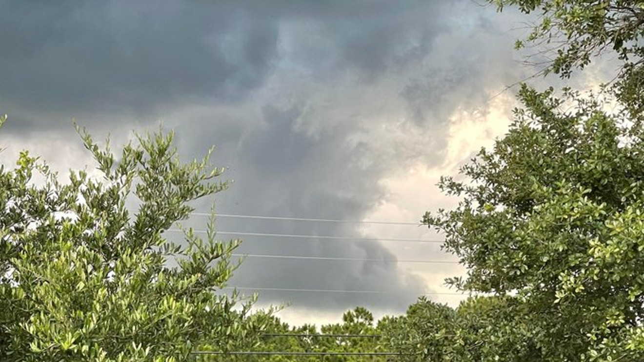
WEST PALM BEACH, Fla. (WPEC) — South Florida will remain hot, humid, and unsettled through the weekend, with daily opportunities for showers and thunderstorms.
Weekend heat peaks as daily storm chances continue across South Florida. (WPEC)
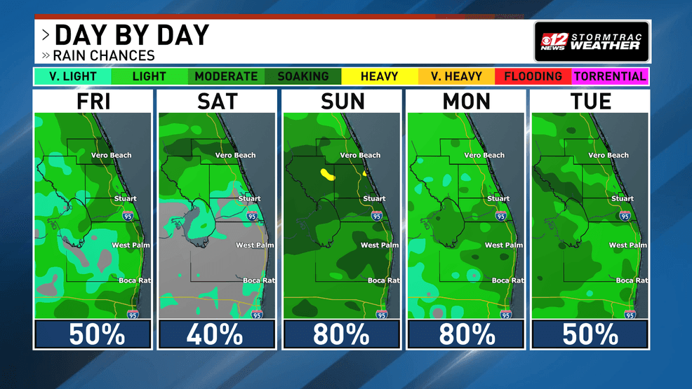
Deep tropical moisture remains in place across the region, helping fuel scattered storms this afternoon and evening. Storms are expected to develop along sea breeze boundaries—winds moving inland from the coast—and may become more widespread later in the day as those boundaries collide. Additional storms could also drift south from Central Florida during the evening hours.
Weekend heat peaks as daily storm chances continue across South Florida. (WPEC)
Saturday may offer a brief break from the more widespread storm activity. Drier air higher in the atmosphere could limit the number of storms that develop, although scattered showers and thunderstorms are still expected, especially along the east coast.
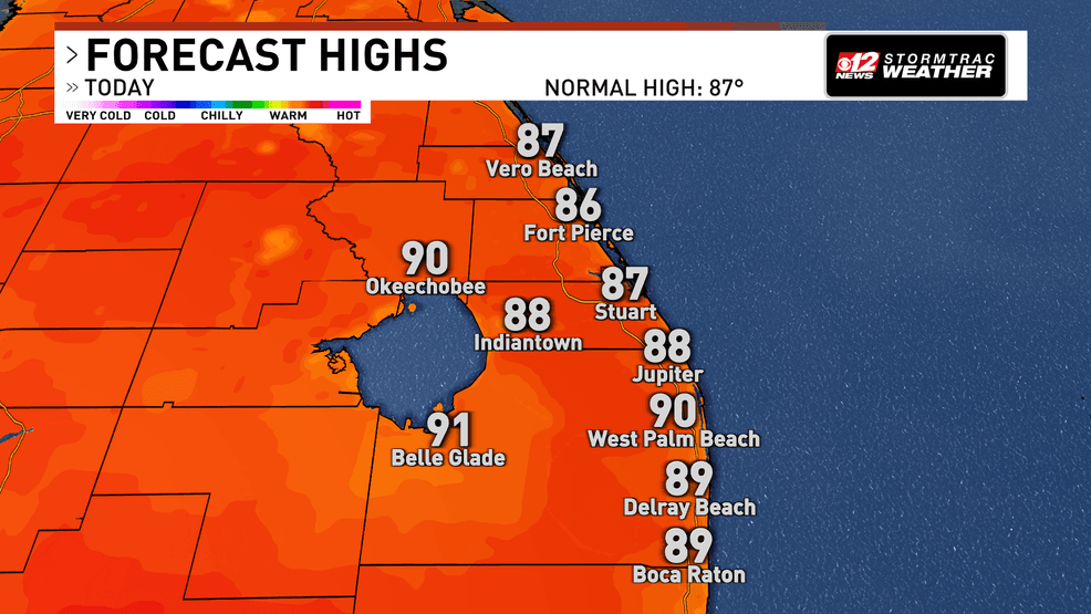
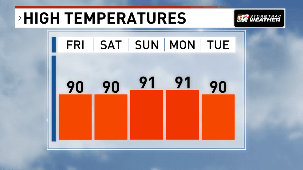
The biggest story will be the heat. Afternoon temperatures will climb into the upper 80s and low 90s through the weekend, while humidity pushes heat index values into the low 100s. Sunday and Monday are expected to be the hottest days, with some locations feeling as hot as 105 degrees during the afternoon. This level of heat can increase the risk of heat-related illness for people spending extended periods outdoors without adequate hydration or cooling.
Weekend heat peaks as daily storm chances continue across South Florida. (WPEC)
Comment with Bubbles
BE THE FIRST TO COMMENT
Rain chances increase again Sunday and Monday as deeper moisture returns and a front slowly approaches from the north. Showers and thunderstorms will become more numerous, especially along the east coast and during the afternoon and evening hours.