
TALLAHASSEE, Fla. (WCTV) – We stay warm and muggy to kick off June, but a noticeable change is knocking on the door. Meteorologist Cameron Aaron explains.
Tonight Through Monday Night
Scattered showers and thunderstorms are possible for Sunday evening, mainly before midnight. We are expecting a drying trend for the overnight as lows stay mild and muggy. We dip into the low-70s under a partly cloudy sky.
A warm Monday is on tap across the region. Highs climb into the low-90s under a mix of Sun and clouds. During the afternoon and evening, we are anticipating some of those random, pop-up showers and storms. However, the better chance should stay in our southern and western counties.
We are mostly quiet for Monday night. Lows settle in the low-70s under a partly cloudy sky.
One More Muggy Day Before Some Relief
Moisture will stay high on Tuesday before a brief change.
The first half of Tuesday is looking dry, muggy and warm. Highs top out in the low-90s under a mix of Sun and clouds. During the afternoon and evening, we are tracking another round of scattered showers and thunderstorms.
A couple of storms could pack a punch with heavy rain, gusty winds and lots of lightning. A Level 1 Marginal risk of severe weather is in place. The threat is low, but it is not zero, so stay weather aware.
Temperatures dip into the upper-60s and low-70s for Tuesday night under a mostly cloudy sky.
Extended Forecast
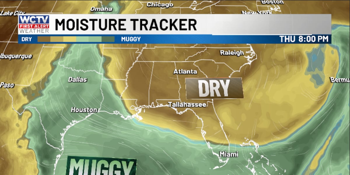
For the middle of the week, all eyes are on some drier air.
Dew points are looking much lower for Wednesday, Thursday and Friday. As the moisture drops, you will notice a drier feel to the air.
Wednesday is looking breezy and partly sunny. A stray shower is possible, but rain chances stay rather low. Highs top out in the mid-80s, with lows in the low-60s.
Thursday and Friday are looking very nice for early June. The forecast is looking dry, mostly sunny and not as muggy. Highs top out in the upper-80s to low-90s, with lows in the low-to-mid-60s.
To stay updated on all the latest forecasts and weather, follow WCTV First Alert Weather on Facebook and X (Twitter).
Click here to see all the latest weather headlines and here to view the First Alert Radar. Receive push alerts and watch the latest forecast anytime on the free WCTV First Alert Weather app. Click here to download it now.
Interested in becoming a WCTV First Alert Weather Watcher? Click here to join the team!
Copyright 2026 WCTV. All rights reserved.