
Dyllan Furness, College of Marine Science
On a warm spring morning, a team of oceanographers from the USF College of Marine
Science cruised into the Gulf to service buoys equipped with sophisticated ocean sensors.
The clock was ticking. Hurricane season was just around the corner, and the data recorded
by these sensors are used to help forecast storm surge, rapid intensification, and
other key hazards associated with tropical storms.
The trip would have been routine if not for one recent event: A fire that engulfed
the college’s primary facility, the 80,000-square-foot Marine Science Laboratory,
just over a week prior. More than 125 people were displaced, research activities faced
significant disruption, and the Ocean Circulation Lab, which maintains USF’s buoy program, lost its workspace.
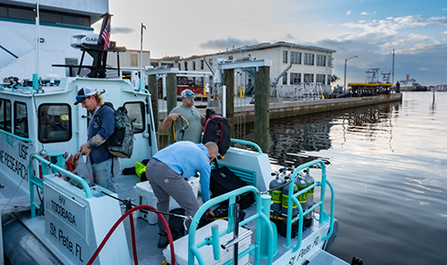
Crew members prepare for departure from the College of Marine Science
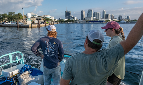
As the boat exists Bayboro Harbor, the crew looks back at the damaged Marine Science
Laboratory
“The fire was devastating,” said Jay Law, a research scientist in the lab who has
led more than 100 research cruises. “I stood on the seawall that evening with colleagues
and strangers and watched the flames take our professional home in a matter of hours.
Of course, we feel gutted, but the most important thing is that no one was hurt. And
we were fortunate in that we recovered some key equipment that allowed us to get back
to what we do, back on the water to keep our observing network up and our research
going.”
Law and his team quickly secured a boat, assembled diving equipment, and compiled
a crew of six, including two graduate students and an undergraduate intern to document
the trip with his camera. Shortly after sunrise, they departed Bayboro Harbor aboard
the R/V Tocobaga.
Scientific modeling
For decades, researchers in the Ocean Circulation Lab have gathered data from the
Gulf, which they use to inform detailed, scientific models that forecast the movement
of water along Florida’s west coast and in Tampa Bay.
These models have been used to predict which areas will encounter red tide and plumes of marine pollution, such as wastewater discharge from the Piney Point phosphate plant. They have aided forensic investigators searching for bodies in the bay. And on multiple
occasions over the last few years, the models have been put to the test during hurricane
season.
In September 2022, as Category 5 Hurricane Ian approached Florida’s west coast, the
lab’s director, Yonggang Liu, monitored the models from his home in St. Petersburg. Days before landfall, the models accurately predicted that Ian would push water
out of Tampa Bay, while Lee and Collier counties farther south would see significant
storm surge. Data gathered from buoys and tide gauges later validated these forecasts.
A year later, as Category 4 Hurricane Idalia brewed in the Gulf, the models again
accurately predicted storm surge of about 1.5 meters in Tampa Bay and about 2 meters
at Cedar Key.
“Hurricane season has always been a busy time for our team,” says Liu, an associate
professor of physical oceanography in the College of Marine Science. “It’s also been
a chance for our lab to demonstrate the value and accuracy of our models, and to refine
our forecast capabilities moving forward.”
The lab shares data from its models and field instruments with the National Oceanographic and Atmospheric Administration, helping municipalities and emergency agencies prepare and communicate risks to the
public.
“Coastal oceans are the last few miles before tropical cyclones make landfall and
cause substantial damage through extreme winds, storm surges, and compound flooding,”
said Matt Anderson, science and operations officer of the NOAA National Weather Service in Tampa Bay. “It is critical to know whether a hurricane will further intensify or not in this
region, as it leaves less time for preparation.”
The work of the Ocean Circulation Lab continues to expand. A partnership with the
Florida Flood Hub for Applied Research and Innovation is improving model resolution for intracoastal waterways and small estuaries along
Florida’s west coast, while researchers are developing a new model covering the state’s
east coast.
“These efforts have allowed us to not only provide broader coverage of Florida’s coastline,
but also to cover the state in finer detail,” Liu said.
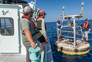
Researchers board a buoy used to monitor ocean conditions in the Gulf
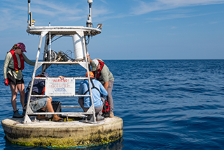
Sensors on the buoys measure key ocean parameters
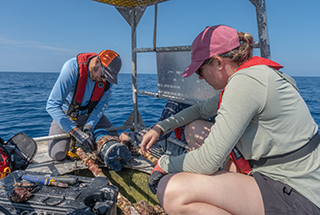
Mitch Lemon and Samantha D’Angelo service sensors on a buoy
Buoy service
About two hours into the trip, after traveling 50 miles offshore, the Tocobaga pulled
alongside a yellow buoy off the coast of Siesta Key. Crew members climbed aboard and
serviced a suite of meteorological and oceanographic sensors used to measure winds,
currents, water temperature, and other important parameters. The instruments are regularly
retrieved, with their real-world data feeding directly into the lab’s predictive models.
At another site about an hour away, crew members donned wetsuits, masks, fins, and
SCUBA gear before back-rolling into the Gulf. They dove 60 feet to a device mounted
to the seafloor.
Data gathered from sensors beneath the sea surface, not detectable by satellites,
have proven to be valuable for hurricane forecasters. In 2025, Liu, Law, and others found that Hurricane Ian’s rapid intensification was likely fueled by unusually warm
subsurface water in the shallow coastal part of the Gulf.
“When subsurface water temperatures are included in models, they help provide a full
picture of the water column and the potential energy available for hurricanes,” Liu
said. “These subsurface features are not detectable by satellites. Real-time monitoring
via surface buoys is essential in providing this information to both the hurricane
forecast community and the general public.”
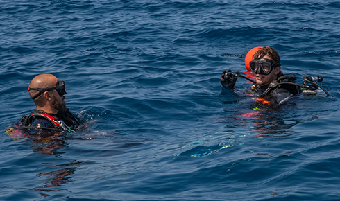
Mitch Lemon and Orion Scharton-Witmer prepare to dive
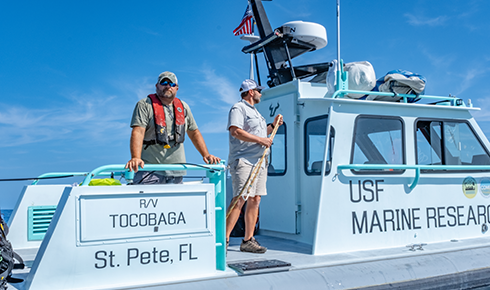
Jay Law and Ben Meister look out from the Tocobaga’s starboard
The Tocobaga returned to the College of Marine Science that evening about an hour
before sunset. The crew unloaded equipment onto golf carts and transported it to the
Maritime and Defense Technology Hub, which has provided storage and operational space following the fire.
By the end of the month, the researchers were back at sea — this time aboard the Florida Institute of Oceanography’s R/V Weatherbird II for a four-day cruise deploying and recovering additional buoys across the Gulf.
“It’s been incredible to witness the resilience of our researchers,” said Tom Frazer, dean of the College of Marine Science. “Our people continue to overcome immense
challenges because of the fire. The efforts of the Ocean Circulation Lab in particular
will help ensure the security of our coastal communities as we enter hurricane season.”
Bold Research. Real Impact.
Research and innovation at the University of South Florida leads to better health
care, Al and cybersecurity solutions, a deeper understanding of the environment to
prepare for hurricanes and much more.