
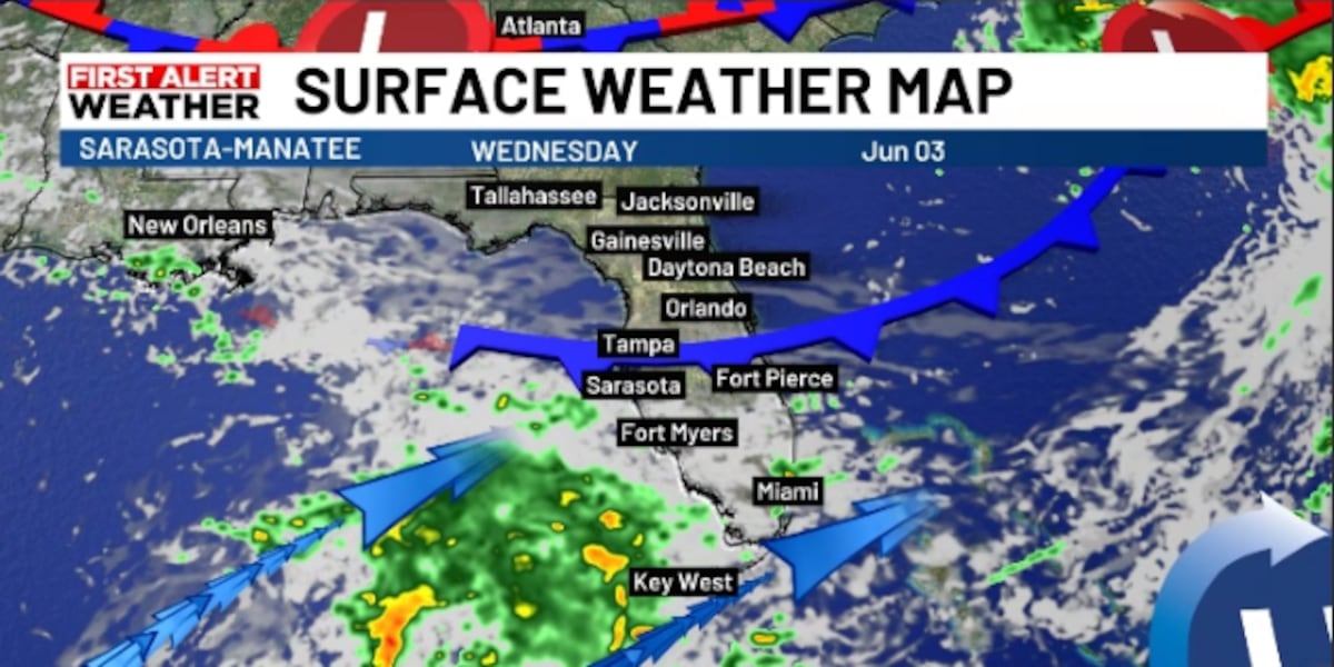
SARASOTA, Fla. (WWSB) – Today starts with increasing clouds and a few showers developing during the morning as a weak front moves south through Florida.
By afternoon, showers and thunderstorms will become scattered across the Suncoast, with the heaviest activity capable of producing frequent lightning, gusty winds, and locally heavy rain.
High temperatures will stay cooler than recent days, generally in the mid-80s as northeast winds increase.
Tonight, showers and thunderstorms will begin gradually tapering off. Breezy northeast winds may gust over 20 mph at times, especially near the coast. Lows will fall into the lower 70s.
Thursday will remain unsettled, with periods of showers and thunderstorms, especially during the afternoon and evening. The cold front will stall to our south and keep the highest rain chances across southern third of the state, while areas just to the north of us begin to dry out somewhat. Highs will remain in the mid-80s with a brisk east wind.
Friday through Monday, high pressure north of Florida will bring a return to a more typical early-summer pattern. Rain chances will decrease, with mainly isolated to scattered afternoon and evening thunderstorms developing along sea breeze boundaries.
Temperatures will gradually climb, with highs reaching the upper 80s Friday and lower 90s over the weekend into early next week. Humidity may be slightly lower for a few days
On our waters we will get a northeast wind increasing today and tonight, becoming 15 to 25 knots with rough conditions on bays and coastal waters by overnight. Seas will build to 2 to 4 feet, occasionally higher offshore. Boaters should expect numerous showers and thunderstorms through Thursday before conditions slowly improve Friday and Saturday as winds and seas gradually subside.
Across the nation, active weather will continue from the Rockies into the Plains through Thursday, with rounds of thunderstorms producing heavy rain, localized flooding, and some severe weather.
Copyright 2026 WWSB. All rights reserved.