
The Brief
The wind coming down from the north has funneled in the chill, which is why temps have started off in the 40s to 50s.
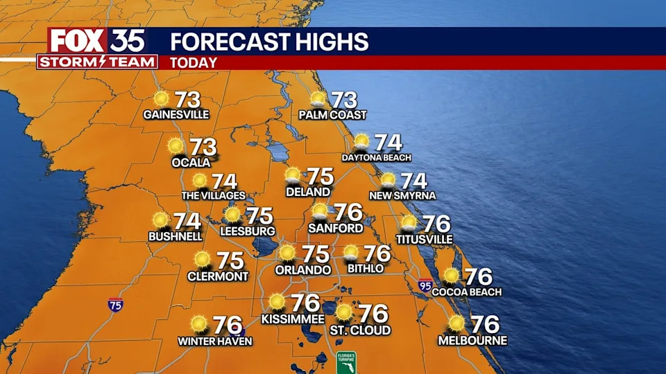
Highs rebound nicely, topping out in the lower to middle 70s along with plenty of sunshine.
ORLANDO, Fla. – High pressure is in control and that means more beautiful but chilly weather. The wind coming down from the north has funneled in the chill, which is why temps have started off in the 40s to 50s.
Highs rebound nicely, topping out in the lower to middle 70s along with plenty of sunshine. Overnight, it won’t be quite as chilly as our airmass starts to moderate some.
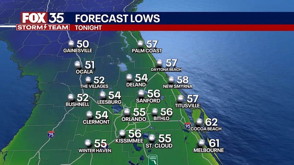
Lows dip back into the lower to mid 50s under just a few clouds.
What will the weather look like tonight?
What to Expect
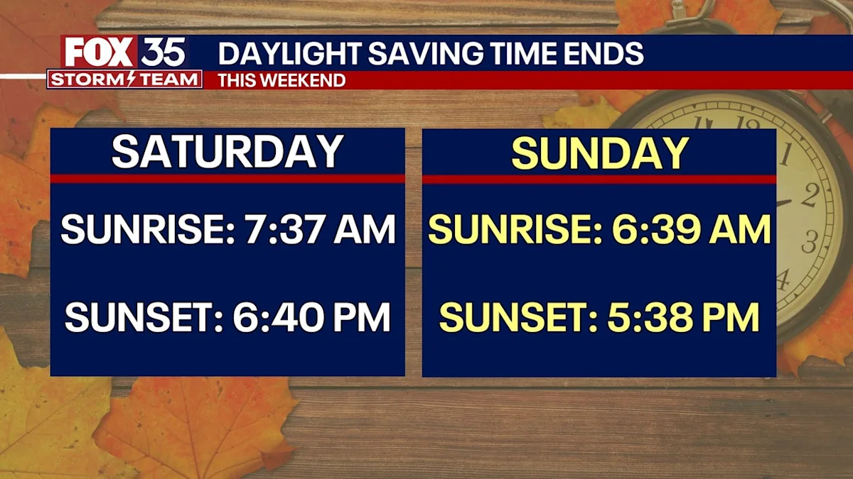
Remember to turn the clocks back an hour before bedtime as Daylight Saving Time comes to an end early Sunday a.m.
What will the weather look like tomorrow?
What to Expect
Conditions start to change on Sunday ahead of our next storm system we’re watching. Temperatures climb back toward normal for this time of year, rising into the middle to upper 70s. Some of our southern neighborhoods may step into the lower 80s.
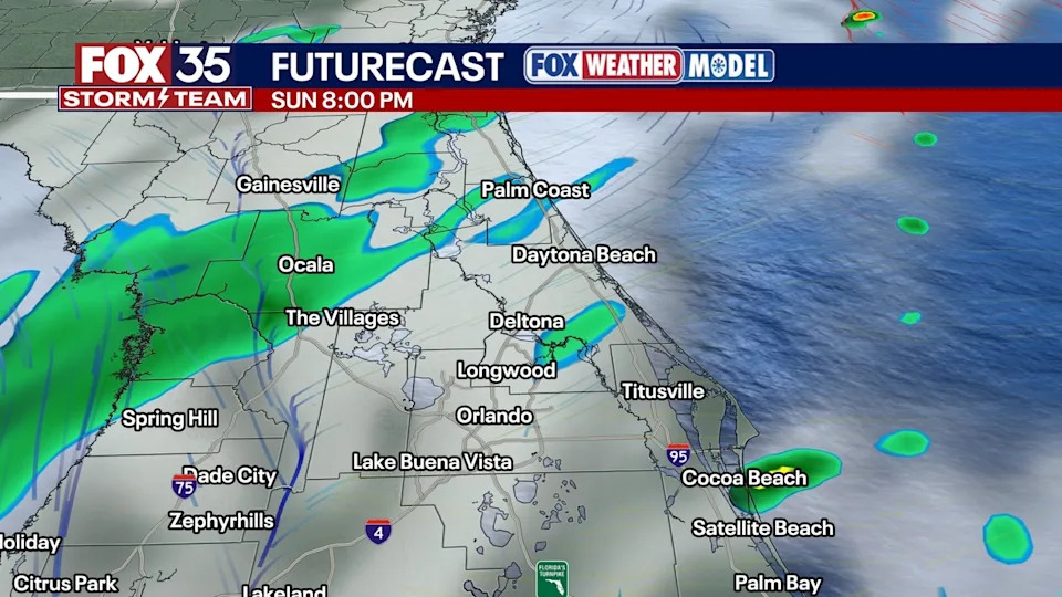
We’ll also see a little more cloud cover. Clouds will be on the increase throughout the day with the chance for at least an isolated shower or two rising as well. Chances stay low though, only around 20%.
Looking ahead
What to Expect
The chance for hit-or-miss showers and storms rises Monday to near 40%. It won’t be a washout, but you’ll probably want to keep the umbrella handy just in case. We will have wind energy in the atmosphere but not a lot of instability.
We could see a stronger rough storm but with gusty wind and heavy rain. The higher chances for rain looks to be around during the morning on Monday with drier conditions likely later in the day. With this disturbance overhead, temps look chilly.
The clouds will aid in holding down temps too, as highs round out in the lower to middle 70s.
A sprinkle is possible on Tuesday as this system departs, but it’s looking much brighter. That trend continues into late this week as a ridge of high pressure builds in.
Temperatures warm up, and we’ll see plenty of sunshine. Afternoon readings look to rise back close to average (lower 80s), topping out in the lower to middle 80s.
The Source
This story was written based off information shared by the FOX 35 Storm Team on Nov. 1, 2025.