
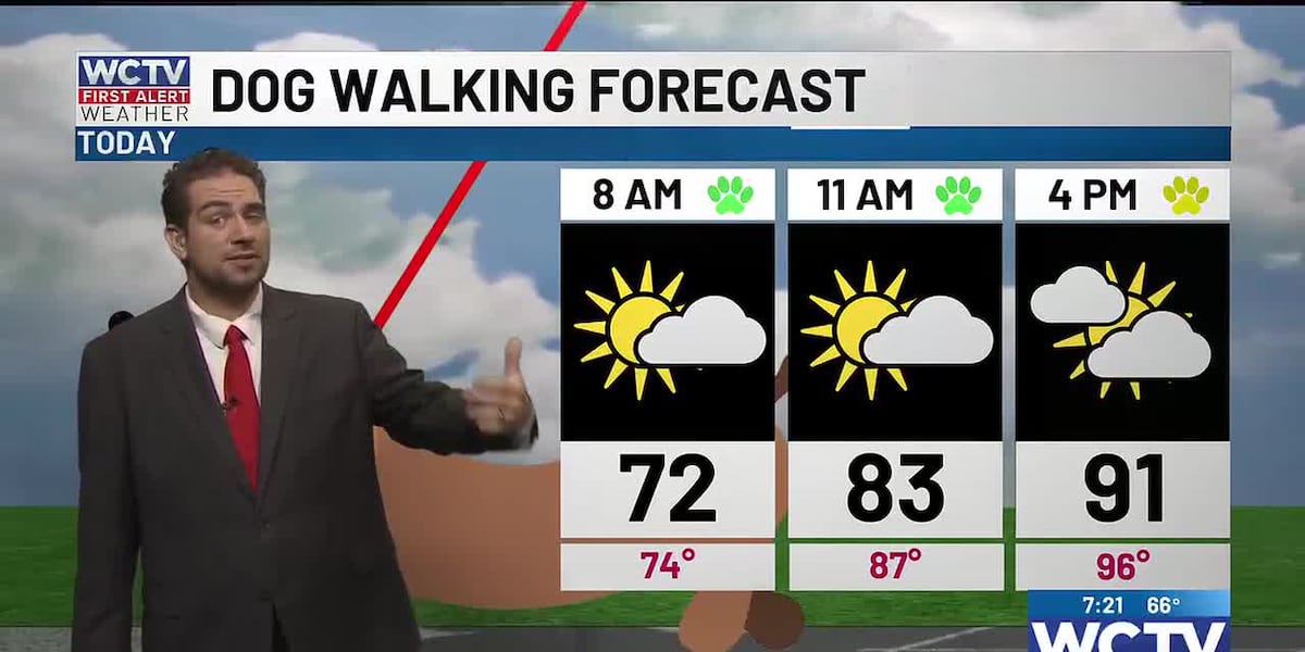
TALLAHASSEE, Fla. (WCTV) – As you step outside this morning, you’ll notice the air feels a little different today. More muggy than recent days.
The humidity is back:
Definitely an iced coffee type of morning with thermometers reading around 70 as you walk the dog or get ready to head to church.
This afternoon is going to be hot and humid, so a good day to spend at the pool. Highs in the low 90s, but feeling hotter, especially when the sun is out. Be sure to apply sunscreen when spending time outside.
Beach and Boating:
If you are cooling down by the water, the waves will be 1 to 2 feet and generally light onshore winds.
Wakulla County beaches are okay, but Franklin County beaches are facing a high rip current risk. As you step onto the beaches today, be sure you are looking out for the flags. Red is a high-hazard day. A double red flag means NO SWIMMING.
Staying humid next week:
More heat and humidity on Monday as high pressure stays in control. Humid as you head out the door for work tomorrow and hot in the afternoon with temperatures in the mid-90s, but feeling like near 100. Be sure you are giving yourself breaks if you work or are spending time outside.
Clouds move in late Monday and Tuesday ahead of a weak front. This will keep temperatures in the upper 80s on Tuesday, but it will be very humid before the front passes this week.
A more traditional summer-like pattern takes shape late week with hot and humid afternoons and scattered storms after lunch. The highest rain chances return late week and next weekend.
To stay updated on all the latest forecasts and weather, follow WCTV First Alert Weather on Facebook and X (Twitter).
Click here to see all the latest weather headlines and here to view the First Alert Radar. Receive push alerts and watch the latest forecast anytime on the free WCTV First Alert Weather app. Click here to download it now.
Interested in becoming a WCTV First Alert Weather Watcher? Click here to join the team!
Copyright 2026 WCTV. All rights reserved.