
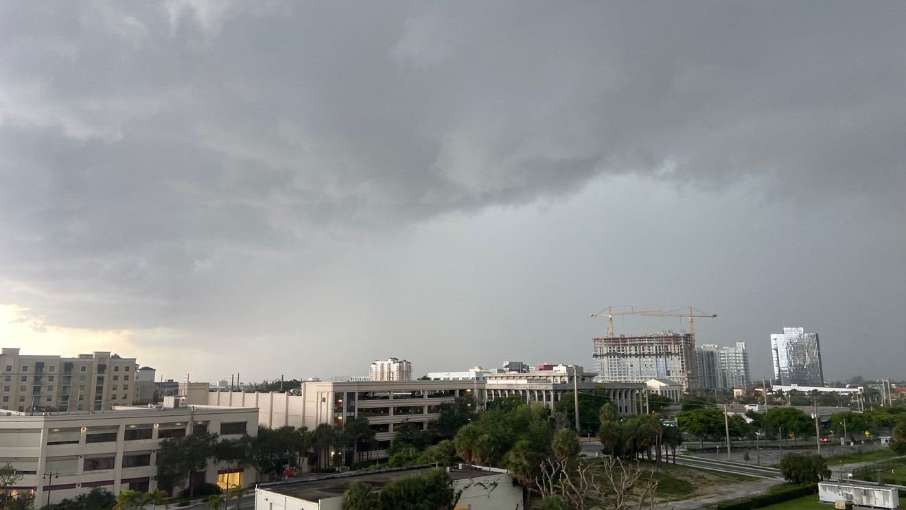
WEST PALM BEACH, Fla. (WPEC) — South Florida will see another round of scattered thunderstorms this afternoon and early evening, with heavy rain and dangerous heat remaining the primary concerns.
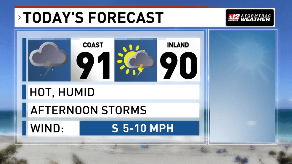
Heat and humidity are sticking around for Sunday’s forecast. Afternoon storms will be more widespread, making their way closer to the coast today. (WPEC)
The day will begin relatively quiet before sea breezes, which are winds moving inland from both coasts, help trigger thunderstorms during the afternoon. The greatest coverage of storms is expected across inland areas, though some activity could drift into metro communities as the day progresses.
Heavy rainfall will be the main hazard. The atmosphere contains a lot of moisture, allowing storms to produce intense downpours which could overwhelm drainage systems in a short amount of time. Localized urban flooding and flooding in low-lying areas are possible, especially where storms linger. A few storms could also become briefly strong, producing damaging wind gusts.
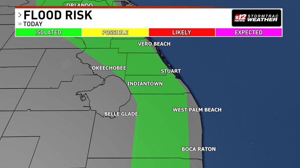
Heavy downpours are possible in South Florida this afternoon. (WPEC)
Because of the rainfall threat, the Weather Prediction Center has but the coastal communities under a marginal risk (level 1 out of 4) for excessive rainfall.
Heat and humidity will continue to build through the afternoon. Temperatures will reach the upper 80s to lower 90s, while humidity pushes heat index values into the 100 to 105 degree range. Sensitive groups, including older adults and those spending extended periods outdoors, may be more vulnerable to heat-related illnesses.
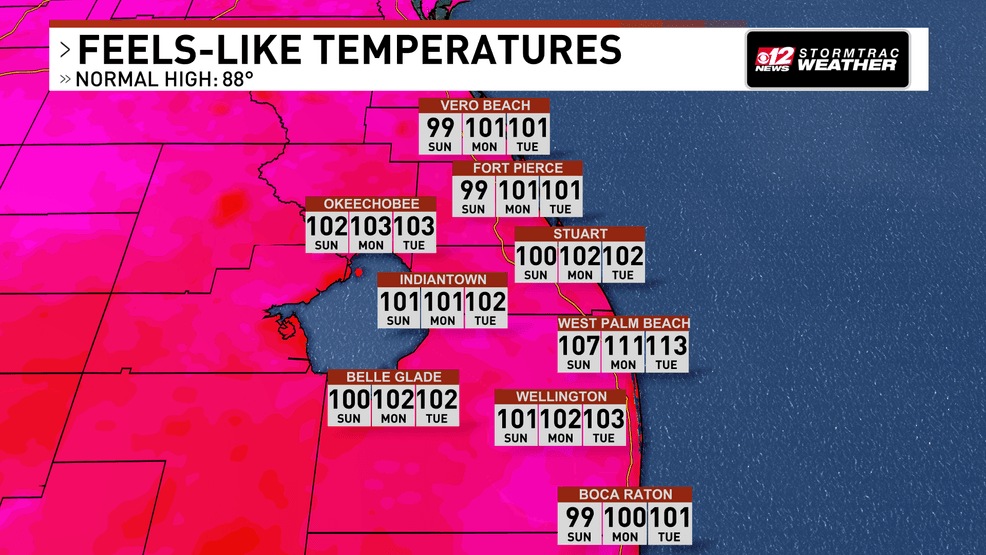
Heat index values will be in the 100s today across the area. (WPEC)
Thunderstorms will diminish after sunset, leading to a mostly quiet overnight period.
Tomorrow, winds will shift more from the south-southeast, increasing the likelihood of afternoon storms developing closer to the east coast metro areas. The combination of slow-moving storms and very heavy rainfall could once again create localized flooding concerns.
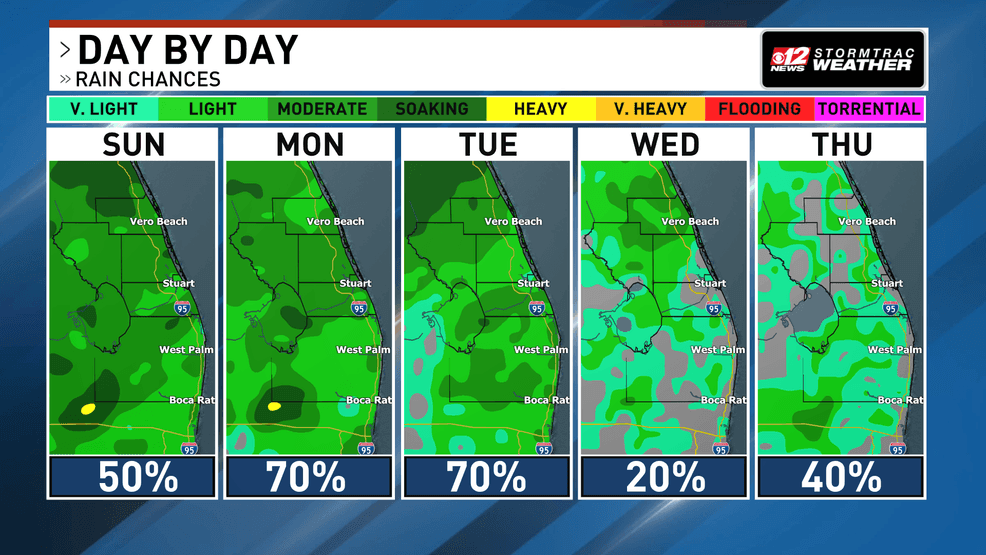
More water vapor moves into the area to start the week. This will lead to widespread rain probabilities through Tuesday. (WPEC)