
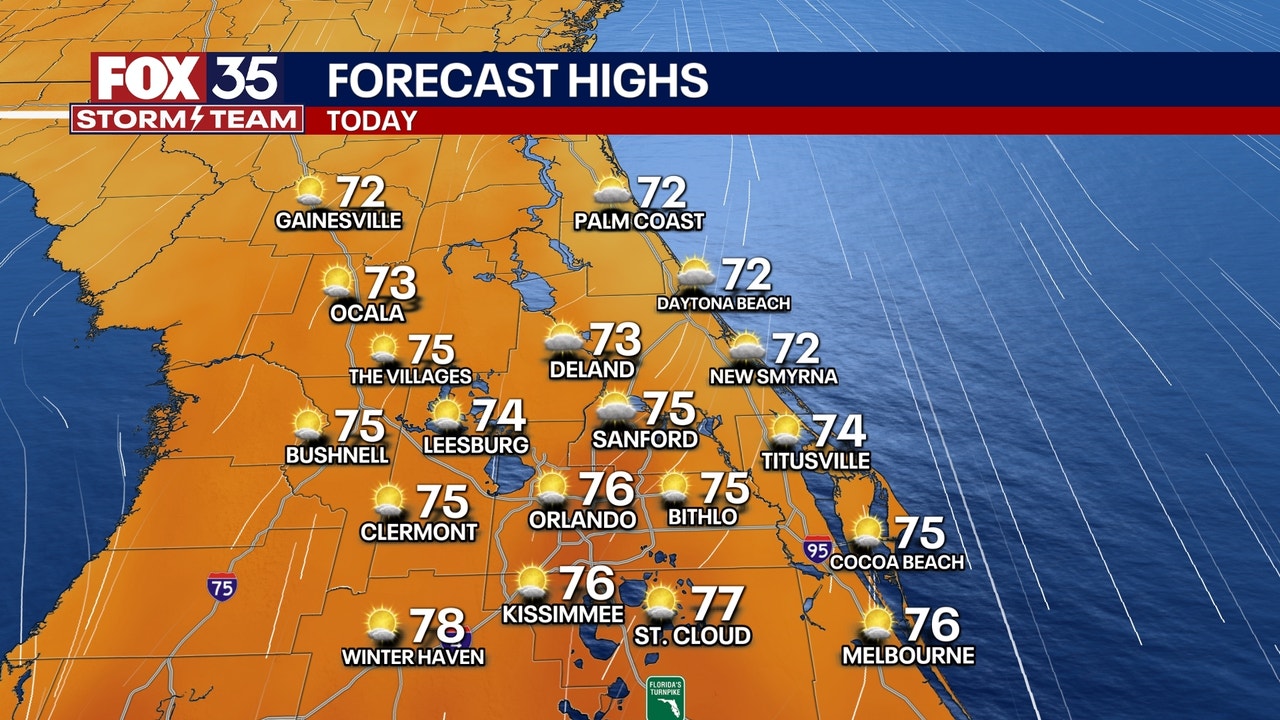
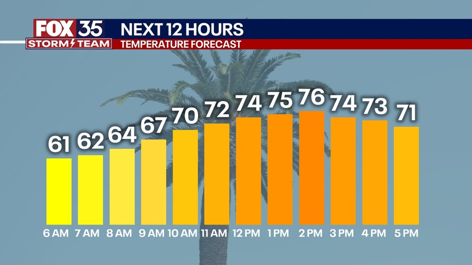
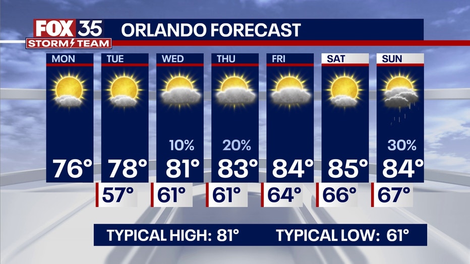
ORLANDO, Fla. – A beautiful day is on the way for Central Florida. Temperatures will warm from the 50s and 60s this morning into the low and middle 70s for today’s highs.
Orlando’s high of 76° will be about five degrees below our average high of 81° for Nov. 3. A few clouds are possible this morning, before giving way to mostly sunny skies for the majority of our daylight hours. Winds will be a little breezy at times, with gusts up to around 20 mph.
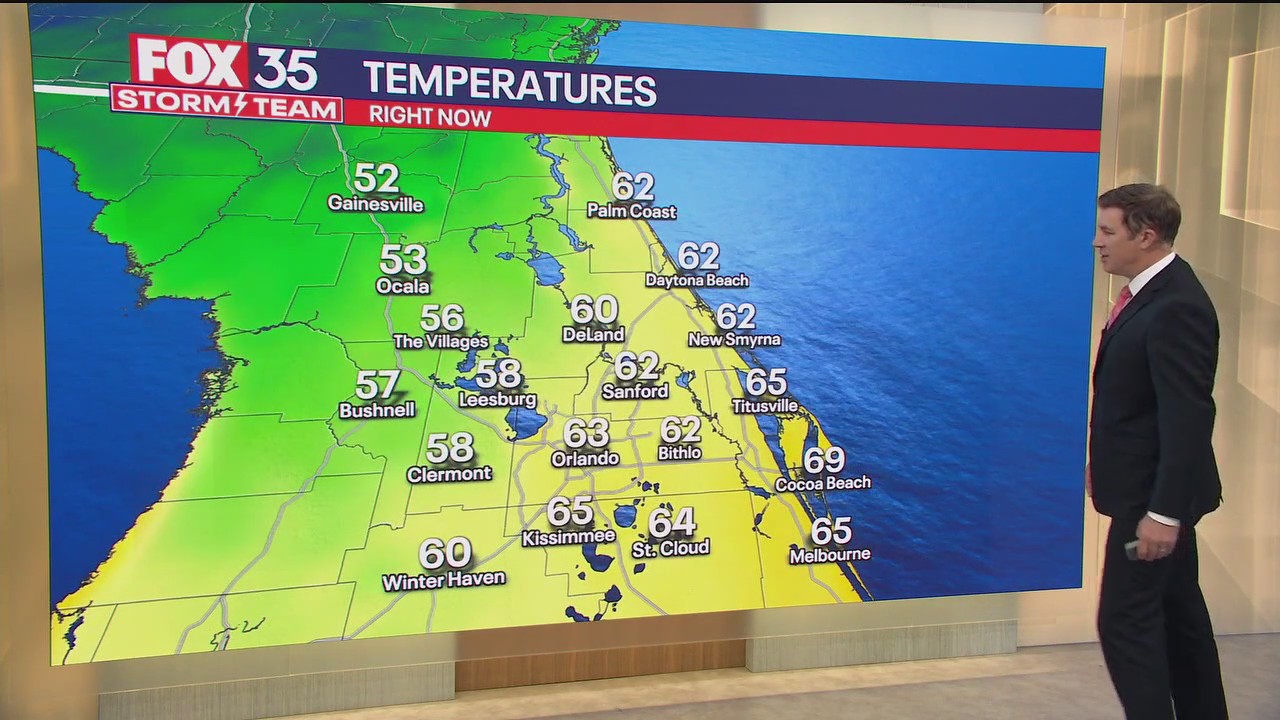
Clear and cool conditions continue overnight. Temperatures will still remain a few degrees below normal. Plan for a low of 57° in Orlando, which is below our average low of 61°.
 Scattered showers possible later in the week
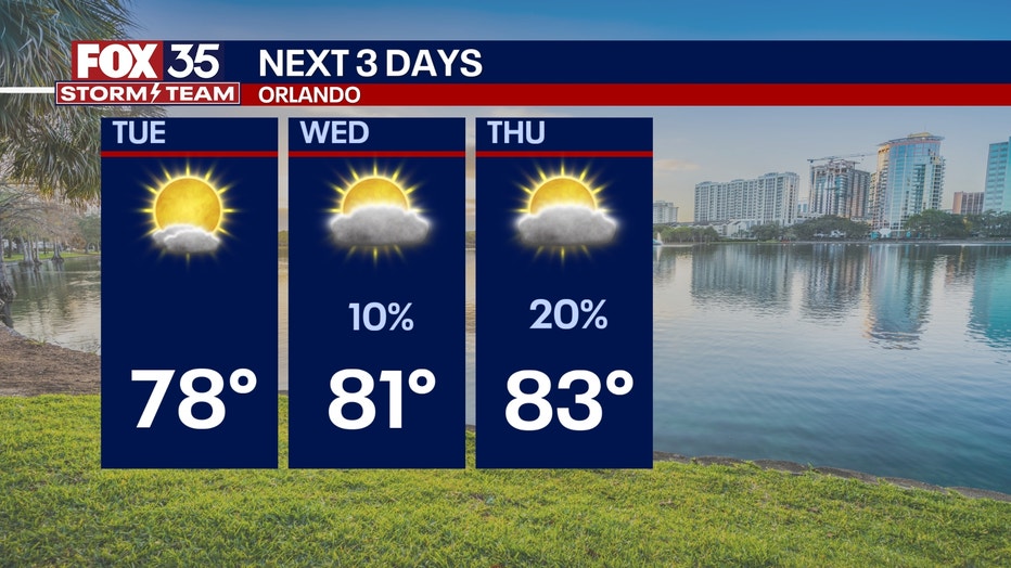
Slim chances of rain are on the way for the rest of this week. Only a few scattered light showers will be possible, mainly for areas to the south of Orlando. These will take place Wednesday night into early Thursday. Otherwise, plan for a mostly dry and mostly sunny stretch this week.
Temperatures will be steadily warming up, too. Highs will actually warm into the middle 80s by Friday and Saturday, which will be 3 to 4 degrees above normal for this time of year. By Sunday, another disturbance will come into play. This will mean a more substantial chance of rain and the possibility of a few storms. We’re still about a week out, so stay tuned for more details.
 A note for beachgoers
Nov. 5 (Wednesday) is the next super moon. This will bring more king tides. This episode of high tides will be the highest of 2025. On Nov. 6 (Thursday) the tides will be about 7 ft high, causing rough surf, beach erosion and a high risk of life-threatening rip currents.
The Source: This story was written based off of information from the FOX 35 Storm Team.