
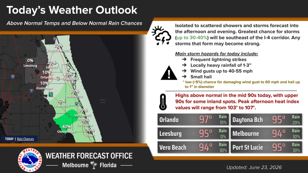
Central Florida remains hot with below normal chances for rain.
Tuesday greatest chance for storms will in afternoon and evening near the southeastern portions of the Interstate 4 corridor, according to NWS Melbourne.
It is anticipated that those storms will be strong.
Temperatures remain in the upper 90s, with peak heat index values at 103 to 107 degrees, resulting in a major risk for heat across much of east Central Florida.
Looking ahead, hot and humid conditions are expected to last through the rest of the week, according to NWS Melbourne.
Highs will continuing ranging in the mid-to-upper 90s with heat indices in the triple digits.