
Storms roll in this afternoon across Central Florida| July 13th forecast
Meteorologist Victoria Wisniewski is tracking a wet afternoon commute
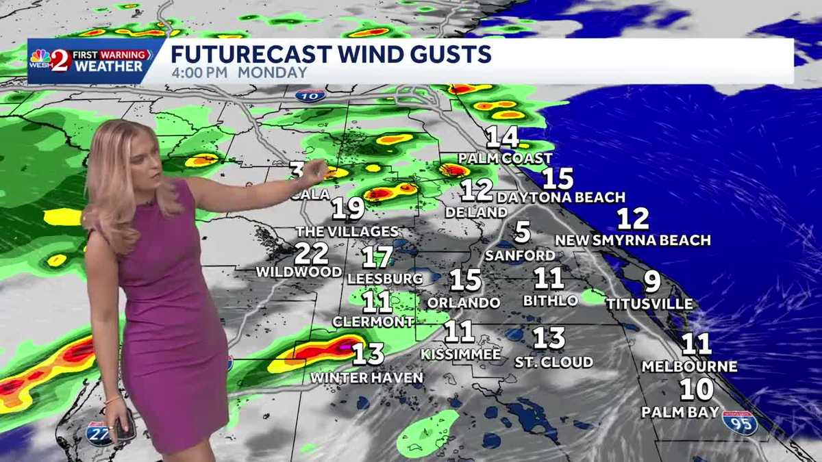
And we have talked about some showers and storms as we had throughout this afternoon, guys. We do have impact weather in place between 1 to 9 p.m., and that does mean that we could have *** couple stronger cells, some of them isolated, severe threat, but we’re also really talking about the heat as well. So there’s just *** lot going on here across Central Florida as we do begin the week. So as I mentioned, for the next couple hours we are going to be watching some storms moving from west to east. The greatest concerns will certainly be some damaging winds, frequent lightning. As well as some heavy rain that could be producing 2 to 3 inch per hour rain rates, and we’ll be watching that over the next couple hours, especially during the afternoon to evening commute time frame. We’re also watching the heat now. We’re not looking at any heat advisories because we have *** lot more of these cooling rains coming throughout the afternoon, but later on in the week, I wouldn’t be surprised if we see some heat advisories pop back up, especially as our rain chances drop off Wednesday into Thursday. Day they come back into the picture as we head towards the weekend. So today impact weather in place specifically through the afternoon to evening time frame, and we’re going to still have temperatures in the mid to upper 90s. By tomorrow, having *** similar trend, about *** 50% rain coverage, and that really drops off as we head throughout midweek. You’re really going to feel *** lot more of the heat as we head throughout the upcoming days. First warning live radar is nice and. Clear at this hour, but we’re having some activity already near the Big Bend region. We’re having some stronger cells, and so we’ll anticipate those to come *** little further south over the next couple hours. Taking *** look at downtown Orlando, we are just have *** couple of clouds out. It’s not as sunny as it was yesterday, and we’re looking at 86 in Sanford, 88 in Orlando, and 86 in the land. Still forecasting to be in the mid 90s as we head throughout 2 to 3 p.m. peak heating hours. We’re looking at 96. And 93 towards Leesburg, but still feeling like the triple digits, about 100 degrees the way it’s going to feel towards the land. Palm Coast feeling like 101 and Orlando like 102 later this afternoon. As we head through the next couple of hours, the impact weather will come in place because we are going to be looking at some of the showers and storms really sweeping from the north and making their way south. Here’s *** look at Futurecast to really paint the picture for you. We see already some activity up near Marion County, Putnam County, and Flagler County, and then also some activity to the west. It’s all going to come together like *** pretty quick wave, and then we’ll see *** lot of our showers and storms, especially around the I-4 corridor, even I-95. As we head right through the afternoon time frame, this is 6:30 p.m., *** couple of heavy downpours moving in towards Newmyrna Beach, but then before you know it, they clear out. So we’ll be watching that as we head throughout the next couple of hours. Futurecast can be bringing *** couple of cells that have 2 to 3 inches of rain, and so we’ll be looking at that isolating flooding threat. Here’s *** look at your certified most accurate 7 day forecast here across the Sunshine State. He is sticking around over the next couple of days, but we actually drop those rain chances through the midweek. We’ll be right back.
Storms roll in this afternoon across Central Florida| July 13th forecast
Meteorologist Victoria Wisniewski is tracking a wet afternoon commute

Updated: 1:38 PM EDT Jul 13, 2026