
FORT MYERS, Fla. (WINK) — The numbers tell an interesting story. Since 2022, Fort Myers has experienced a noticeable increase in the number of July afternoons reaching 95 degrees or hotter. Based on National Weather Service climate data, Fort Myers recorded 11 days at or above 95° in July 2022, followed by 14 days in 2023, 10 days in 2024, and 12 days in 2025.
That recent stretch stands out compared to the previous seven Julys. From 2015 through 2021, Fort Myers recorded 5 days at or above 95° in July 2015, 7 days in 2016, 4 days in 2017, 0 days in 2018, 7 days in 2019, 3 days in 2020, and 7 days in 2021.

From 2015 through 2021, Fort Myers averaged fewer than five 95-degree afternoons each July. Since 2022, that average has increased to nearly 12 days per July, more than double the previous average.
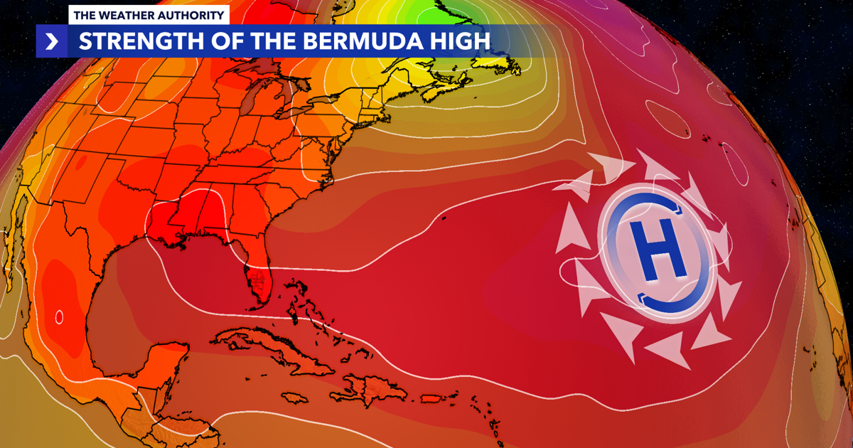
One possible explanation is that several recent Julys have featured stronger or more persistent subtropical ridging over the western Atlantic. When the Bermuda High is stronger—or positioned farther west—it suppresses afternoon thunderstorms, delays the sea breeze, and allows temperatures to climb higher across Southwest Florida. In many of these hotter Julys, surface high pressure has often been around 1022 mb, compared to a weaker 1016 mb pattern that was more common during several earlier summers. While a difference of six millibars may not sound significant, it can represent a stronger area of high pressure influencing Florida’s weather pattern and creating conditions more favorable for prolonged daytime heating.
A stronger ridge promotes sinking air, which limits cloud development and delays afternoon thunderstorm formation. With more sunshine during the hottest part of the day, temperatures have more time to climb into the mid- and upper 90s before storms and the Gulf breeze provide relief.
A weaker high-pressure pattern allows the Gulf sea breeze to move inland earlier, bringing more clouds and earlier thunderstorms that can limit afternoon heating. A stronger ridge can also produce more persistent easterly winds across Southwest Florida, delaying the cooling influence of the Gulf and allowing temperatures to rise for several additional hours.
Of course, high pressure is only one piece of the puzzle. Long-term warming trends, warmer Gulf waters, occasional intrusions of drier Saharan air, and year-to-year weather patterns all influence how hot a July becomes.
Still, the climate data show that the recent increase in 95-degree afternoons has coincided with a period of more frequent, stronger summertime ridging across the region. While this correlation does not prove the Bermuda High is the only cause, it provides a meteorologically consistent explanation for why Fort Myers has experienced so many more extreme July heat days in recent years.
As Southwest Florida continues through the heart of the rainy season, the strength and position of the Bermuda High will remain one of the biggest factors determining whether afternoon thunderstorms develop early enough to keep temperatures in check—or whether another 95-degree day is added to the record.