
Saturday
Showers and thunderstorms will gradually diminish through the evening, although a few heavy downpours will remain possible before activity tapers off overnight.
Skies will stay mostly cloudy with warm and muggy conditions continuing. Overnight lows will fall into the middle and upper 70s.
Meanwhile, the broad area of low pressure over the eastern Gulf has become better organized and is now designated Invest 91L.

While the system still lacks a well-defined center, satellite imagery and surface observations indicate that a broad surface low is developing. The National Hurricane Center says gradual development remains possible, and the system could become a tropical depression over the next few days as it drifts north to north-northwest.
Regardless of whether it becomes tropical, Southwest Florida will continue to experience periods of tropical downpours, gusty winds, and rough marine conditions through the weekend.
Sunday Outlook
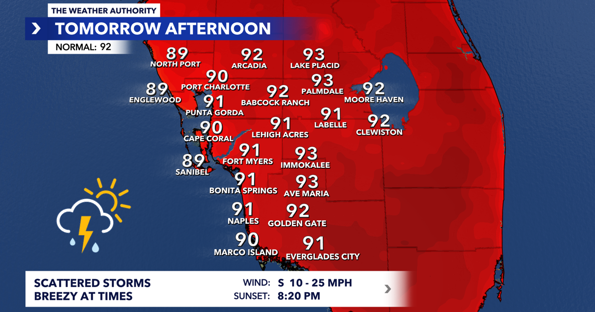
Sunday looks similar, although rain coverage should be a bit lower as the disturbance drifts farther northwest and away from the area. Expect scattered showers and storms to develop once again, beginning near the coast in the morning before shifting inland during the afternoon.
High temperatures remain near seasonal averages in the lower 90s.
Looking Ahead
Rain chances remain around 50% Monday as Invest 91L lifts farther north toward the northern Gulf Coast.
By Tuesday and especially the middle of next week, slightly drier air should begin filtering into Southwest Florida, allowing for fewer afternoon storms and a return to hotter temperatures.
Highs are expected to climb into the middle 90s by Thursday and Friday, with more typical summertime scattered storm coverage.
Tropics
The National Hurricane Center has increased development odds for Invest 91L to 40% over the next 48 hours and 50% over the next seven days.
The system is expected to move slowly north to north-northwest over the eastern Gulf, where environmental conditions could support gradual development. An Air Force Reserve Hurricane Hunter aircraft is scheduled to investigate the disturbance on Sunday, if necessary.
The current forecast keeps the greatest potential for tropical development and the heaviest rainfall focused along the northern Gulf Coast from the Florida Panhandle westward into Alabama.
For Southwest Florida, the primary impacts remain periods of heavy rain, scattered thunderstorms, gusty south winds, rough boating conditions, and an elevated risk of rip currents. The next update from the National Hurricane Center is scheduled for 8:00 PM.