Tropical Storm Bertha has strengthened in the northern Gulf with 40 mph sustained winds.
Author: Michael Prangley, Lee Southwick, Lewis Turner, Robert Speta, Ross Mummah
Published: 8:00 PM EDT July 20, 2026
Updated: 8:03 PM EDT July 20, 2026

JACKSONVILLE, Fla. — Tropical Storm Bertha has formed in the Gulf, and it will continue to bring rain and storms to parts of Florida as it tracks west towards Louisiana and Texas.
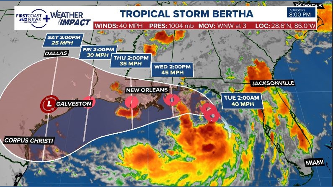
As of the 8:00 p.m. update from the National Hurricane Center, Tropical Storm Bertha is located about 110 miles south of Panama City, Florida with sustained winds of 40 mph and a central pressure of 1006 mb. It is moving WNW at 3 mph.

This story continues below.
Where is Bertha going?
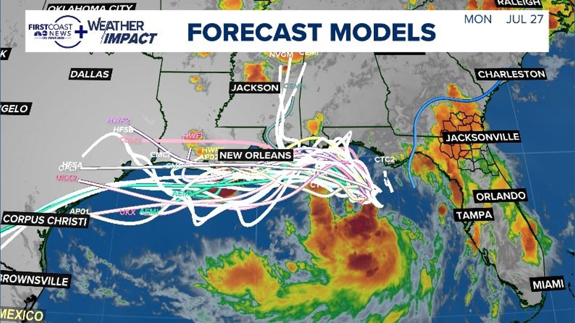
Most storm models are in agreement that Bertha will continue to track west, making landfall over Louisiana before going over Southeast Texas.
The National Hurricane Center’s cone has Bertha possibly making landfall in southern Louisiana Wednesday afternoon or evening, but as always, this is subject to change.
There is still a lot of uncertainty, and that is why the cone is so wide. Remember, the center of a storm could go anywhere inside a NHC cone. So right now, the NHC is saying they can’t rule out a landfall from Mobile, AL to Corpus Christi, TX.
What are the Florida impacts?
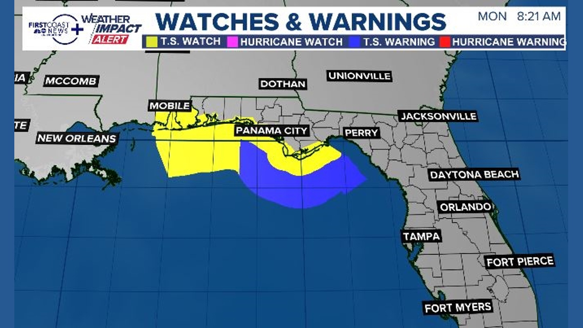
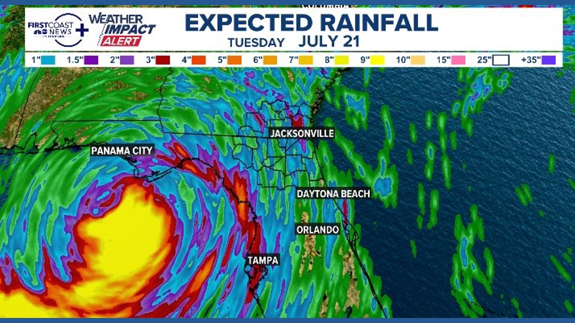
First Coast impacts include tropical downpours, isolated flooding, and wind gusts of 40-60 mph. Please keep monitoring this forecast for the latest.
Storm surge of 1-3 feet is a possibility for parts of the Big Bend.
Heavy rain could lead to flooding for parts of the Gulf Coast.