
Another round of storms will develop in South Florida on Monday.
Some rain has already moved in across parts of the Florida Keys on Monday morning.
Scattered to numerous storms will be possible late morning and this afternoon due to plenty of moisture and a frontal boundary to our north.
Storms could be slow movers since the wind will be lighter out of the west, so heavy downpours and localized flooding will be possible.

This graphic shows the heat-related health risk in South Florida on Monday, July 27, 2026.
CBS News Miami
Highs will soar to the upper 80s this afternoon and it will feel like the upper 90s and 100s when you factor in the humidity before the rain rolls in to provide some relief.
We stay unsettled with high rain chances through Tuesday.

This graphic shows the forecast rain chances in South Florida over the next seven days.
CBS News Miami
Scattered storms will develop with the potential for heavy rain in spots. Highs will climb to the low 90s and it will feel like the triple-digits.
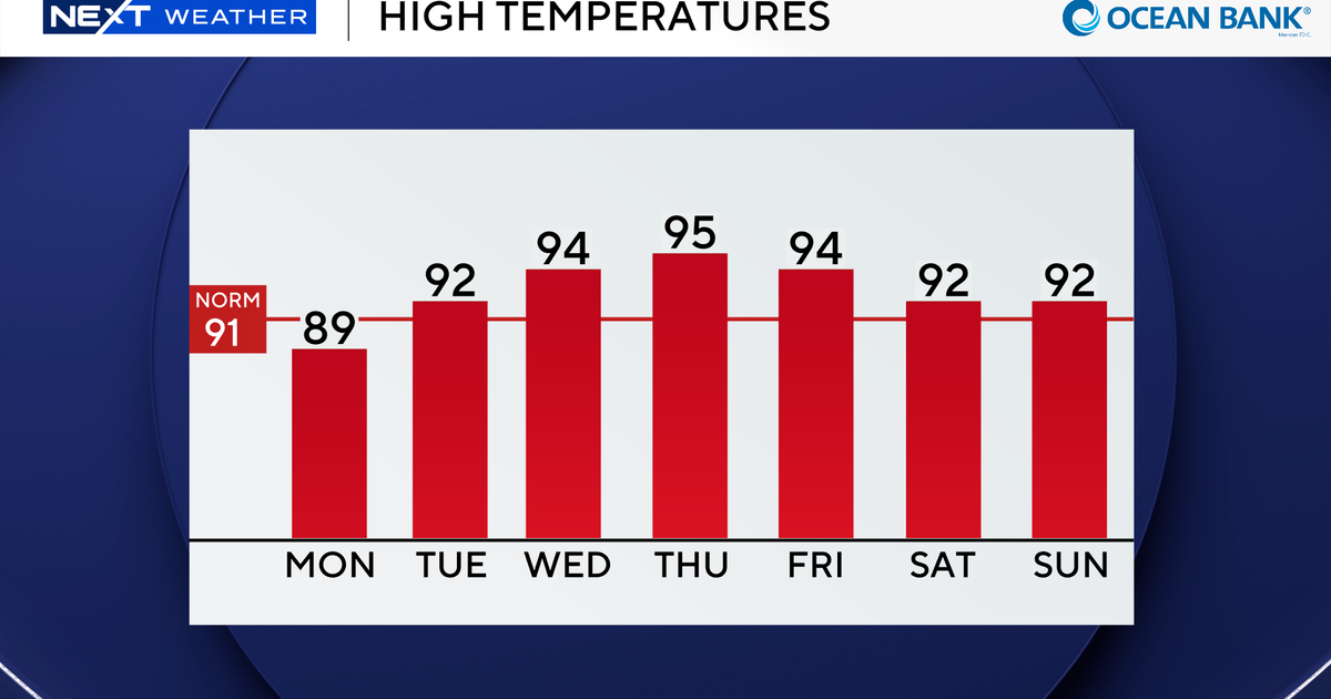
As the chance of rain decreases midweek and the west wind remains in place, temperatures will soar to around the mid 90s in the afternoon on Wednesday and Thursday.

This graphic shows the forecast high temperatures in South Florida over the next seven days.
CBS News Miami
Near record highs will be possible.
Spotty storms will be possible but drier air associated with Saharan dust will limit any widespread storm development.
The Saharan dust will lead to hazy skies at times and may lower air quality.

This graphic shows the forecast in South Florida over the next seven days.
CBS News Miami
This weekend the chance of rain remains fairly low at 30% with highs in the low 90s Saturday and Sunday.
Tropical development is not expected over the next seven days.