
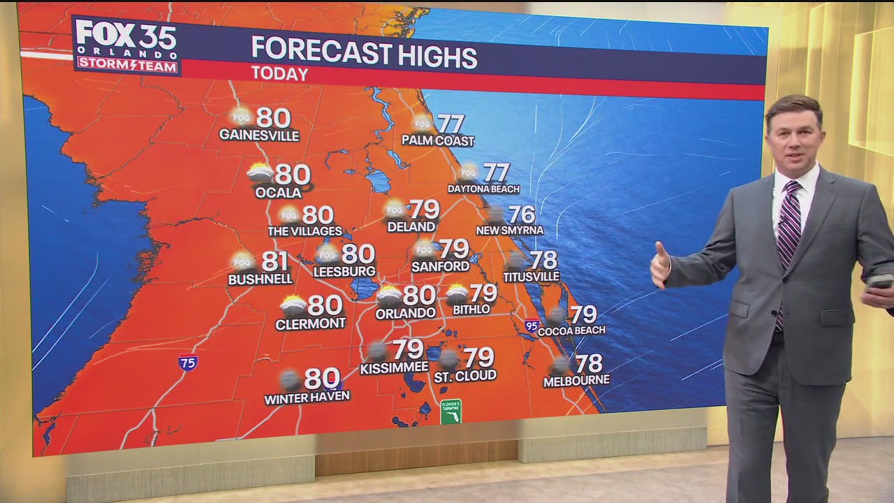
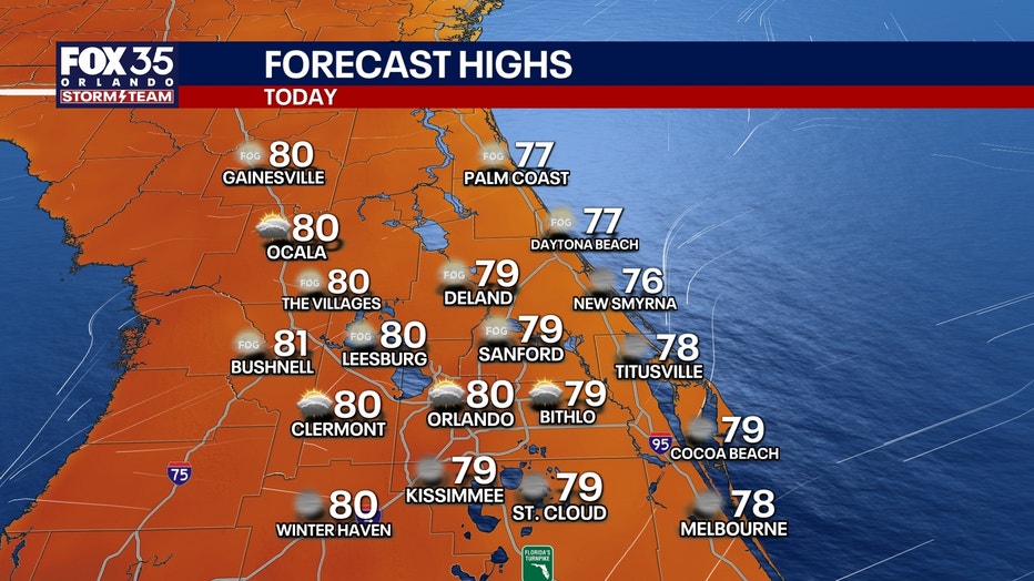
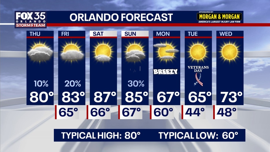
ORLANDO, Fla. – A few areas of patchy dense fog will be possible this morning, especially near the I-4 and I-75 corridors. Temperatures will go from the 50s and 60s this morning, and will warm into the upper 70s and low 80s this afternoon. Our average high in Orlando is 80°, which is what the high temperature will be for The City Beautiful as well. Clouds will gradually increase throughout today.
A few very isolated and light showers will be possible, mainly south of Orlando. Plan for only a 10% chance of light showers today. At the beaches, the biggest king tides of 2025 will take place today. This will bring rough surf, beach erosion and a high risk of life-threatening rip currents.
 Tonight’s forecast
What to Expect:
A few sprinkles are possible tonight. Skies will remain partly to mostly cloudy. Morning lows will fall into the 50s and 60s, 65° will be Orlando’s low temperature tomorrow morning.
 Weekend warm up
Looking Ahead:
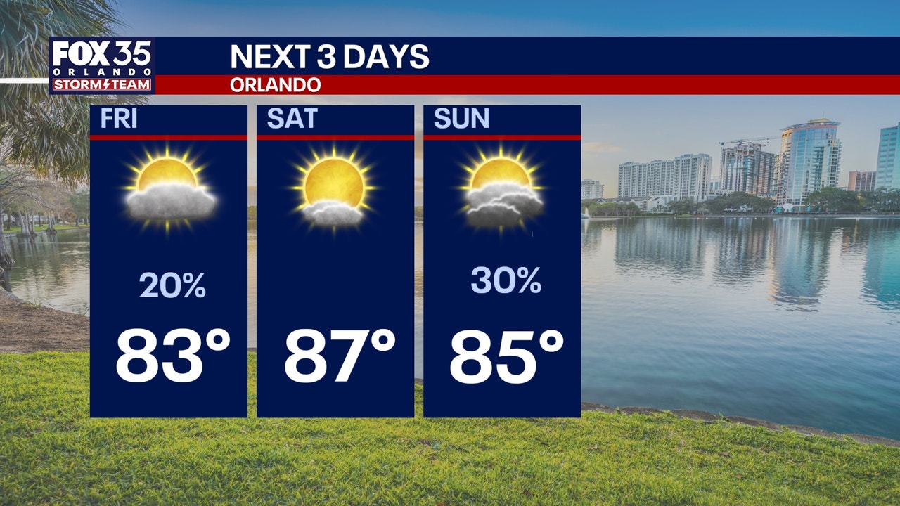
Slim chances of rain are on the way for Friday. A few isolated and light showers will be possible, with a 20% chance of a few showers. Temperatures will be steadily warming up into the weekend as well. Highs will warm into the middle 80s on Saturday and Sunday, which will be 3 to 4 degrees above normal for this time of year.
By Sunday, another disturbance will come into play swinging a cold front into the region. This will mean around a 30% chance of rain and a big-time cool down. Much cooler air moves in on Monday and Tuesday next week. Highs will be dramatically cooler, only reaching the 60s for Monday and lows will fall into the 40s on Wednesday morning.
The Source: This article was written based off of information from the FOX 35 Storm Team.