A trio of road diets is planned for the Brooklyn neighborhood, poised to bring traffic-calming measures to Riverside Avenue, Monroe Street and Forest Street.
The plans were presented to the community at a public meeting hosted by District 7 City Council Member Jimmy Peluso on Thursday, July 23. Representatives from the City of Jacksonville Traffic Engineering Division, including Traffic Chief Chris LeDew, were in attendance as well to share details surrounding the road diets.
“These are projects that are low-cost, and these are projects that can make a resounding difference for the community,” said Peluso.
According to City of Jacksonville Traffic Engineer and Project Manager Lee Durbin, these projects are aimed at creating friendlier walking conditions, safer bike lanes, and improving access to area businesses and attractions while building on other recent city projects like the Park Street Road Diet and the Fuller Warren Bridge Shared-Use Path, which have impacted pedestrian and cyclist mobility in the city.
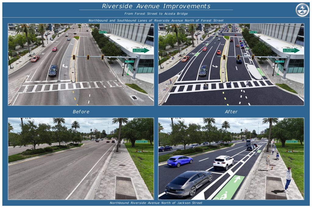
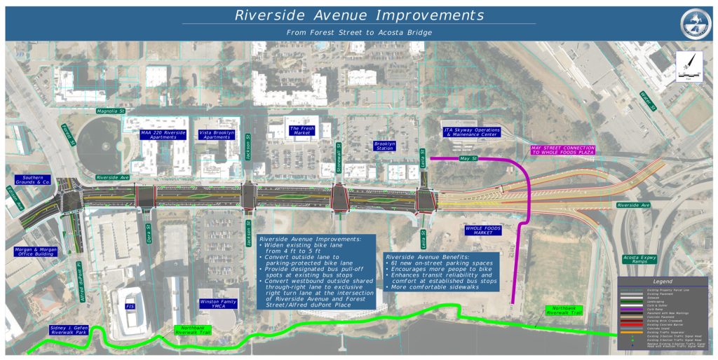
For Riverside Avenue, the road diet would begin at the Acosta Bridge ramps and end at Forest Street, converting the outside lane in either direction to on-street parking, which would add 61 new parking spaces to that corridor, and moving the bike lane on the other side of those new parking spaces.
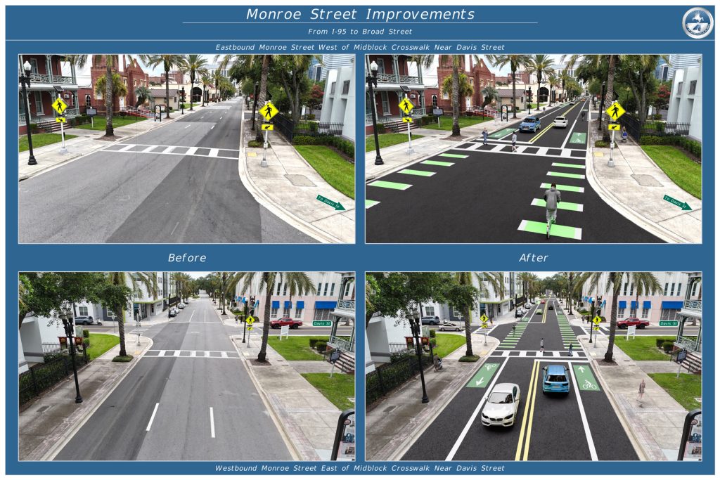
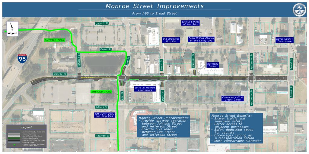
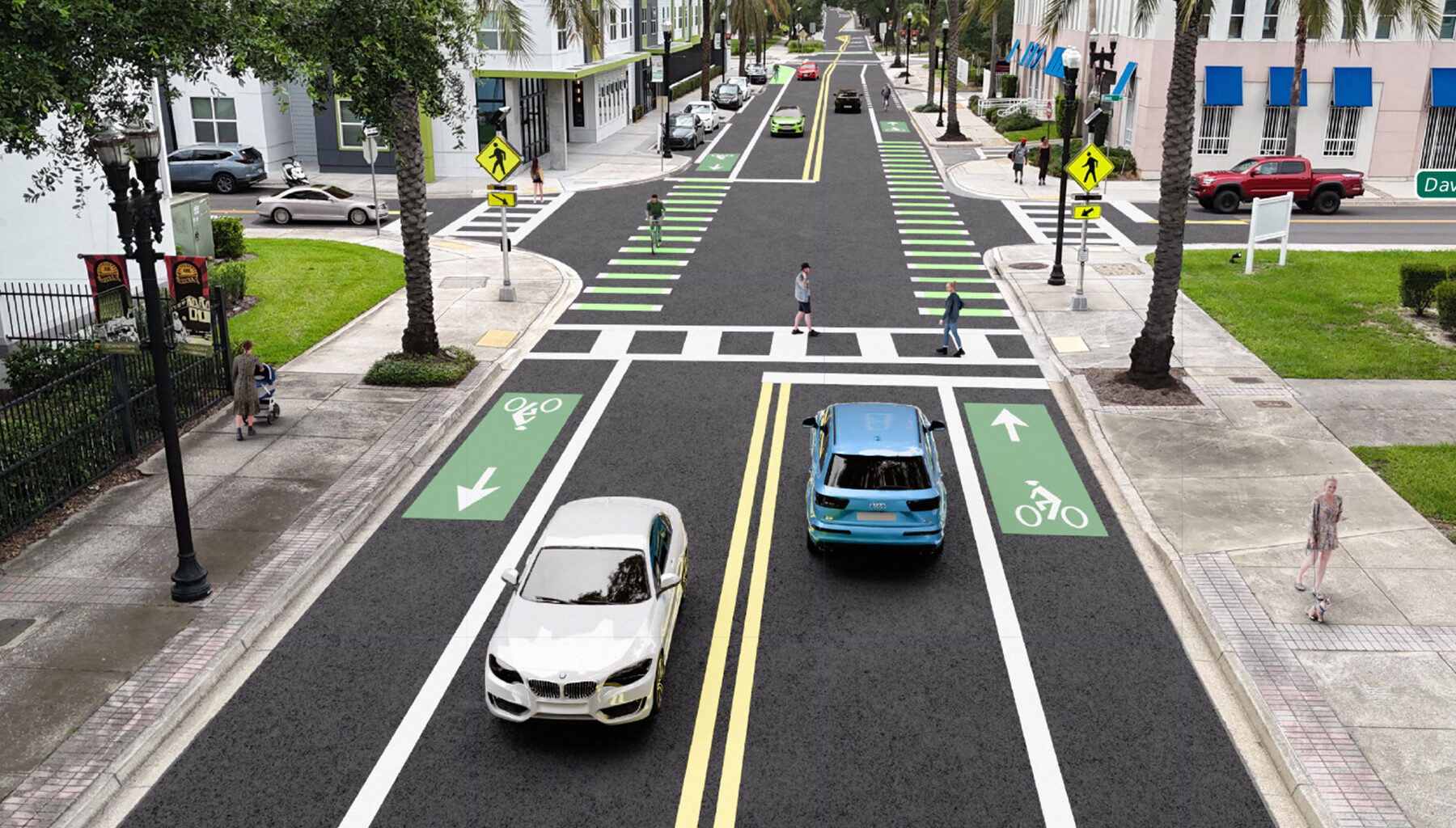
Currently, Monroe Street is three lanes of one-way traffic down which drivers have a propensity to speed. Under the proposed project, Monroe would be converted to two lanes of traffic, one going in each direction with added bike lanes.
“This will slow people down because it will make it look more like a neighborhood,” said Durbin. “It’s not going to feel like a highway where drivers are supposed to go really fast. When drivers see a street like this, they’ll naturally slow down.”
The added bike lanes will provide a connection to the Emerald Trail to the heart of downtown, almost down to the courthouse.
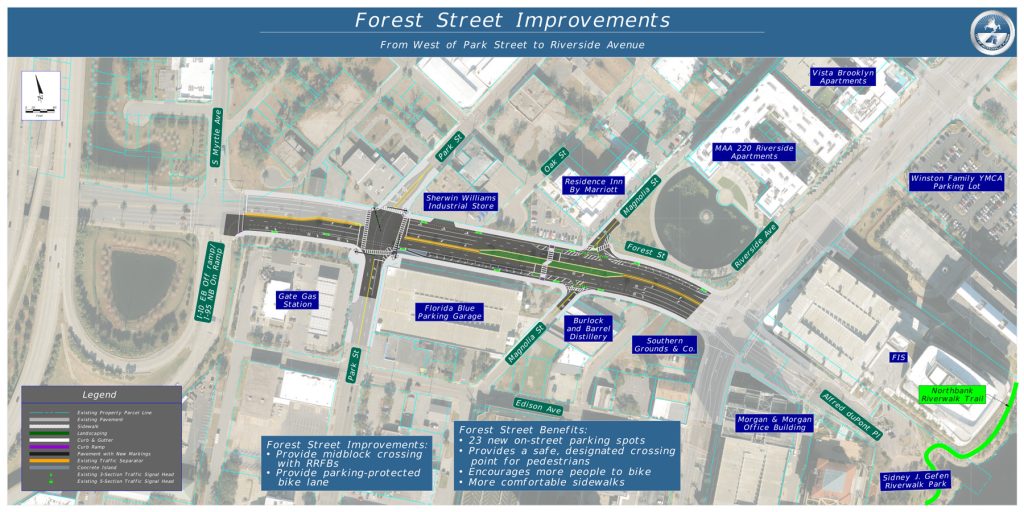
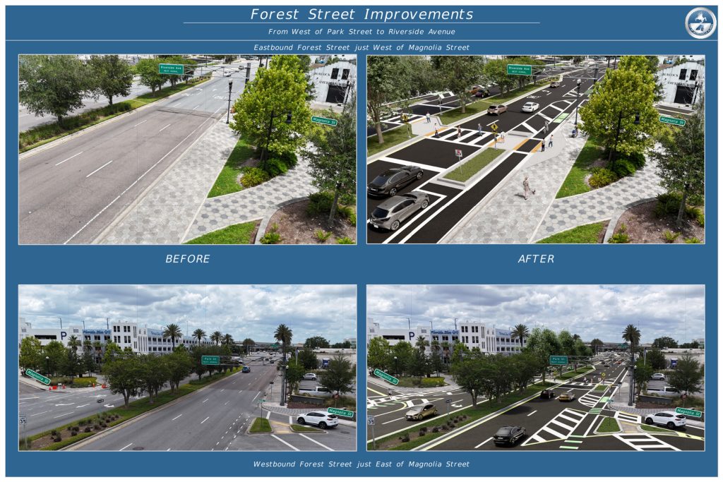
With similar existing conditions as Riverside Avenue, Forest Street has some of the same issues – six lanes of traffic with high occurrences of speeding with little protection for cyclists – Forest Street would see similar changes as well: converting the outside lanes on both sides of the street to on-street parking (creating 23 new parking spots) and moving the bicycle lane to the other side of that new row of parking. This project, which is bordered by Riverside Avenue and just west of Park Street, would also install a midblock pedestrian crosswalk at Magnolia Street, which does not currently have a crosswalk but is already a popular place for pedestrians to cross.
Because these are not part of the Capital Improvement Plan (CIP), Peluso said these do not need to go before city council for approval. Durbin said these projects could be completed in quick succession sometime in 2027. The estimated cost is $100,000.
Responding to public questions about the traffic lights along these roads, LeDew said a separate project would be done to retime the traffic signals to reconcile with the reduced number of traffic lanes.
Following the meeting, LeDew said retiming the lights is a data-intensive process that could take three to six months.
“We do that periodically, and whenever there’s a big change to a road like this, where we’re removing lanes, it would definitely change the timing,” LeDew said.