The National Hurricane Center is monitoring two areas in the tropical Atlantic for possible development.
TAMPA, Fla. — The National Hurricane Center (NHC) is monitoring two areas in the tropical and subtropical Atlantic for possible development.
Central subtropical Atlantic
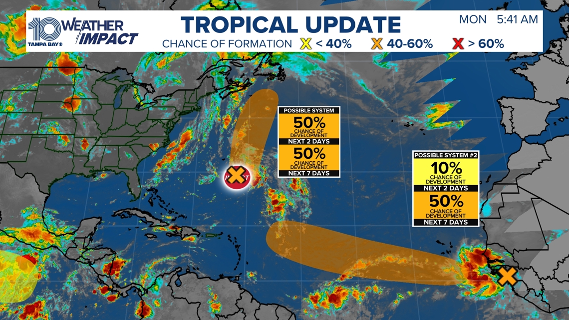
The first system is an area of low pressure located several hundred miles southeast of Bermuda. Satellite images show showers and thunderstorms are becoming better organized, and further development is possible.

This story continues below.
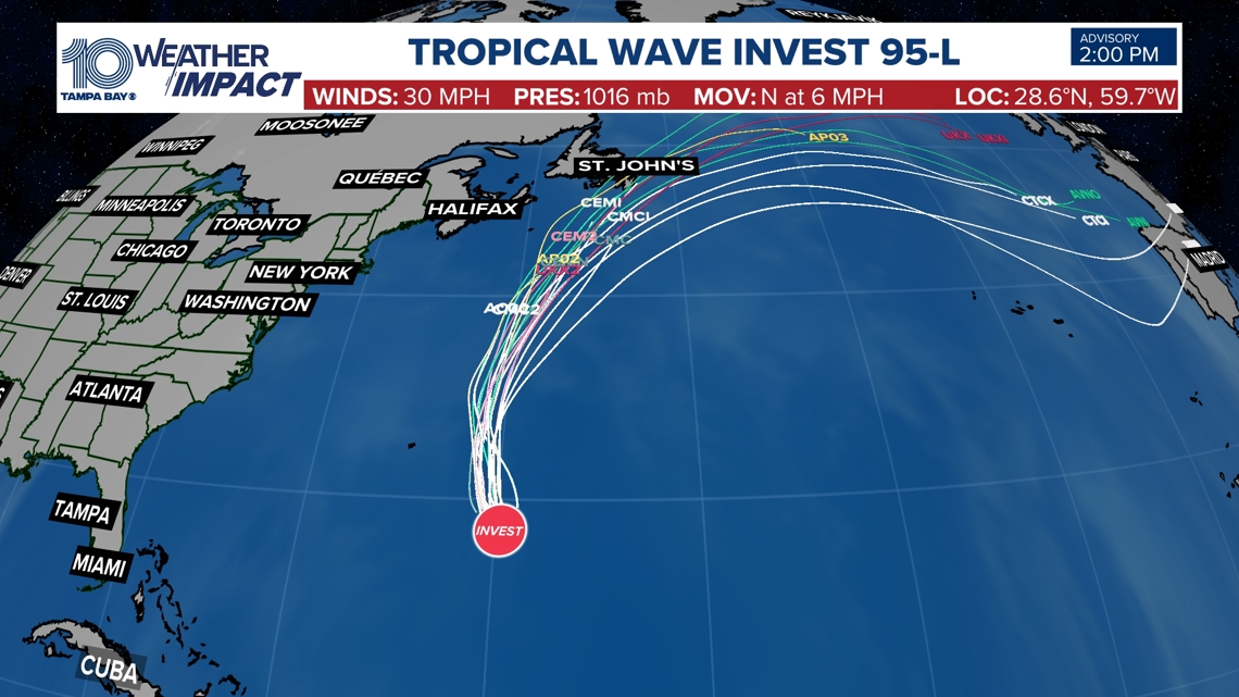
The system could become a short-lived tropical depression or storm during the next couple of days as it moves northward to north-northeastward, well northeast of Bermuda. The NHC currently gives it a 50% chance of development over the next two to seven days.
Eastern Tropical Atlantic
The second area to watch is a tropical wave expected to move off the west coast of Africa on Monday. An area of low pressure could form in association with the wave early this week.
Environmental conditions are expected to be marginally conducive for development, and a tropical depression could form by the middle to latter portions of the week as the system moves generally westward at 15 to 20 mph across the eastern and central tropical Atlantic.
The NHC currently gives this system a 50% chance of development over the next seven days.
Neither system poses an immediate threat to the Atlantic Coast or the Tampa Bay area.