
ORLANDO, Fla. – A near-record warm weekend will give way to a near-record cold start to the work week.
Feels Like Forecast
During the transition, ahead of a strong cold front Sunday, a few storms could be strong.
A couple of storms will be possible Saturday, but most will be dry and warm with highs in the mid-80s.
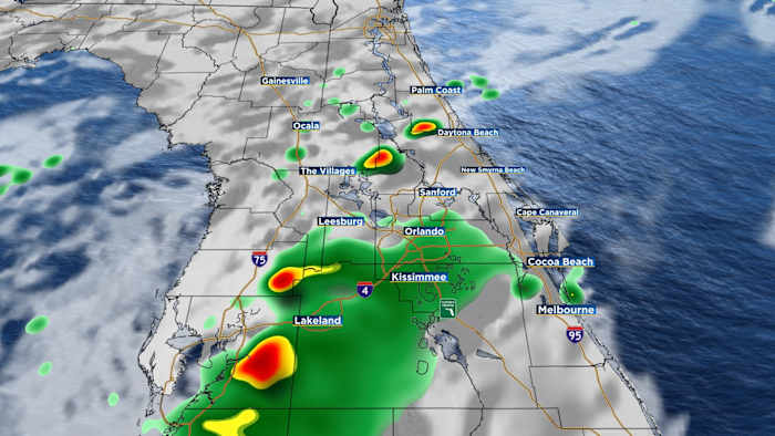
Storm chances still won’t be all that high Sunday, 30%, but the few that do develop could be on the stronger side, with isolated damaging wind gusts the primary threat.
Clouds and rain forecast
After lunch through the evening will be the best bet to see a storm.
Future radar
Much colder air then pushes down the peninsula Monday morning.
Highs only top out in the mid-60s.
Highs Monday
The coldest morning of this round of cold air settles in Tuesday with widespread 30s and 40s.
Tuesday morning
With a gusty wind, it will feel like the upper 20s to mid-30s.
wind chill Tuesday morning
Highs Tuesday will be in the upper 50s and lower 60s.
The chill lingers into Wednesday before a gradual warmup returns to close the work week.
News 6 Weather Insider
More Stories Like This In Our Email Newsletter
Copyright 2025 by WKMG ClickOrlando – All rights reserved.