
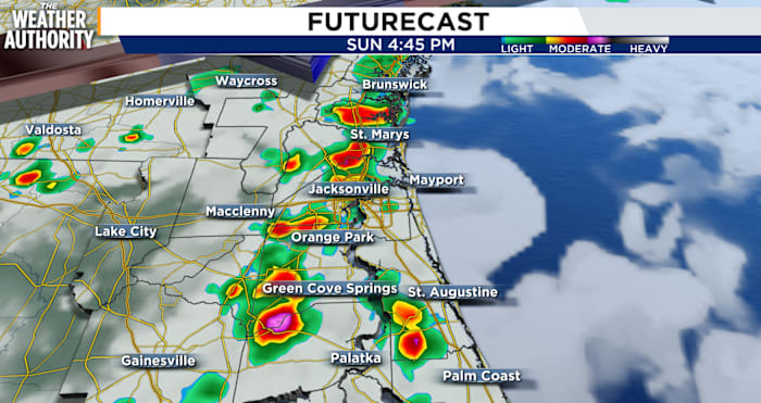
JACKSONVILLE, Fla. – Heavy rainfall and localized flooding are the main concerns today, particularly for areas between the US-301 and I-75 corridors.
Showers and thunderstorms are expected to fire up along the coastline during the afternoon hours before pushing inland.
While flooding remains the top concern, a few of the stronger storms could also bring gusty winds between 40 and 50 mph and frequent lightning. The overall risk for severe weather, however, remains relatively low.
Heat adds another layer of misery
It won’t just be the rain making people uncomfortable Sunday. Temperatures are expected to reach the upper 80s near the coast and along the I-95 corridor, while areas further inland could climb into the lower 90s.
Factor in the thick humidity and it’s going to feel more like 100 to 105 degrees at the peak of the afternoon.
Overnight won’t bring much relief. Low temperatures will hover in the lower to middle 70s inland, with upper 70s expected along the Atlantic Coast. Some patchy fog is also possible by early morning.
Copyright 2026 by WJXT News4JAX – All rights reserved.