
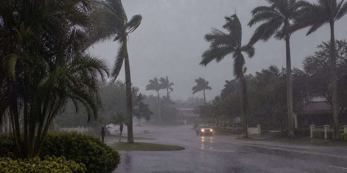
SARASOTA, Fla. (WWSB) – ABC7 has issued a First Alert Weather Day for Tuesday as an unusually moisture-rich atmosphere increases the potential for heavy rainfall and localized flooding across the Suncoast.
Tuesday is just the beginning of what could be a very wet stretch.
A deep supply of tropical moisture combined with a stubborn easterly wind pattern will keep showers and thunderstorms in the forecast nearly every day through the upcoming week.
Numerous to widespread showers and thunderstorms are possible each day, with some storms capable of producing very heavy rainfall. Urban and poor-drainage areas will be particularly vulnerable to localized flooding.
And the timing matters.
The easterly flow favors storms developing inland before gradually migrating west toward the Suncoast during the late afternoon and evening, meaning some of the heaviest activity can arrive near the coast relatively late in the day.
Tonight: Storms make a late run at the coast
Scattered thunderstorms will continue moving toward the Suncoast this evening.
The atmosphere has plenty of moisture available, meaning any stronger storm could produce torrential rain, frequent lightning and gusty winds. Localized flooding is possible where heavy rain repeatedly falls over urban or poor-drainage areas.
Most of the activity should gradually diminish later tonight, although some storms may survive offshore into the Gulf.
Temperatures overnight fall into the middle and upper 70s.
Tuesday: First Alert Weather Day
ABC7 has declared Tuesday a First Alert Weather Day because of the potential impact from heavy rainfall and localized flooding.
September begins with an atmosphere loaded with moisture. Showers and thunderstorms will become increasingly numerous as the day progresses, with some capable of producing very high rainfall rates.
Rain chances are around 60% across the Sarasota-Bradenton area, but that number doesn’t tell the whole story. A 60% chance of rain does not mean it rains for 60% of the day, nor does it describe how intense an individual thunderstorm could become.
The primary concern Tuesday isn’t severe weather. It’s water.
Repeated or slow-moving thunderstorms could dump heavy rain over the same locations, creating localized street flooding and problems in low-lying and poor-drainage areas.
Highs will reach around 91 degrees, with the heat index potentially reaching around 102 degrees before thunderstorms provide some relief.
The easterly steering flow will once again favor storms migrating toward the Suncoast later in the afternoon and evening.
Why is it so wet?
High pressure positioned north of Florida is maintaining a generally easterly wind flow across the state.
At the same time, deep tropical moisture is parked over Florida.
Put those two ingredients together and thunderstorms can develop inland during the heat of the day before gradually migrating west toward the Gulf Coast.
And unlike some summertime patterns that change after a day or two, there isn’t much in the atmosphere to knock this one out of place.
That’s why the forecast starts looking repetitive.
There is also additional tropical moisture in the broader region associated with the remnants of what was Tropical Storm Dolly. That moisture will help reinforce an already very humid atmosphere around Florida during the middle of the week.
The rest of the week: Rain chances stay high
Tuesday isn’t a one-day event.
Wednesday through Friday could continue the very wet pattern, with rain chances around 70% each day and numerous afternoon and evening thunderstorms possible.
High temperatures remain near 90 to 92 degrees, but the bigger concern may become how much rain repeatedly falls over the same areas.
With deep moisture remaining in place, thunderstorms will be capable of producing substantial rainfall in relatively short periods of time.
That doesn’t mean everyone will flood. It does mean some locations could receive considerably more rain than others, particularly where thunderstorms repeatedly develop or move over the same neighborhoods.
The weekend doesn’t break the pattern
Don’t expect a dramatic change when the weekend arrives.
Showers and thunderstorms remain likely Saturday and Sunday, with rain chances around 60% to 70%.
Temperatures may actually come down slightly, with highs around 89 to 90 degrees, but that’s largely because additional clouds and thunderstorms can limit afternoon heating.
The takeaway is simple: there isn’t currently a dry day in the seven-day forecast.
Yes, we still need the rain
There’s an interesting twist to such a wet forecast.
Parts of West Central and Southwest Florida remain in drought, including pockets of extreme drought.
Recent rain has helped some locations, but significant longer-term rainfall deficits remain.
That means we can simultaneously need rain and have too much rain fall in one place at one time.
A thunderstorm dumping several inches of rain over a neighborhood can cause street flooding without immediately erasing a rainfall deficit that developed over weeks or months.
Several days of widespread, beneficial rainfall would help. Several inches falling in an hour over the same neighborhood is a different story.
The tropics: Two systems, two very different stories
There are two tropical features worth watching, but neither currently represents a tropical cyclone threat to the Suncoast.
Tropical Depression Five is over the northern Gulf and headed toward the Texas-Louisiana coast. The system could strengthen before reaching the coast, but it is not headed toward Florida.
Then there is Dolly, or what’s left of it.
The remnants of Tropical Storm Dolly are moving generally westward through the Caribbean and Bahamas region. Redevelopment is not expected.
For Florida, Dolly’s remnants are more important as a source of tropical moisture than as an organized tropical system.
That moisture will become part of an already moisture-loaded environment around Florida during the middle of the week, helping maintain the active thunderstorm pattern.
Boaters: The wind isn’t the biggest problem
Overall winds over the local Gulf waters remain relatively light, generally out of the east before the afternoon sea breeze develops near the coast.
But don’t let relatively calm winds fool you.
Thunderstorms will move toward and eventually off the Gulf Coast during the evening, and some may linger over the water overnight.
Any thunderstorm can suddenly produce frequent lightning, strong wind gusts and locally rough seas.
For boaters, this is a week when conditions can go from manageable to dangerous very quickly underneath a thunderstorm.
Copyright 2026 WWSB. All rights reserved.