
ORLANDO, Fla. – Central Florida will see a swing, with near-record warmth this weekend quickly giving way to much colder air as a strong cold front moves in.
Today’s highs
Temperatures are expected to reach the upper 80s across the area on Saturday and the lower 80s on Sunday. But don’t get too comfortable with the warm temperatures; beginning Sunday night, temperatures are expected to tumble.
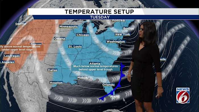
By the time the cold front passes, the area could see wake-up temperatures in the 30s and 40s with wind chills in the 20s and 30s, with a brisk high of just 60 degrees on Tuesday — and it may even break the record for the lowest high, which was 61 degrees set in 1913.
Tuesday Wake Up TempsSevere storms possible ahead of cold frontMarginal Risk for Severe Weather on Sunday
A few strong to severe storms are possible as the cold front pushes through Sunday afternoon into the evening. All of Central Florida is under a marginal risk for severe weather, meaning a few thunderstorms could turn strong. These storms are expected to bring gusty winds of 40 to 50 mph, small hail, and a minimal chance of a tornado.
Scattered showers may start popping up as early as 1 p.m. on Sunday, with storm chances steady around 30% through the late afternoon and evening. Things should start to clear out Sunday night.
Colder air is expected to begin to move in behind the front, the biggest concern: wind chills are expected to dip into the 20s and 30s across much of the area on Tuesday morning, especially in inland spots. Coastal communities such as those in Brevard County will likely feel wind chills in the upper 30s and lower 40s.
Temperatures are forecast to gradually recover, with high temperatures climbing back into the lower 70s by the end of the work week.
Want to show off how you’re preparing for Central Florida’s sudden cold snap?
Pin your photos and weather scenes with PinIt!.
Copyright 2025 by WKMG ClickOrlando – All rights reserved.