
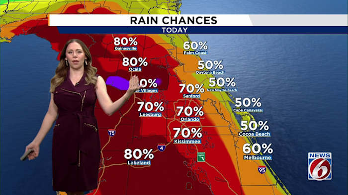
ORLANDO, Fla. – After several days of dodging pockets of heavy rain, Central Florida is likely to get a littler wetter through the rest of the week as tropical moisture from remnants of Tropical Storm Dolly move in.
THURSDAY & FRIDAY
Expect another day with elevated rain chances at 70-80% with some storms being capable producing 2 to 3 inches.
The Weather Prediction Center has all of East Central Florida under a Marginal Risk for excessive rainfall, or Level 1 out of 4.
Stronger storms could also produce wind gusts around 40 mph and frequent cloud-to-ground lightning.
Highs will reach the upper 80s to low 90s, with heat indices near 100 to 106 degrees.
WEEKEND
The wet pattern sticks around for them majority of the holiday weekend as winds turn more southerly and then southwesterly. That will push the sea breeze collision farther inland, keeping plenty of storms in the forecast.
Heavy rain remains the main concern, with 2 to 4 inches possible in some areas from slow-moving storms. Highs remain near normal in the upper 80s to low 90s.
Daily Forecast
The News 6 Weather team ensures you’re always on top of the day’s weather.
Copyright 2026 by WKMG ClickOrlando – All rights reserved.