
JACKSONVILLE, Fla. – It will be hot and humid today, with afternoon highs in the low to mid-90s. The heat index could reach around 105 degrees east of US301 during the early to mid-afternoon.
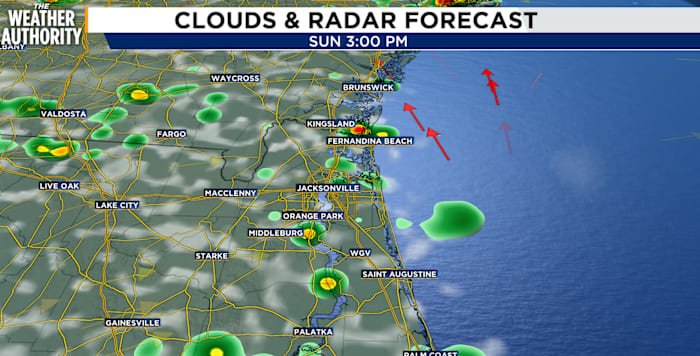
Scattered showers and thunderstorms will develop along the Gulf and Atlantic sea breezes, as well as near the Georgia-Florida line. Storms will become more numerous late this afternoon and this evening, especially along and east of US301 and toward the Atlantic coast.
The strongest storms could bring damaging wind gusts and brief, heavy downpours that may cause flooding in low-lying areas. The greatest concern will shift into Southeast Georgia this evening, before storms move south toward the I-10 corridor after sunset.
Most areas could receive a quarter-inch to an inch of rain, but some parts of Southeast Georgia could see 3-4 inches.
Showers and a few thunderstorms may continue after midnight, but storms should gradually weaken as the front stalls near the Georgia-Florida line. Overnight lows will range from the low 70s inland to the mid-70s along the coast, with less fog expected because of the clouds.
Be sure to keep your eye on the sky and your Weather Authority app on throughout the day to receive the latest updates. And, always have your indoor plans ready when the weather turns ugly outside.
Copyright 2026 by WJXT News4JAX – All rights reserved.