

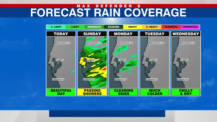
Tampa, Fla. (WFLA) — The coldest air of the season is headed for Tampa behind Sunday’s showers. After a lovely weekend in the warm 80s, temperatures are expected to plunge 25° below average for us for this time of the year.
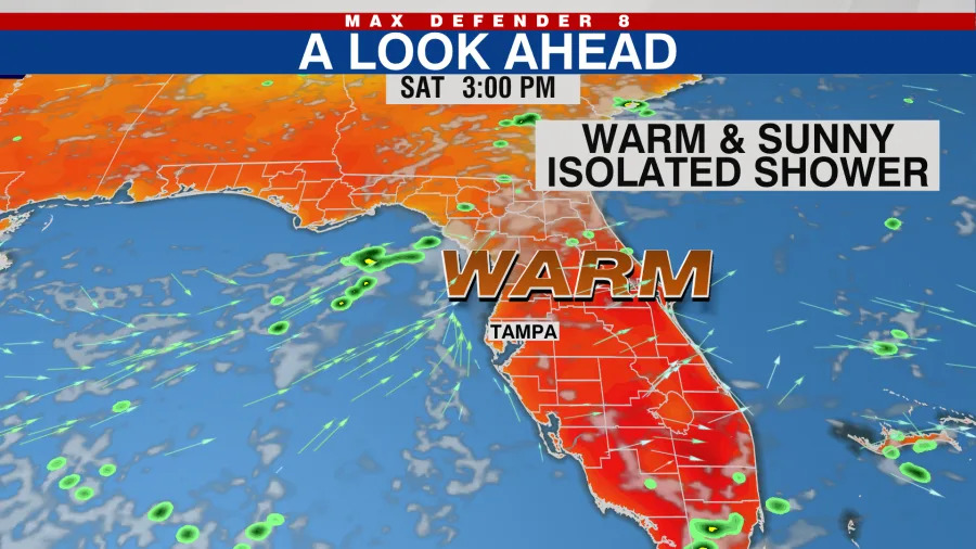
Saturday
Expect mostly sunny skies and warm temperatures, climbing into the mid-80s during the afternoon. There is a 30% chance for an isolated shower, mainly inland around 4 p.m. Temperatures will cool slowly into the upper 60s and low 70s Saturday evening.
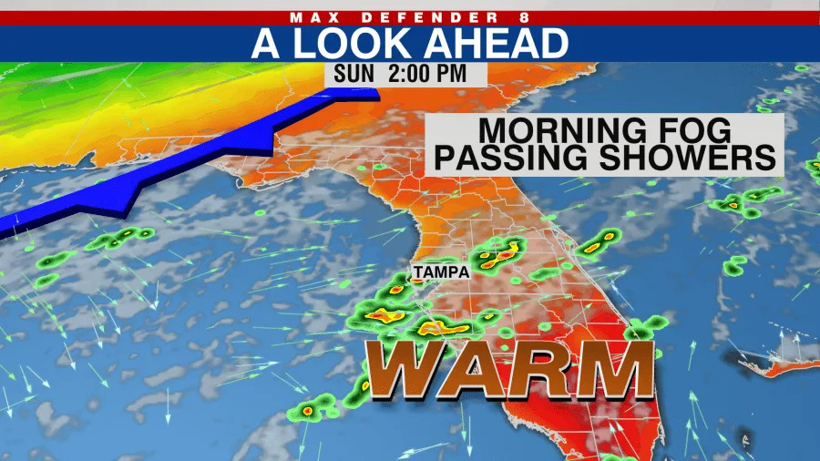
Sunday
Sunday will start out foggy and then it will be on the cloudier side, with warm temperatures topping out in the low 80s. A cold front will begin pushing through the southeast, enhancing our chances for passing showers. We may see a limited morning round of showers, but the main chances for rain will be between 1-3 p.m., with the showers heading east of us by 4-5 p.m. There may be a midnight round of showers as well, as the front itself pushes through overnight Sunday into Monday morning.
Monday
Monday is the beginning of the cool down, and we wake up around 59°. A brisk, cold wind blows all day, bringing the colder air down across the state. The sunshine can’t overcome the volume and intensity of the cold air, so we will just hover in the 60s all day, never really warming up. As the sun gets lower on the horizon on Monday afternoon, temperatures start plummeting. The coldest part of this cold snap will be Monday night into Tuesday morning. The brisk winds around 20 mph will make it feel even colder than it actually is.
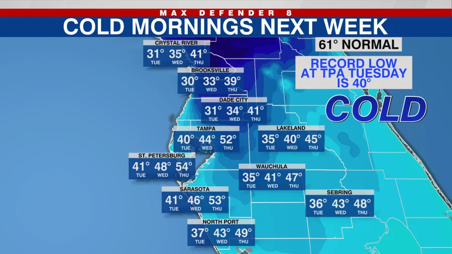
Tuesday
Tuesday, we wake up to record-challenging cold, in the 30s and 40s. The record low for that day for Tampa is 40°, which is what we are expected to get down to. We will most likely see a Freeze warning issued for Citrus, Hernando, and inland Pasco Counties. Even in our coastal and southern counties, we will get down into the record-challenging mid to low 40s. Expect a breezy day, adding a wind chill factor to the forecast as well. Actual temperatures will only climb into the low 60s for the afternoon
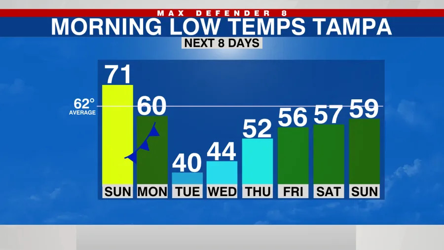

Wednesday
We plunge back into the 40s early Wednesday morning, but not quite as cold. Under sunny skies, with lighter winds, we climb into the cool low 70s. This marks the beginning of a slow warm-up, back to our average temperatures by the end of the week and next weekend.
Copyright 2025 Nexstar Media, Inc. All rights reserved. This material may not be published, broadcast, rewritten, or redistributed.
For the latest news, weather, sports, and streaming video, head to WFLA.