
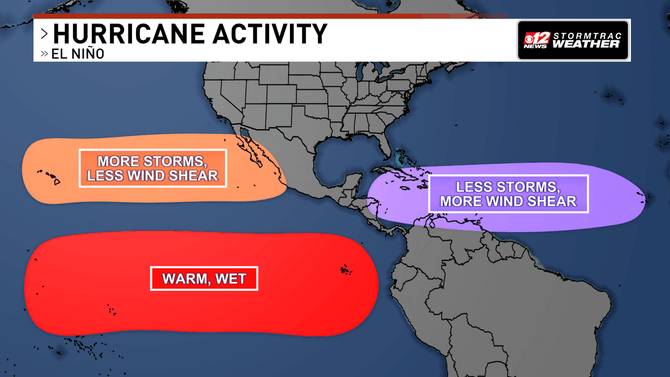
West Palm Beach, Fla. (WPEC) — A strengthening El Niño is already influencing weather patterns across the tropics, and it could have a meaningful—though not guaranteed—effect on South Florida’s winter weather.
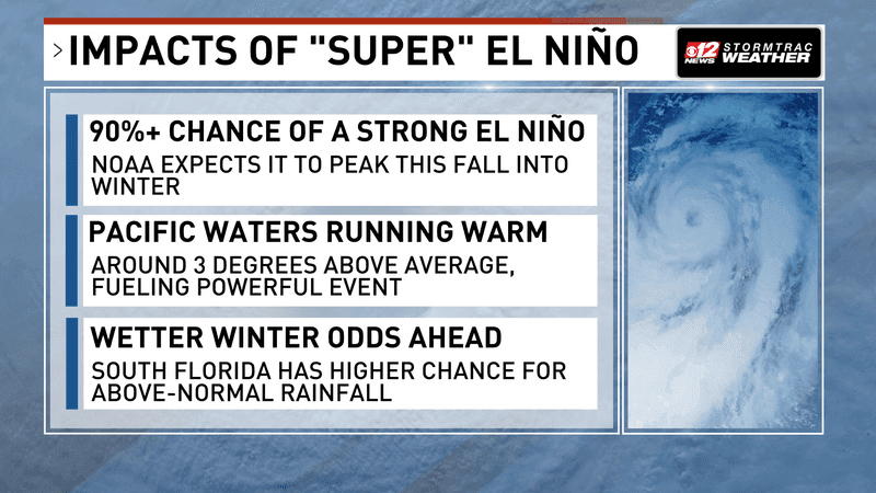
This strong El Niño event shows signals of a wetter winter in Florida. (WPEC)
NOAA’s Climate Prediction Center says El Niño has strengthened further during the past month, with more than a 90% chance that it becomes a very strong event during the fall and winter of 2026-27.
El Niño occurs when water temperatures in parts of the equatorial Pacific run warmer than average.
That warmth can shift weather patterns well beyond the Pacific, including the jet stream and upper-level winds across North America and the Atlantic basin.
A quieter Atlantic, a busy Pacific
One possible El Niño influence has already shown up in the Atlantic hurricane season.
Stronger upper-level winds can create wind shear, which makes it harder for tropical systems to organize and strengthen.
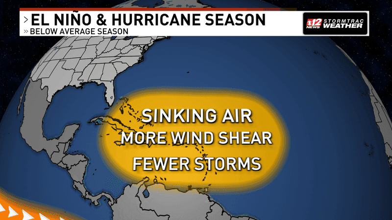
This warmer water in the Pacific creates strong wind shear in the Atlantic, as well as cooler waters to balance out. (WPEC)
That does not stop every storm, but it can be one ingredient behind an unusually quiet Atlantic season.
The Pacific tells a different story.
Warm Pacific waters and a more favorable environment have supported repeated development this season, including powerful Hurricane Polo and several other named systems.
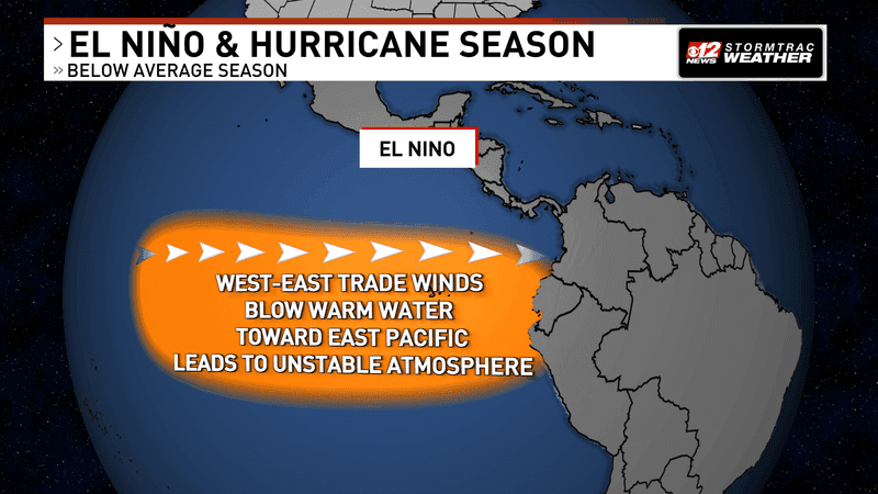
Warmer waters are present in the eastern Pacific from El Niño. (WPEC)
El Niño is not the only factor controlling any individual storm, but it can help create a broader pattern that is less favorable for Atlantic hurricanes and more supportive of eastern Pacific activity.
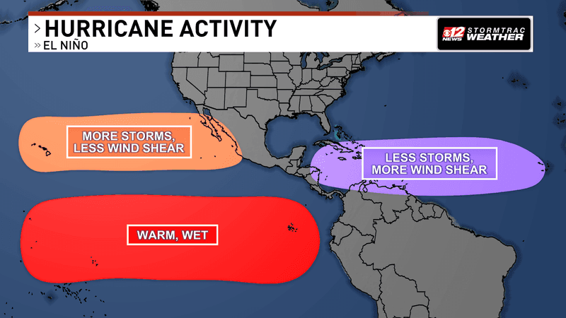
Cooler waters and more wind shear have lead to less activity in the Atlantic so far this hurricane season. (WPEC)
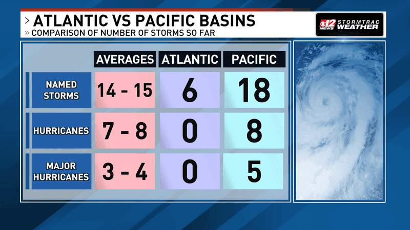
El Niño is the reason why the Pacific continues to rapidly outpace the Atlantic this hurricane season in both frequency and intensity of storms. (WPEC)
What it could mean for South Florida this winter
For the Palm Beaches, Treasure Coast and the rest of South Florida, the biggest El Niño-related signal is typically rainfall.
NOAA’s winter outlook favors above-normal precipitation across much of Florida.
That does not mean it will rain every day, nor does it guarantee frequent flooding.
Instead, it means the three-month winter period has a better-than-normal chance of ending up wetter than average.
In practical terms, that can mean more passing fronts, more cloud cover at times, and a greater chance for periods of rain compared to a typical dry-season pattern.
Some fronts may still arrive with cooler, drier air behind them, but the overall setup can be more active and less consistently dry.
Temperatures are less certain.
South Florida can still see warm stretches during an El Niño winter, especially between fronts.
The more reliable takeaway right now is simply this: a strengthening El Niño increases the odds that this winter features more rain than usual.