
The Brief
Cooler, drier weather continues through Tuesday before heat and humidity return later this week.
Highs will climb into the low 90s this weekend, with heat index values reaching 100 to 105 degrees inland.
Afternoon storms return Wednesday through Friday, while two weak Atlantic tropical storms are expected to dissipate without becoming hurricanes.
ORLANDO, Fla. – Big changes are ahead with a rise in heat and humidity for the upcoming weekend.
The lovely fall preview will be a distant memory come Saturday and Sunday.
Still dry, partly cloudy Tuesday
Florida got a nice refreshing treat of cooler temps and low humidity this weekend. Enjoy it while we have it, because our little taste of fall will come to an end.

Temperatures will reach into the upper 80s around Orlando, with a mixture of clouds and sunshine. A slight breeze from the south at 5-10 mph will slightly increase the humidity, but not much. Most places should remain dry as any chance of rain will remain in south Florida.
Heat, humidity, rain return midweek
A dome of high pressure in the jet stream will form and park over Florida at the end of the week, surging temperatures into the low 90s, with a heat index of 100 to 105 again, especially areas inland.

Places from Orlando and points west will have the highest heat index, up to 105 degrees each afternoon, while beach towns may be in the mid 90s.

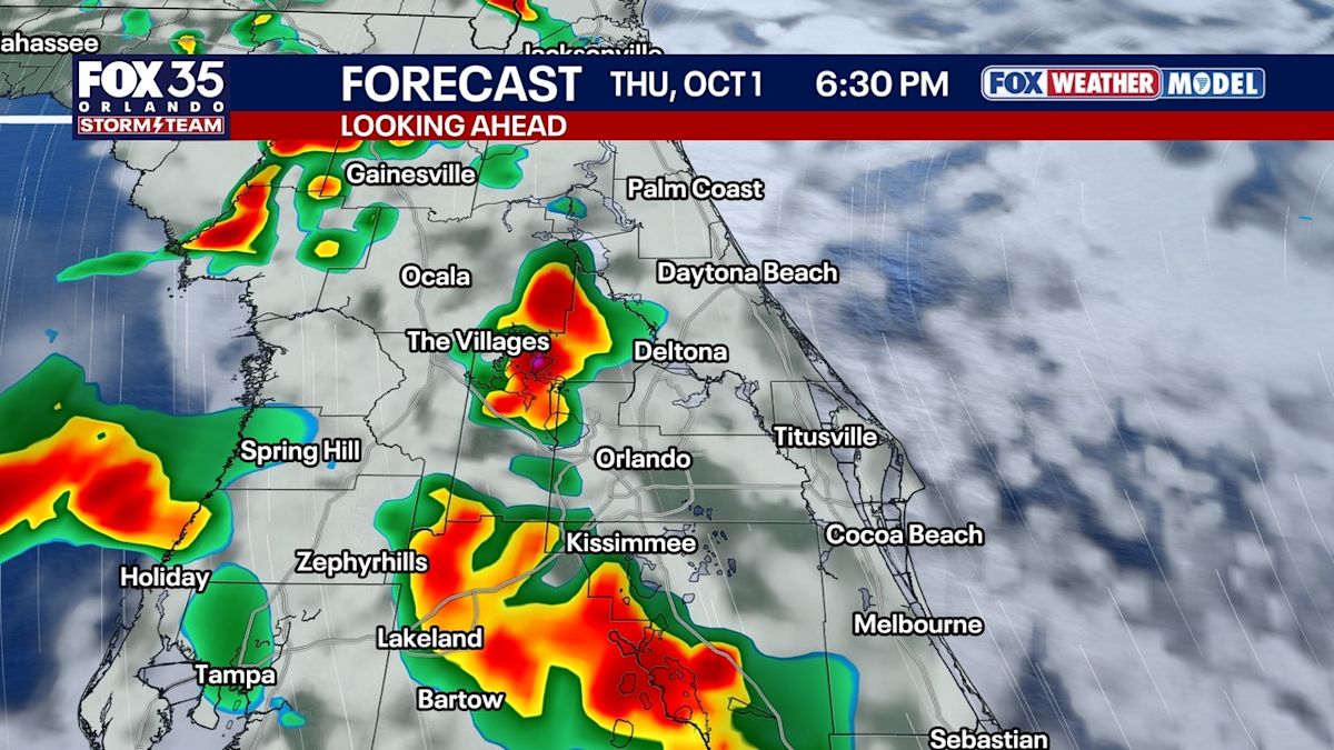
Rain chances creep back up into next weekend with the help of sea breeze collisions and our next approaching disturbance.

With another wave of tropical moisture moving in, our daily storms will come back as well as the heat and humidity.
2 weak tropical systems in Atlantic
Tracking the Tropics
Tracking two weak tropical storms in the Atlantic, that still remains the quietest season on record to date — and the first season with no hurricane through Oct. 1st on record.

Fay will fall apart by Tuesday. Hanna will track east and fall apart Thursday in the open waters of the Atlantic Ocean

There is no threat to Florida or the United States.
The Source
This story was written based on information shared by the FOX 35 Storm Team, the National Weather Service and the National Hurricane Center.