
ORLANDO, Fla. – SUMMER LIKE FORECAST IN FALL
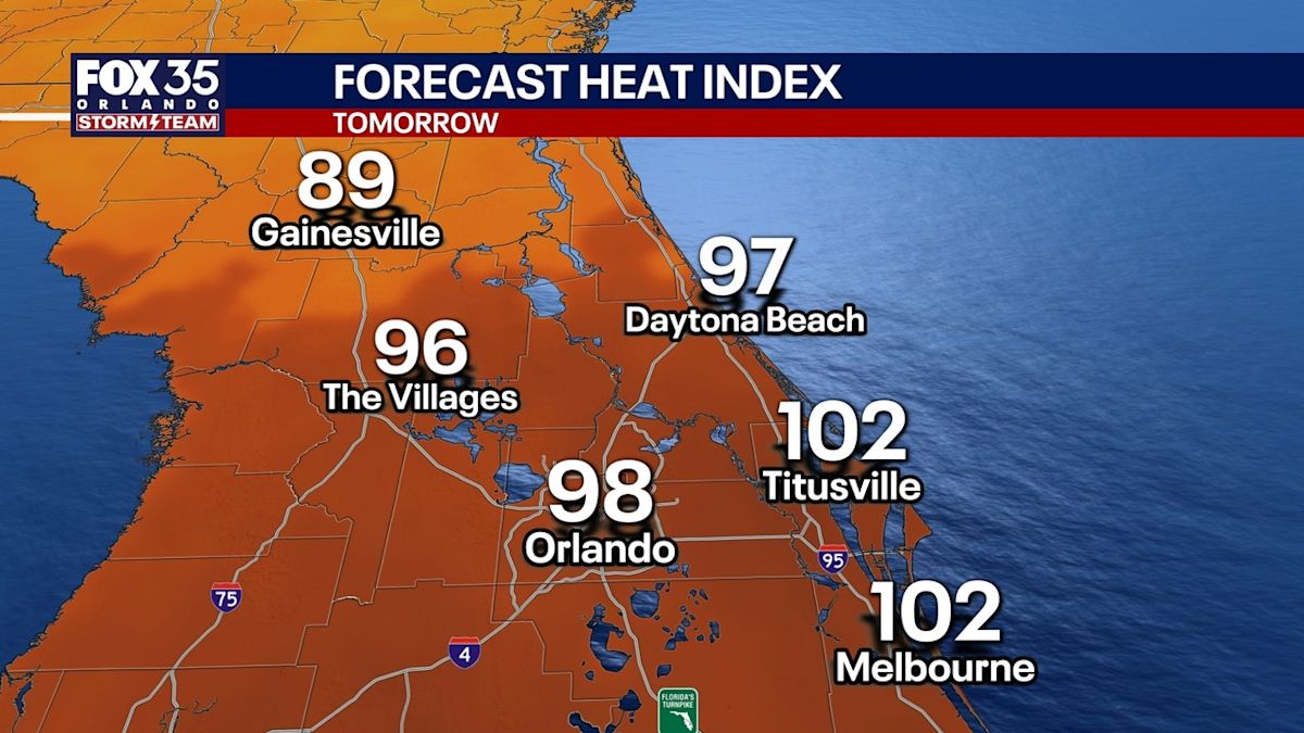
With another surge of tropical air settling in over Central Florida, the humidity will feel like it is in the middle of summer as opposed to the start of October.
There will be widespread showers each and every day for the next 5 days through the afternoon and evening. Keep the umbrella handy!
Temperatures will top off in the upper 80s and low 90s, which is seasonable for this time of year. But with the humidity, it will feel like it is close to triple digits. The air will feel like soup for quite a while
STALLED FRONT BRINGS HEAVY RAIN THIS WEEK
A more active pattern takes shape for early parts of next week, which means higher-than-normal chances of showers and storms. An approaching cold front will stall out over Central Florida, driving up shower and storm chances across the region.

Plan for at least a 60% chance for Monday, a 70% chance for Tuesday and an 80% Wednesday. With rounds of heavy rain expected, minor flooding is possible for low-lying or poor drainage areas.
A widespread 2–4 inches of rain is possible over the next 7 days, with isolated totals of 5 inches or more.
TRACKING THE TROPICS
The NHC has outlined an area of interest for potential tropical development in the southern Gulf over the Bay of Campeche.
There is a 0% chance of development over the next two days and a low 30% chance of development over the next seven days.
A broad area of low pressure could form over the next few days
Development will be slow, and wind shear may limit the formation of an organized system or storm
It’s too early to say if there will be impacts on Florida
The Source
This story was written based on information provided by FOX 35 meteorologist Jessica Dobson on Oct. 4, 2026.