
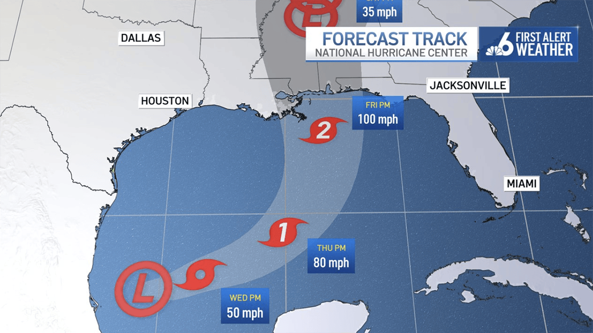
A tropical depression formed over the western Gulf on Tuesday and was forecast to strengthen quickly into a tropical storm and then a hurricane, the National Hurricane Center in Miami said.
Tropical Depression Nine had maximum sustained winds near 35 mph and was moving east at 5 mph about 605 miles southwest of the mouth of the Mississippi River, the NHC said.
NHCNHC
Tropical Depression Nine’s forecast track.
No watches or warnings were in effect but forecasters said the depression was expected to become a tropical storm by early Wednesday and a hurricane on Thursday.
The system was expected to continue heading east and east-northeast before an anticipated turn to the northeast on Friday before it approaches the northern Gulf Coast.
It’s expected to be a hurricane when it makes landfall, the NHC said.
“From Friday through the weekend, the system is expected to produce rainfall amounts of 3 to 6 inches, with localized totals up to 10 inches, across the central U.S. Gulf Coast extending from southeastern Louisiana to the Florida Panhandle,” the NHC said. “Flash and urban flooding, along with isolated river flooding, will be possible.”
4 PM CDT Tue Oct 6 (Advisory 1) Key Messages for Tropical Depression #Nine. Latest info: https://t.co/GrztW6mQJV
4 PM CDT martes 6 de octubre (Aviso 1) Mensajes clave sobre la depresión tropical #Nueve. Más información: https://t.co/GrztW6mQJV https://t.co/drX15GM6Iy
— National Hurricane Center (@NHC_Atlantic) October 6, 2026
The next named storm will be “Isaias.”
The system is not currently expected to directly impact South Florida.