
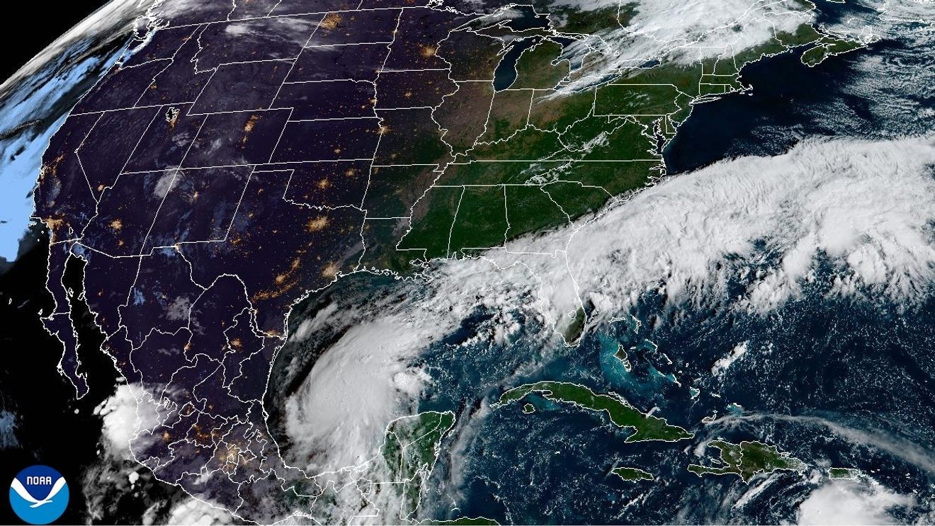
TALLAHASSEE, Fla. (CBS12) — Florida emergency officials are staging generators, fuel, drinking water and flood-control equipment across North Florida as Tropical Storm Isaias strengthens in the Gulf and could become the Atlantic season’s first hurricane.
Gov. Ron DeSantis signed an executive order Tuesday declaring a state of emergency for 25 counties in the Panhandle and Big Bend before the system was named. The order allows the state to mobilize personnel and resources ahead of possible impacts.
A hurricane watch now extends from Bay St. Louis, Mississippi, to Indian Pass, Florida, and a storm-surge watch covers the coast from the mouth of the Mississippi River to Yankeetown, Florida. Tropical-storm watches cover areas on both sides of the hurricane-watch zone.
The NHC projects:
5 to 7 feet of storm surge from Ocean Springs, Mississippi, to Indian Pass, including Mobile Bay.3 to 5 feet from Indian Pass to the Aucilla River.Hurricane conditions could begin late Friday, with tropical-storm conditions possible by midday Friday.Isaias is forecast to rapidly strengthen and could approach the northern Gulf Coast as a strong hurricane.
TRACK THE TROPICS: Interactive Hurricane Radar
The state said the Florida State Emergency Response Team is positioning generators, fuel, flood barriers, boxed water, shelf-stable meals, flood buckets, tarps, Tiger Dams and sandbags in Tallahassee and the Santa Rosa area for rapid deployment.
The emergency declaration covers Baker, Bay, Calhoun, Columbia, Dixie, Escambia, Franklin, Gadsden, Gilchrist, Gulf, Hamilton, Holmes, Jackson, Jefferson, Lafayette, Leon, Liberty, Madison, Okaloosa, Santa Rosa, Suwannee, Taylor, Walton, Wakulla and Washington counties.
See also: Tropical Storm Isaias forms in the southwestern Gulf, forecast to become a hurricane
Tropical Storm Isaias formed Wednesday morning over the Gulf, with maximum sustained winds near 40 mph. Forecasters said the storm was expected to strengthen and could make landfall along the northern Gulf Coast late this week, with heavy rain, damaging winds, coastal flooding and isolated tornadoes possible across North Florida.
The state’s emergency order noted that parts of North Florida were already dealing with saturated ground and elevated water levels after recent heavy rain, increasing the threat of flash, river and urban flooding.
In Escambia County, emergency management staff are monitoring the system around the clock. Officials have opened several public sand locations, while county crews inspect stormwater ponds, lower water levels where needed and watch problem creeks and rivers.
Pensacola city crews also began re-inspecting storm drains, clearing debris, lowering pond levels, securing construction sites and removing roadside debris, according to a joint city-county update.
Dangerous rip currents are already a concern along Panhandle beaches. The National Weather Service issued high-rip-current warnings or statements for beaches from Escambia County east through Franklin County, with some in effect through the weekend.
See also: Hurricane supplies checklist: What to have before a storm
DeSantis urged Floridians in the potential impact area to review their disaster plans, stock hurricane supplies and follow updates from state and local emergency managers.
Florida law also allows eligible residents to obtain early prescription refills during a declared emergency. The Office of Insurance Regulation said insurers, managed care organizations and pharmacy benefit managers must waive “refill too soon” restrictions and authorize payment for at least a 30-day supply when authorized refills remain.
The provision applies to people who live in a county under a hurricane warning, a governor-declared emergency or an activated local emergency plan; the state’s current order covers 25 North Florida counties in the potential path of Isaias.
Residents should monitor the latest forecast, know their evacuation zone and avoid driving through flooded roads.