
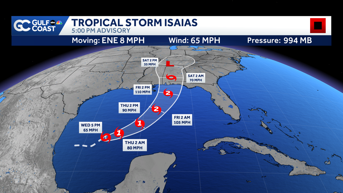
While this poses no direct threat to Southwest Florida, our region will see indirect impacts near the end of the week.
 FORT MYERS, Fla. —
Tropical Storm Isaias (ees-ah-EE-ahs) has developed in the southwestern Gulf, becoming the ninth named storm of the season. As of 5 p.m. Wednesday, Tropical Storm Isaias is producing winds sustained at 65 mph. The storm is tracking east-northeast at 8 mph.
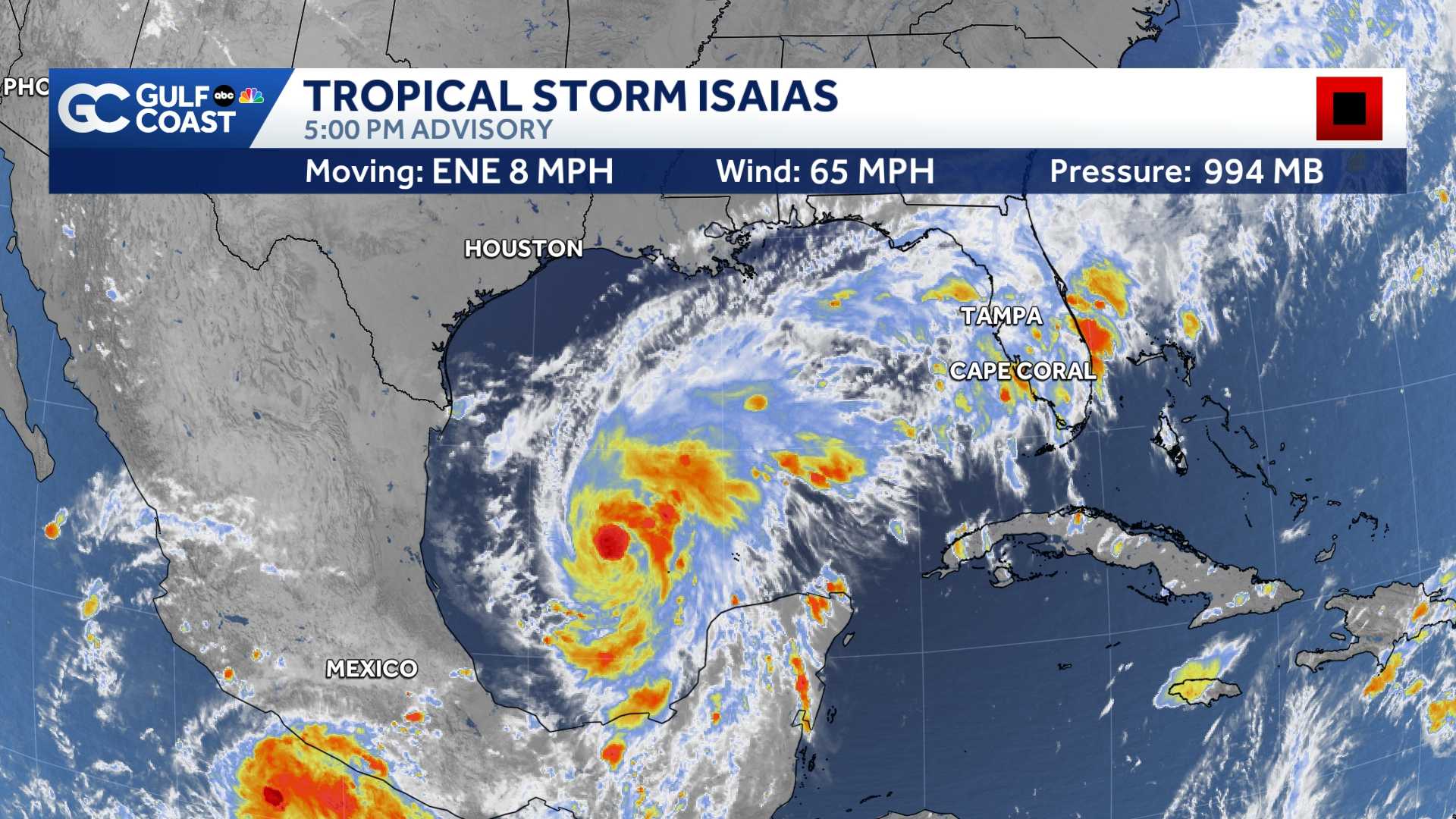
The center of the storm is predicted to drift east before making a sharp turn north on Friday. While the storm is expected to battle wind shear in the northern Gulf, warm sea surface temperatures will still support gradual strengthening.
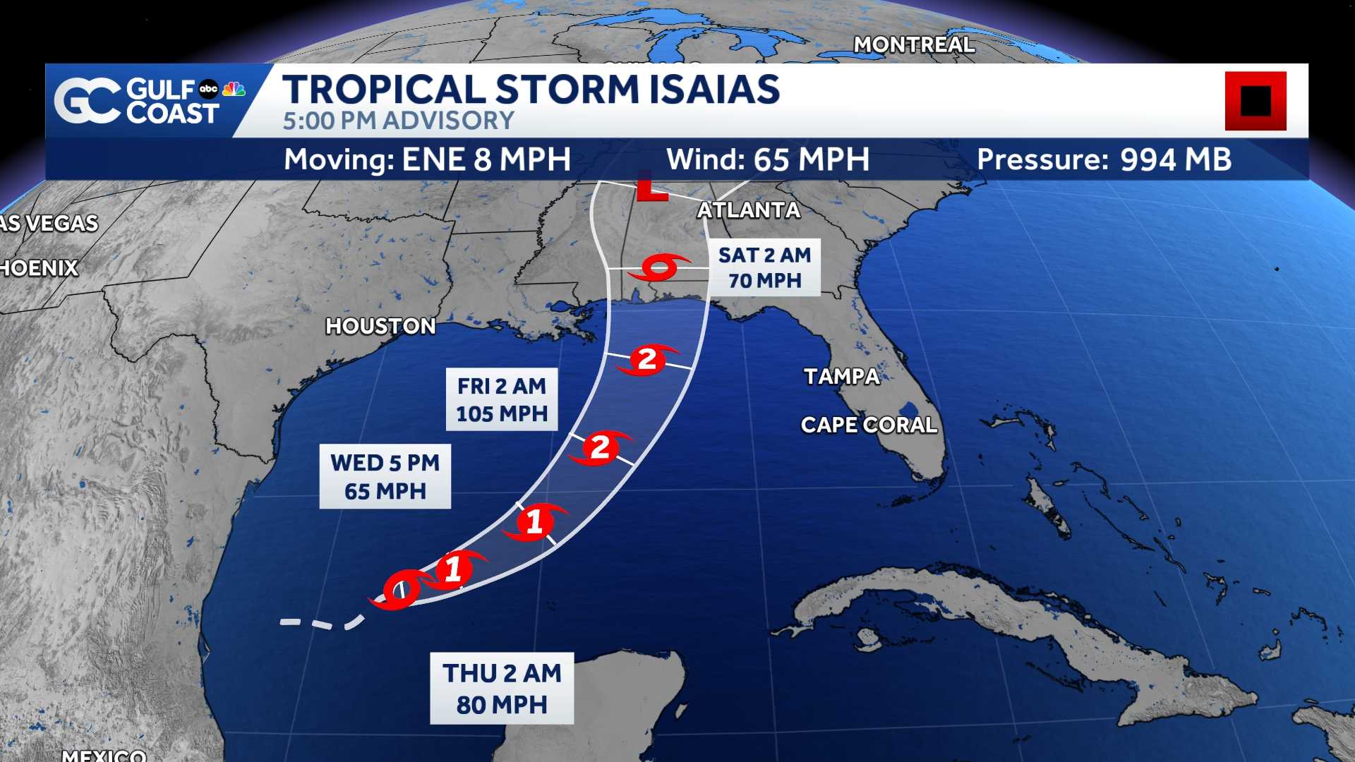
Isaias is set to become the first hurricane of the season on Thursday. This will be the latest first forming hurricane for an Atlantic season on record.
Isaias is predicted to continue strengthening into a Category 2 storm before it makes landfall either Friday evening or Saturday morning. Landfall is possible somewhere between southeastern Louisiana and the western Florida Panhandle.
Southwest Florida Impacts
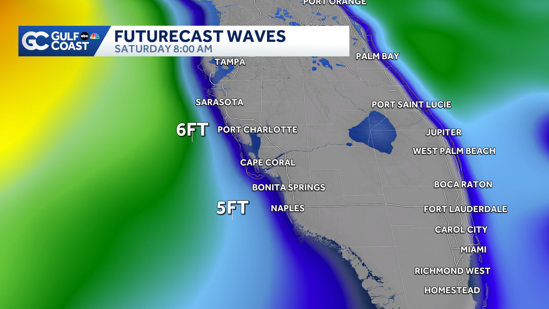
While Isaias poses no direct threat for Southwest Florida, our region will experience indirect impacts Friday and Saturday. The closest pass to our region will be on Friday, though the center of Isaias is still projected to be over 400 miles away.
The main threats will be rough surf and an increased threat for rip currents. Seas will build 3 to 5 feet on Saturday, though calmer conditions will return on Sunday.
Gulf Coast News
Futurecast Waves
Trailing downpours will filter through the region as Tropical Storm Isaias pulls moisture north. Drier conditions will return to Southwest Florida next week.
U.S. Impacts
Those who live anywhere from the Florida Panhandle to Louisiana need to watch this system closely.
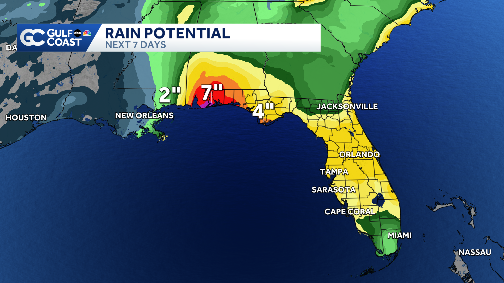
Isaias is projected to bring 3 to 6 inches of heavy rain, the potential for hurricane-force winds, flooding and the threat for tornadoes to parts of the northern Gulf Coast.
Gulf Coast News
Rainfall Totals
Watches & Warnings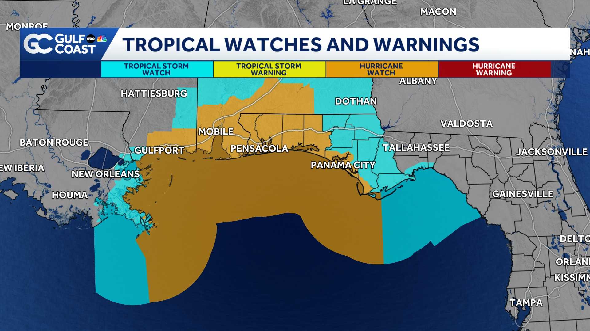
A Hurricane Watch is in effect from Mississippi to Indian Pass Florida.
A Tropical Storm Watch is in effect for much of the northern Gulf Coast, from Louisiana to the panhandle of Florida.
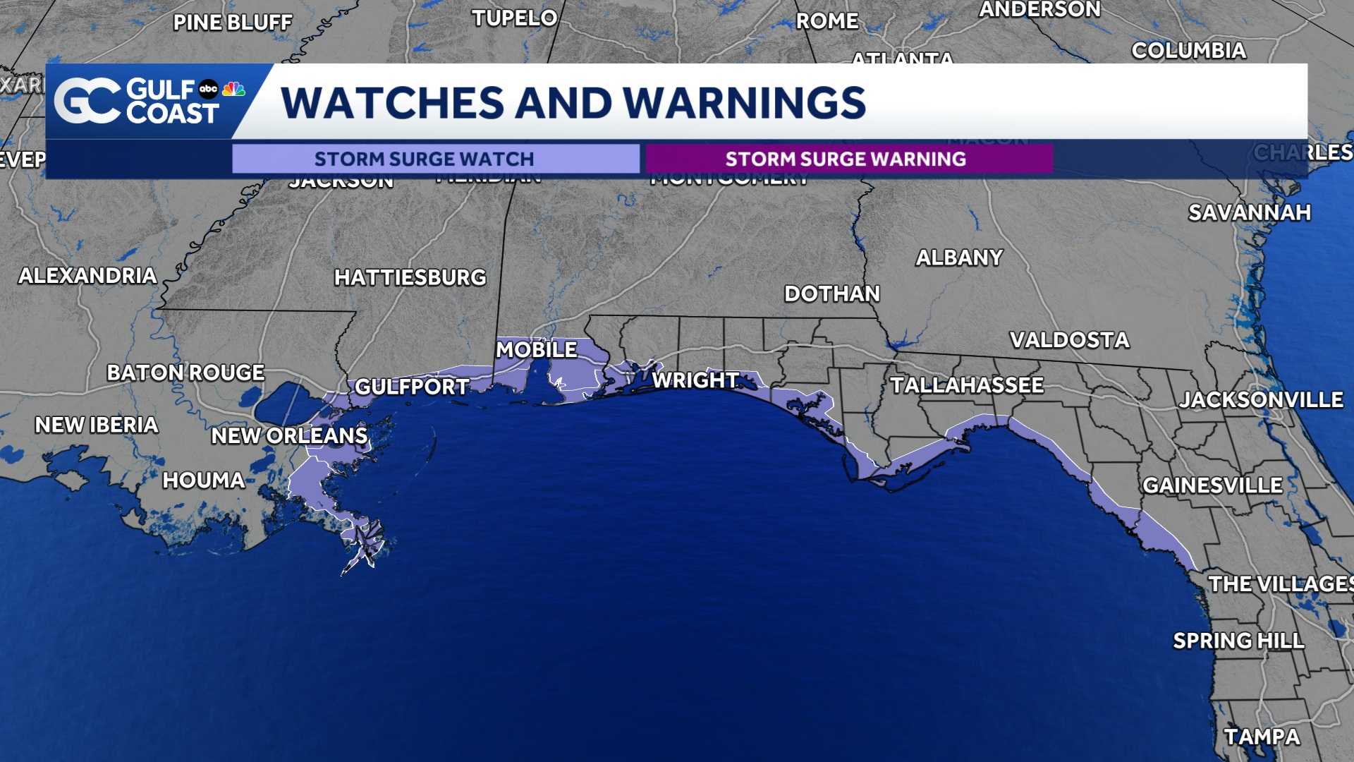
A Storm Surge Watch is in place for points east of the mouth of the Mississippi River to Indian Pass Florida.
Count on the Gulf Coast Hurricane Tracking Team to keep you informed.
However you watch or scroll, we’re committed to delivering your Gulf Coast Weather Most Accurate Forecast, one you can rely on every day, wherever you are.
Live Interactive Radar: Track conditions in real time with the Gulf Coast Live Radar.
Watch Gulf Coast Weather: Find the latest weather forecast videos, streaming live or on demand, on TV and online.
Stream on the Go: Download the free Gulf Coast News app to watch on your phone or tablet.
Your Gulf Coast Weather Team
Follow on Social: Follow, like, and subscribe to Gulf Coast News on social media to share your tips and be part of the conversation with Southwest Florida’s most experienced, trusted weather team: Facebook | Instagram | YouTube | TikTok | Threads | Bluesky | Nextdoor | X
DOWNLOAD the free Gulf Coast News app for your latest breaking news and weather alerts. And check out the Very Local Gulf Coast app to stream news, entertainment, and original programming on your TV.