
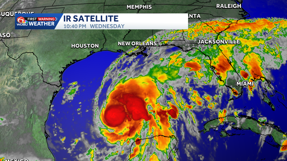
Isaias is forecast to strengthen rapidly and approach the northern Gulf Coast Friday.
Summary:
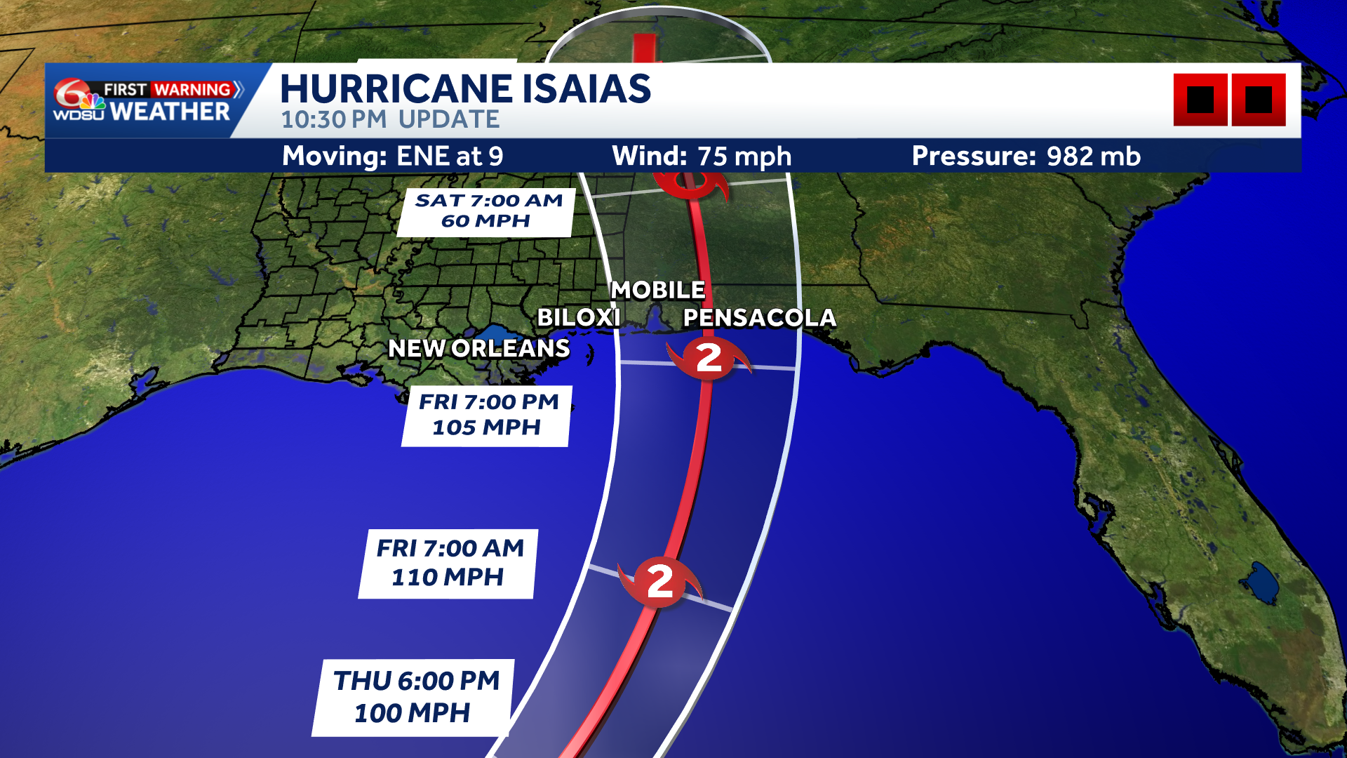
Isaias is now a hurricane, becoming the first hurricane of the 2026 Atlantic hurricane season. Max winds of 75mph.
Hearst Owned
Hurricane Isaias Track
Additional strengthening is expected, and Isaias will likely become a strong Category 2 hurricane by Friday morning.
Isaias could bring life-threatening storm surge, damaging winds and widespread power outages to parts of the Gulf Coast. Landfall expected near Orange Beach/Gulf Breeze/Pensacola. Gusts over 100 mph are possible near landfall, along with 4 to 8 inches of rain, isolated totals near 10 inches and a few tornadoes. Conditions are expected to deteriorate Friday. Small track shifts could significantly change who gets the worst impacts.
Watches & Warnings: A Hurricane Warning is in effect from Ocean Springs, Mississippi, to the Bay/Gulf County line in Florida. Hurricane conditions are expected within the warning area, and residents should complete preparations as soon as possible. 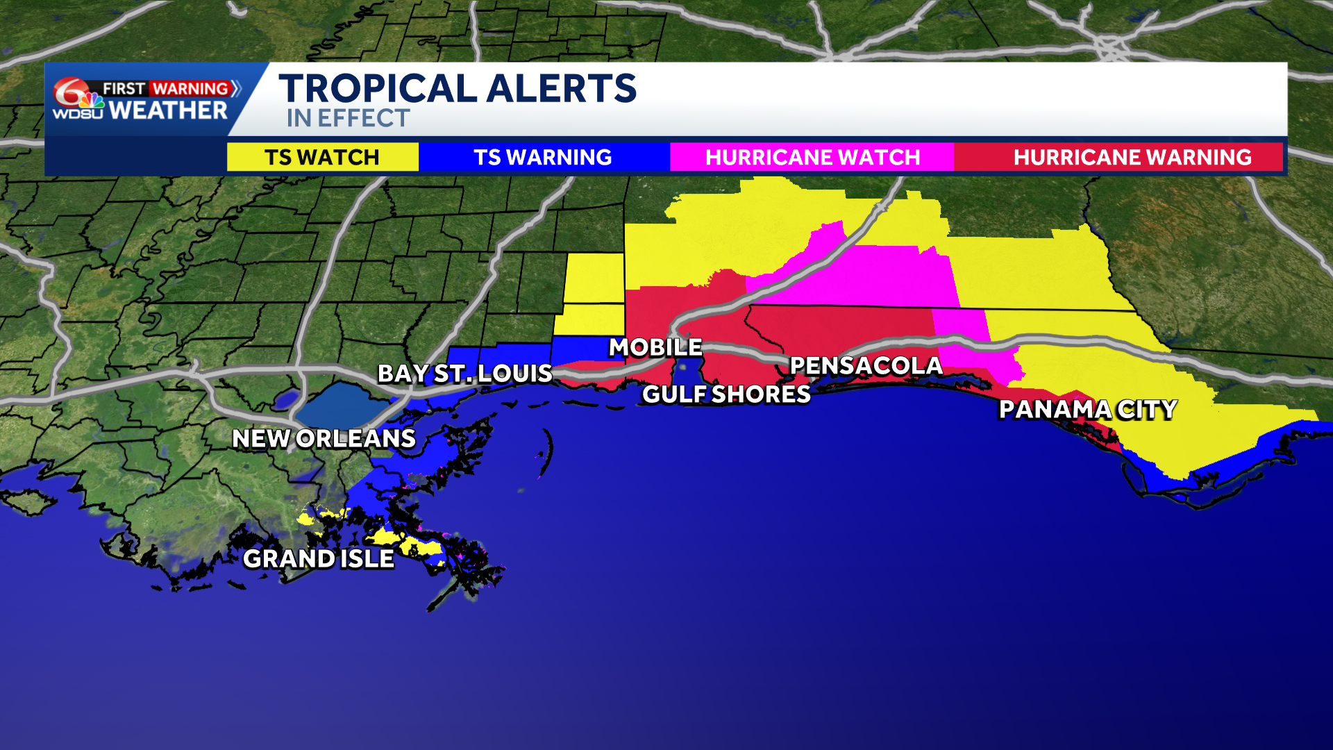
Hearst Owned
Tropical Storm and Hurricane Warnings
A Tropical Storm Warning extends from the Jefferson/Plaquemines Parish line in Louisiana to west of Ocean Springs, Mississippi. Another Tropical Storm Warning is in effect east of the Bay/Gulf County line to the Aucilla River in Florida. Tropical-storm conditions, including gusty winds and possible power outages, are expected in these areas.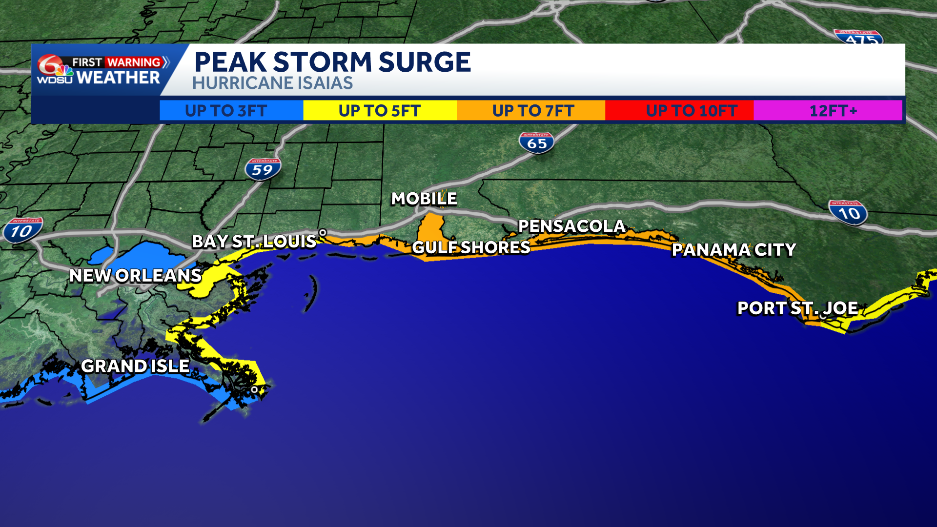
Hearst Owned
Peak Storm Surge
A Storm Surge Warning stretches from the mouth of the Mississippi River to the Steinhatchee River in Florida. This means life-threatening flooding from rising water moving inland is possible. Latest Advisory on Isaias :Time: 1 p.m. WednesdayMaximum Sustained Winds: 50 mphMovement: East-Northeast at 8 mph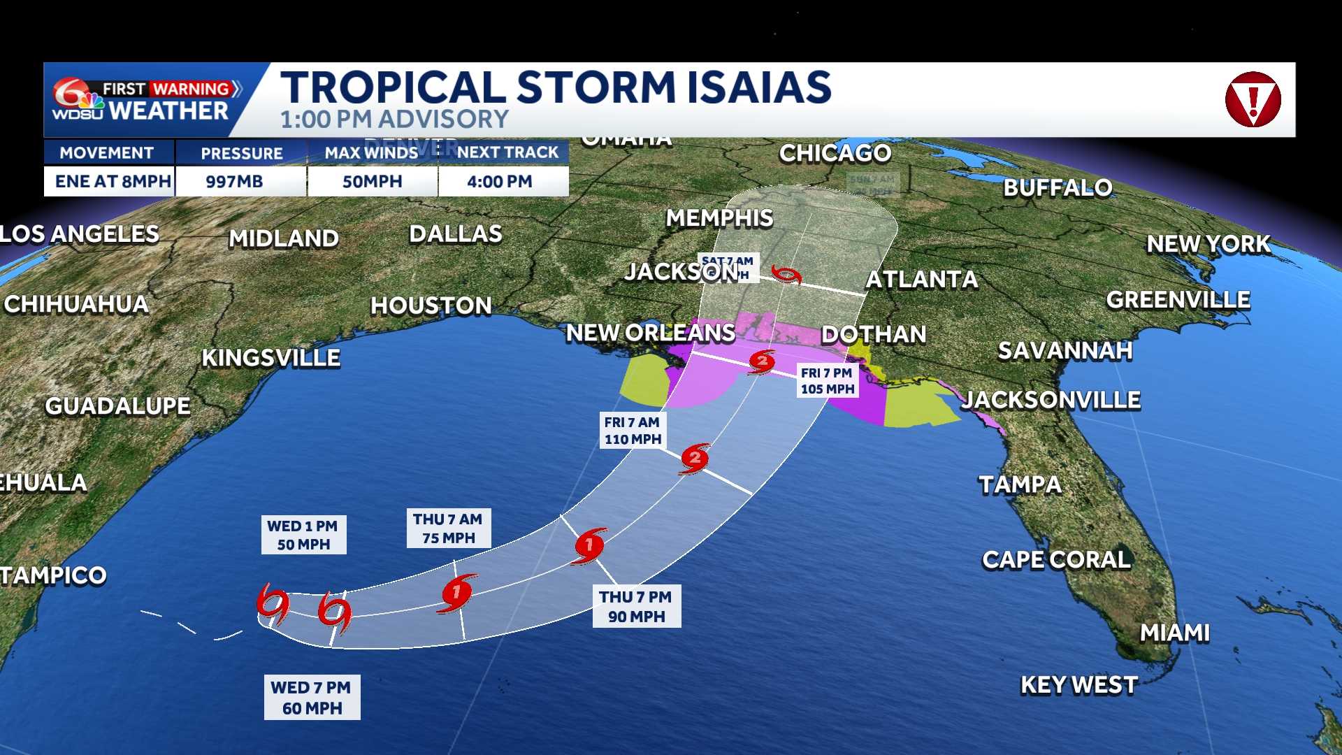
Tropical-storm-force winds extended up to 50 miles from the center.
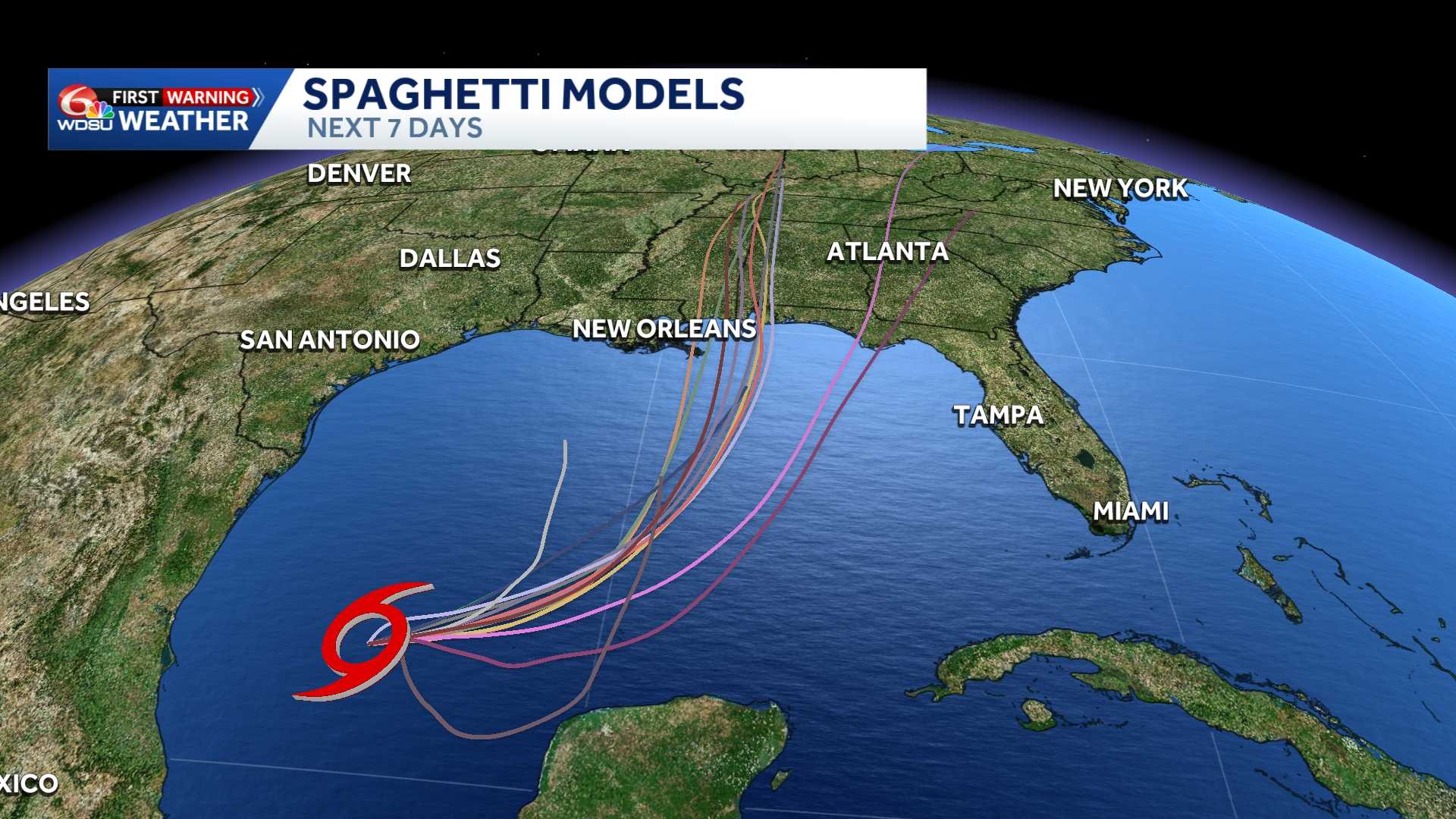
Isaias is expected to continue moving east-northeast Wednesday, then turn northeast and north Thursday and Friday. Its forecast path takes it north of Mexico’s Yucatan Peninsula Thursday before approaching the northern Gulf Coast Friday.
Tropical Impacts: RAINFALL
Friday and Saturday, Isaias could bring 5 to 7 inches of rainfall to Coastal Mississippi, Coastal Alabama, and the Florida panhandle, with localized totals up to 10 inches.
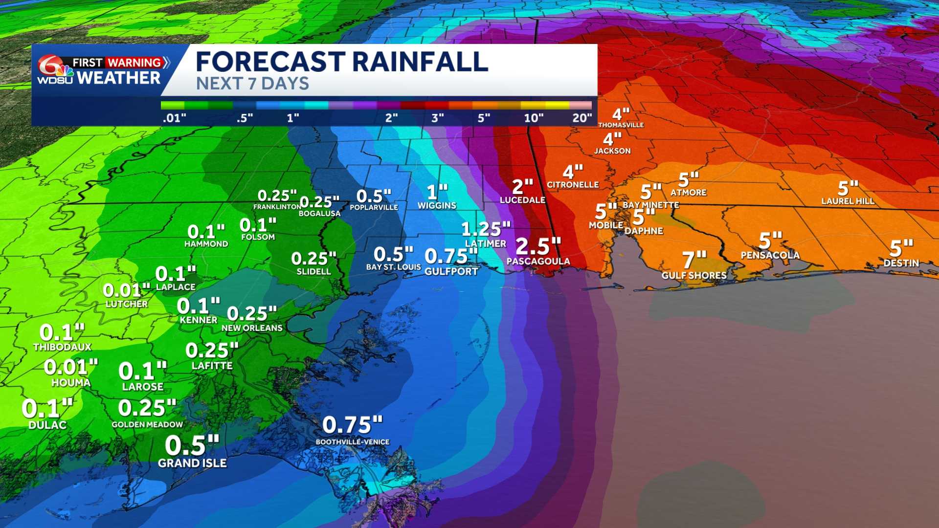
Those amounts are a regional forecast and do not mean every community will receive that much rain. The storm’s track will help determine where the heaviest rainfall develops.
FLOOD RISK
Flash flooding, street flooding and isolated river flooding will be possible.
Dangerous surf and rip currents are also expected along the Gulf Coast late this week.
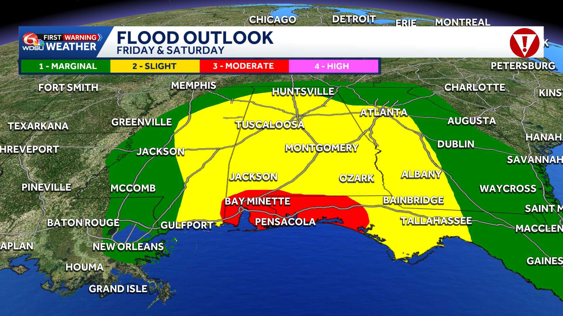
The Weather Prediction Center outlines a level 3 (moderate risk) for flooding for parts of the Alabama, Mississippi, and Florida coastline. Flash flooding is possible to likely in those areas.
SEVERE WEATHER – TORNADO RISK
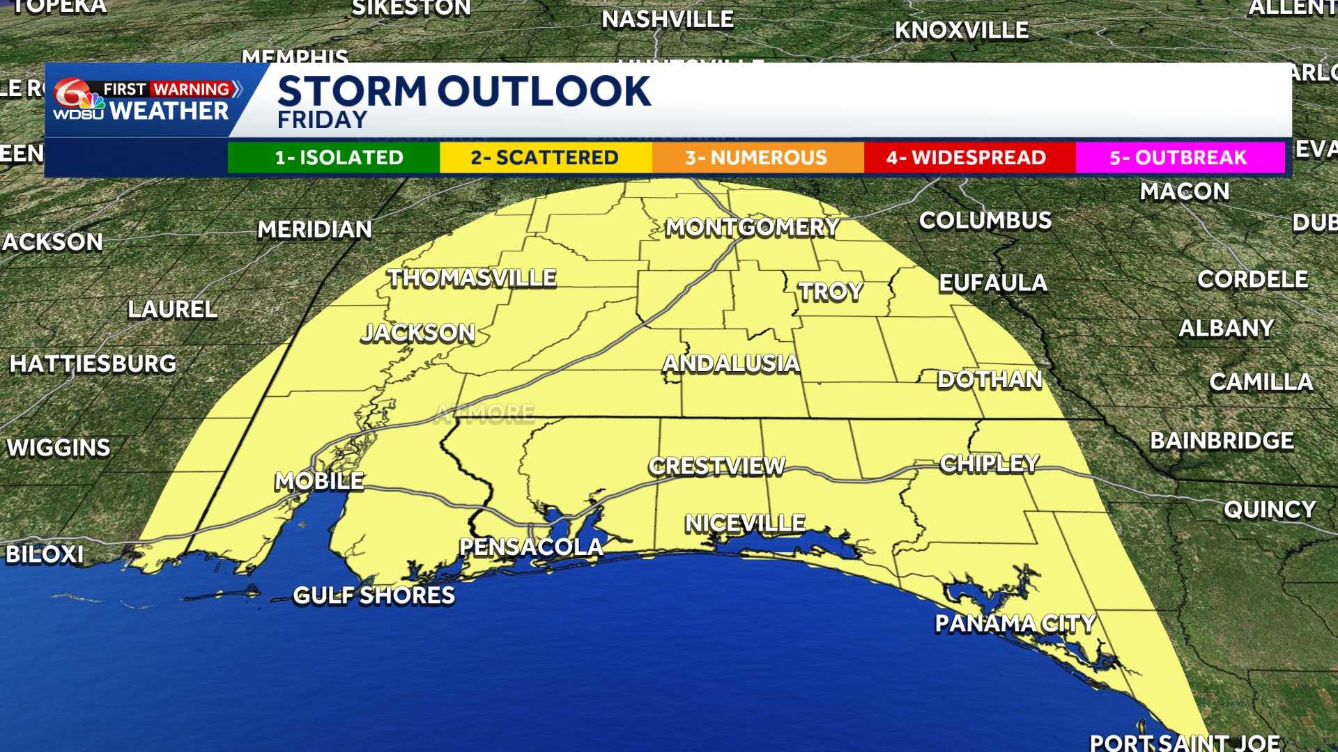
The Storm Prediction Center outlines a level two risk for severe weather for Southern Alabama and the Florida Panhandle Friday into Saturday. The parameter to watch for is tornadoes and waterspouts.
 HURRICANE FORCE WINDS
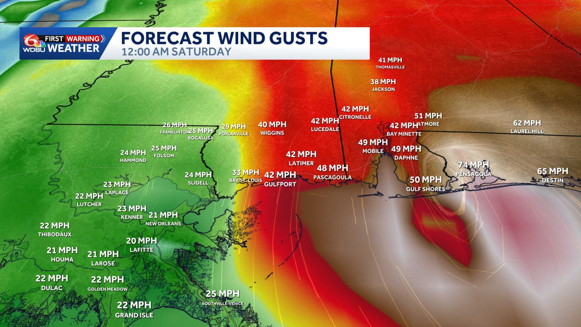
Wind gusts up to 30 mph are possible up Friday night into Saturday, with gusts up to 75 mph along the Alabama and Florida Gulf Coast.
 What to know locally:
Friday and Saturday are WDSU First Warning Alert Days because of the potential for significant weather impacts.
The storm’s track and strength will determine local conditions. Residents should review their hurricane plans, check supplies and follow updates from WDSU First Warning Weather and the National Hurricane Center.
The next complete NHC advisory is scheduled for 4 p.m. Wednesday.
Hurricane Hunters are expected to investigate the system today, providing valuable data that should help refine the forecast.
Related links: