
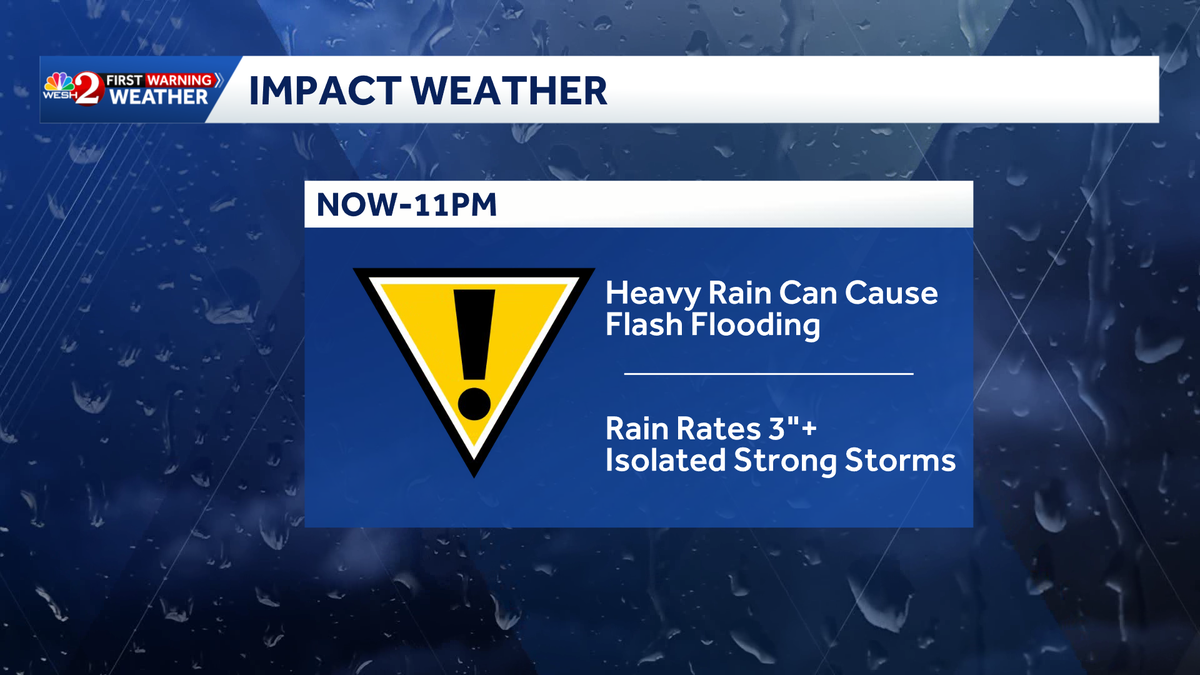

Our wet weather pattern continues across Central Florida this week.
Rain will be on and off throughout the day on Thursday, with heavier downpours and thunderstorms possible this afternoon. A stalled frontal boundary will continue to keep rain chances elevated across Central Florida through the end of the week.
Hurricane Isaias is churning in the Gulf, sending moisture our way. However, the storm is not expected to directly impact Central Florida.
>> Maps, spaghetti models for Isaias
Flood advisory
A flood advisory has been posted for Orange, Brevard, Volusia, Seminole, St. Lucie, Lake, Osceola, Martin, Indian River and Okeechobee counties.
This content is imported from x. You may be able to find the same content in another format, or you may be able to find more information, at their web site.
A flood advisory has been posted for Orange, Brevard, Volusia, Seminole, St. Lucie, Lake, Osceola, Martin, Indian River, Okeechobee- Here’s the radar… pic.twitter.com/VMwKHPAN6u
— Cam Tran WESH (@CamTranTV) October 8, 2026
WESH 2 News
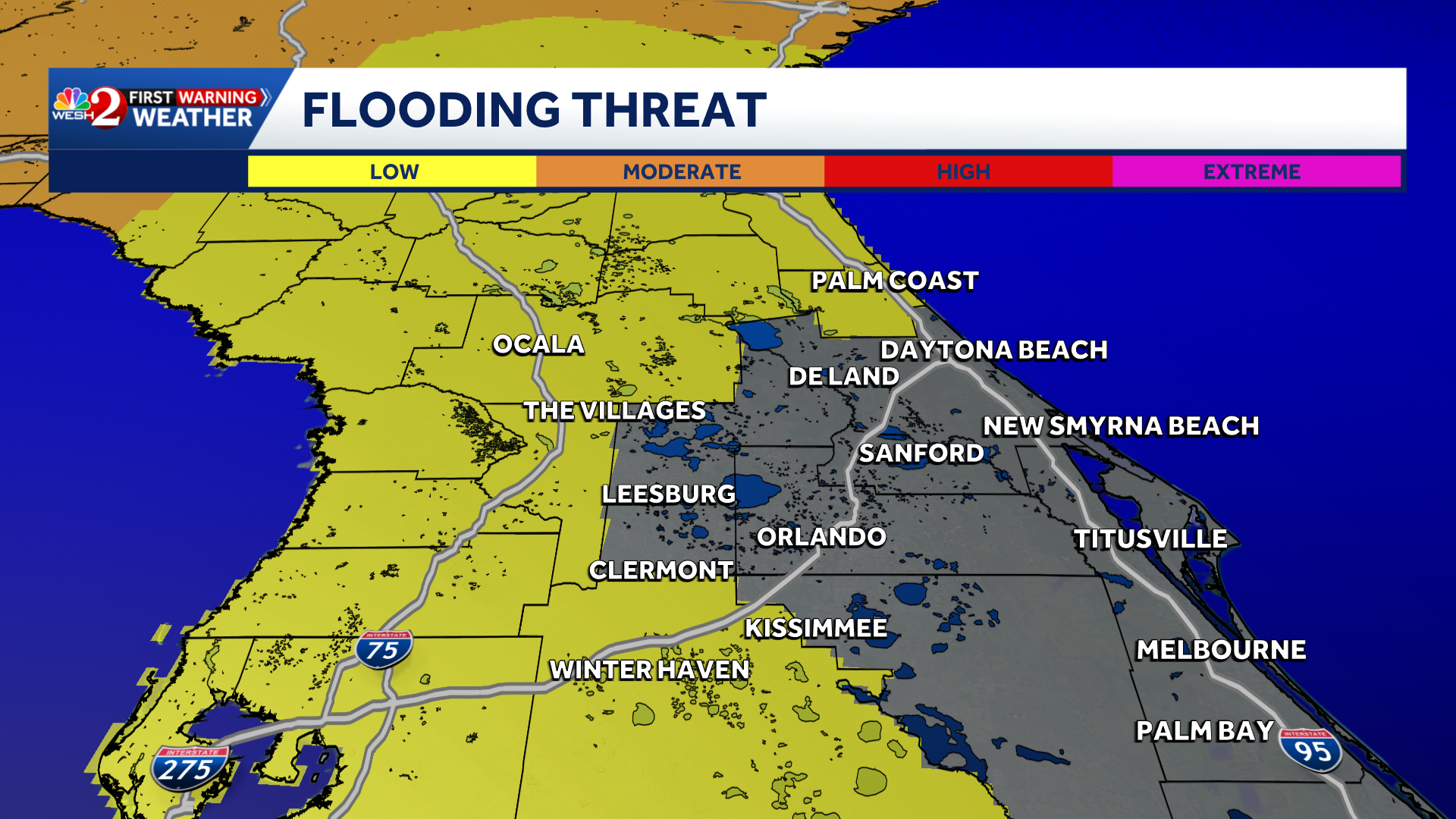
Flood threat Oct. 8, 2026
The First Warning Weather Team is calling for Impact Weather through 11 p.m. Thursday.
WESH 2 News
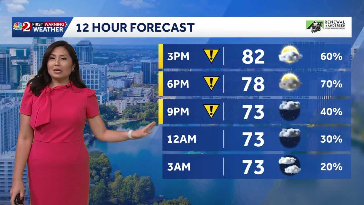
Oct. 8 forecast
Coastal rain
The National Weather Service in Melbourne says a widespread additional 1-3 inches of rainfall is forecast through Saturday night. With a 20-40% chance of a few tallies over 3 inches, especially from Melbourne northward.
This content is imported from x. You may be able to find the same content in another format, or you may be able to find more information, at their web site.
10/8 | Widespread additional 1-3″ rainfall is forecast through Saturday night. With a 20-40% chance of a few tallies over 3″ especially from Melbourne northward, localized flooding is still a risk over the next couple of days. #FLwx pic.twitter.com/IIIndWON4P
— NWS Melbourne (@NWSMelbourne) October 8, 2026
Is the hurricane making it rain in Central Florida?
The NWS says tropical moisture to the east of Hurricane Isaias is keeping rain chances high across Central Florida. The storm is not expected to directly impact Central Florida.
Landfall is forecast along the northern Gulf Coast.
This content is imported from x. You may be able to find the same content in another format, or you may be able to find more information, at their web site.
5:45 AM | A stationary front and rich, tropical moisture to the east of #Isaias will keep rain chances high over Central Florida today. Satellite/radar loop this morning shows showers nearby and the hurricane out in the Gulf. #FLwx pic.twitter.com/BQUP7vZJ0A
— NWS Melbourne (@NWSMelbourne) October 8, 2026
>> Maps, spaghetti models for Isaias
When will the rain clear?
Drier air is expected to move into the region Monday, bringing a break from the unsettled, soggy weather pattern.
This content is imported from x. You may be able to find the same content in another format, or you may be able to find more information, at their web site.
First Warning Weather
Stay with WESH 2 online and on-air for the most accurate Central Florida weather forecast.
Download the WESH 2 News app to get the most up-to-date weather alerts.
The First Warning Weather team includes First Warning Chief Meteorologist Tony Mainolfi, Eric Burris, Cam Tran, Victoria Wisniewski and Luke Vickery.