
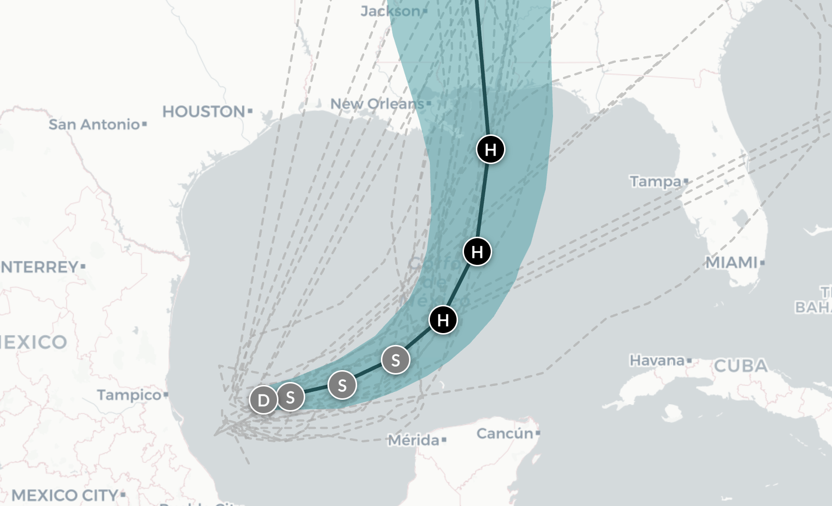
Tropical Storm Isaias formed early Wednesday morning in the southwestern Gulf and is expected to strengthen into a hurricane within hours as it tracks toward the coasts of Louisiana, Mississippi, Alabama or Florida, according to the National Hurricane Center.
Forecasters warned residents close to Isaias’ path are under increasing risk of dangerous wind and storm surge. Flash and urban flooding are possible from Texas to Florida into the weekend. The center of the storm is forecast to be near landfall early Saturday. Impacts could be felt hundreds of miles from the storm’s center, including into the Florida peninsula.
Here’s the latest tracking map, including the spaghetti models, which show the paths generate by various storm forecasting models: