
More Rain And Snow Headed For West
A cold outbreak has plunged deep into the South, with freezing temperatures that are among the coldest so early in the season in Florida and other Southeast states.
Happening Now
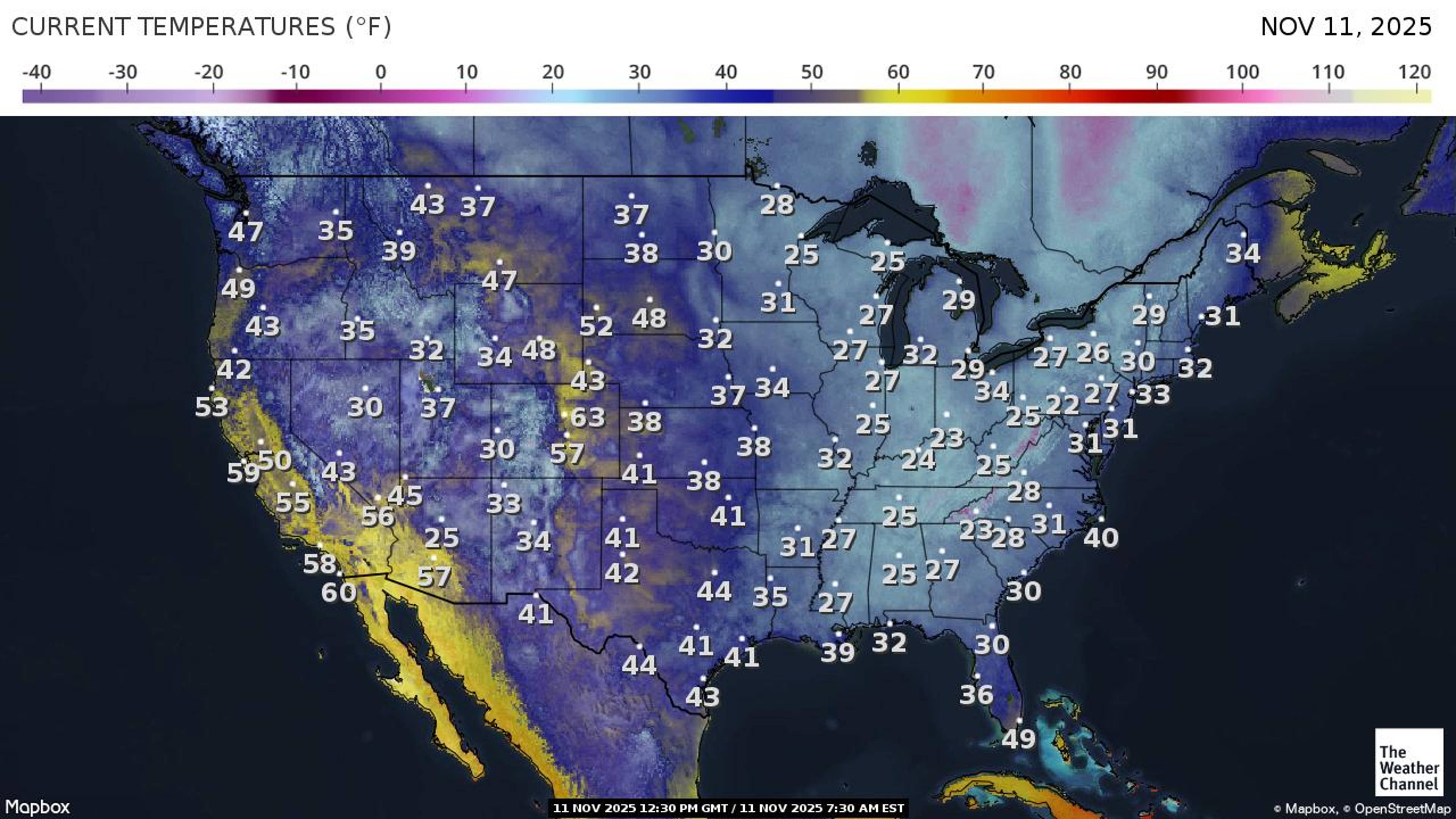
Tuesday morning, freezing temperatures were reported along parts of the northern Gulf Coast into northern Florida.
Pascagoula, Mississippi, and Panama City, Florida, each dropped to 28 degrees. Gainesville, Florida, had its earliest freeze in 17 years, since a record late October cold snap (Oct. 29. 2008).
![]()
Weather in your inbox
By signing up you agree to the Terms & Privacy Policy. Unsubscribe at any time.
Thirties were reported as far south as the north side of Ft. Myers, Florida, upper 40s were reported in the Ft. Lauderdale and Miami metros, and middle to upper 50s chilled the Upper and Middle Florida Keys, respectively.
(MORE: Florida Cold = Falling Iguanas?)
The map below shows what temperatures are like right now.
If that isn’t enough, strong winds have pushed wind chills into the teens and 20s from the Midwest and Northeast into the Deep South. Click here to see the latest wind chills across the nation.
 Cold Records
So far, several daily record lows have been set through Monday mainly in the South, including:
– Pellston, Michigan: 12 degrees Sunday
– Montgomery, Alabama: 26 degrees Monday
– Macon, Georgia, and Waco, Texas: 29 degrees Monday (tie)
– Pensacola, Florida: 33 degrees Monday (tie)
Several cities also tied or set new daily record cold high temperatures Monday, including:
– Buffalo, New York: 29 degrees (tie)
– Chattanooga, Tennessee: 39 degrees (tie)
– Hattiesburg, Mississippi: 52 degrees
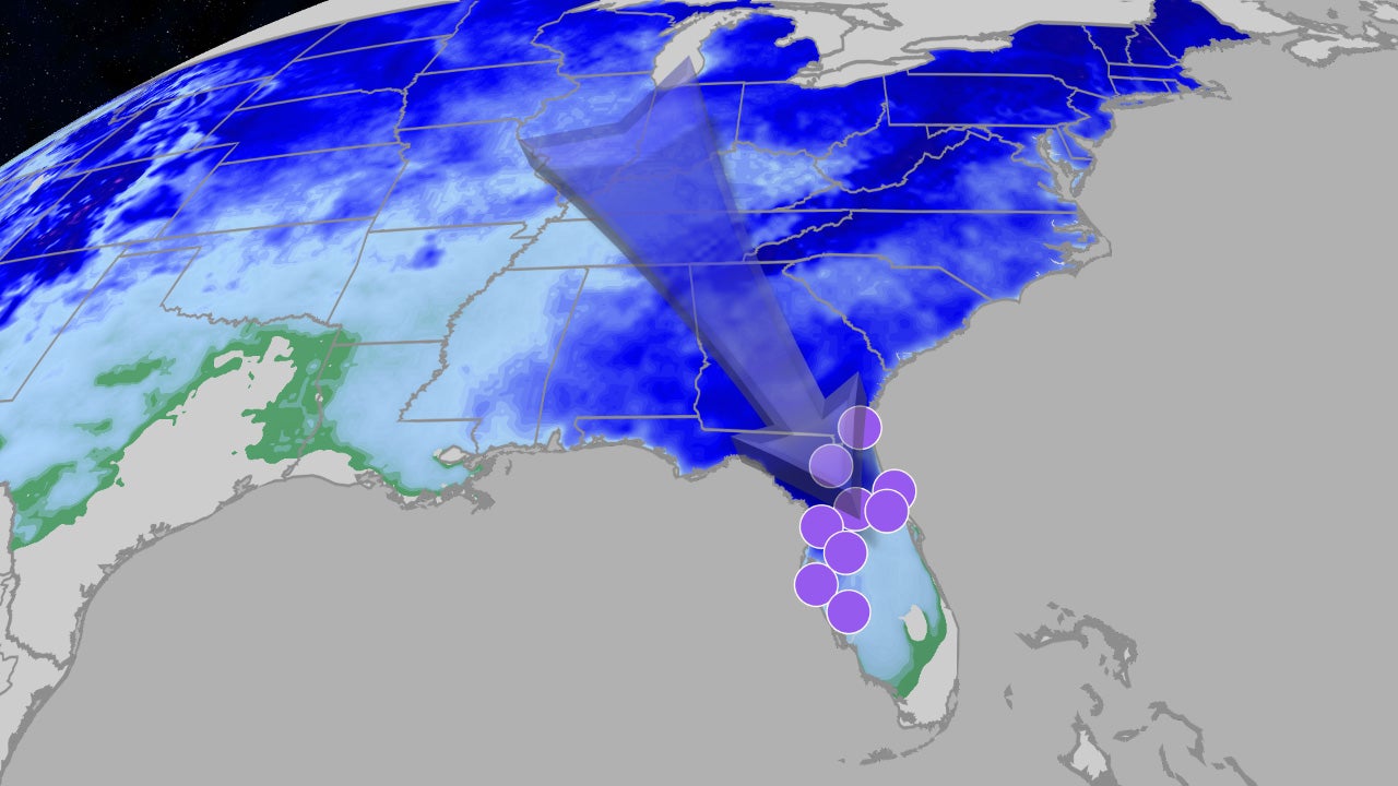
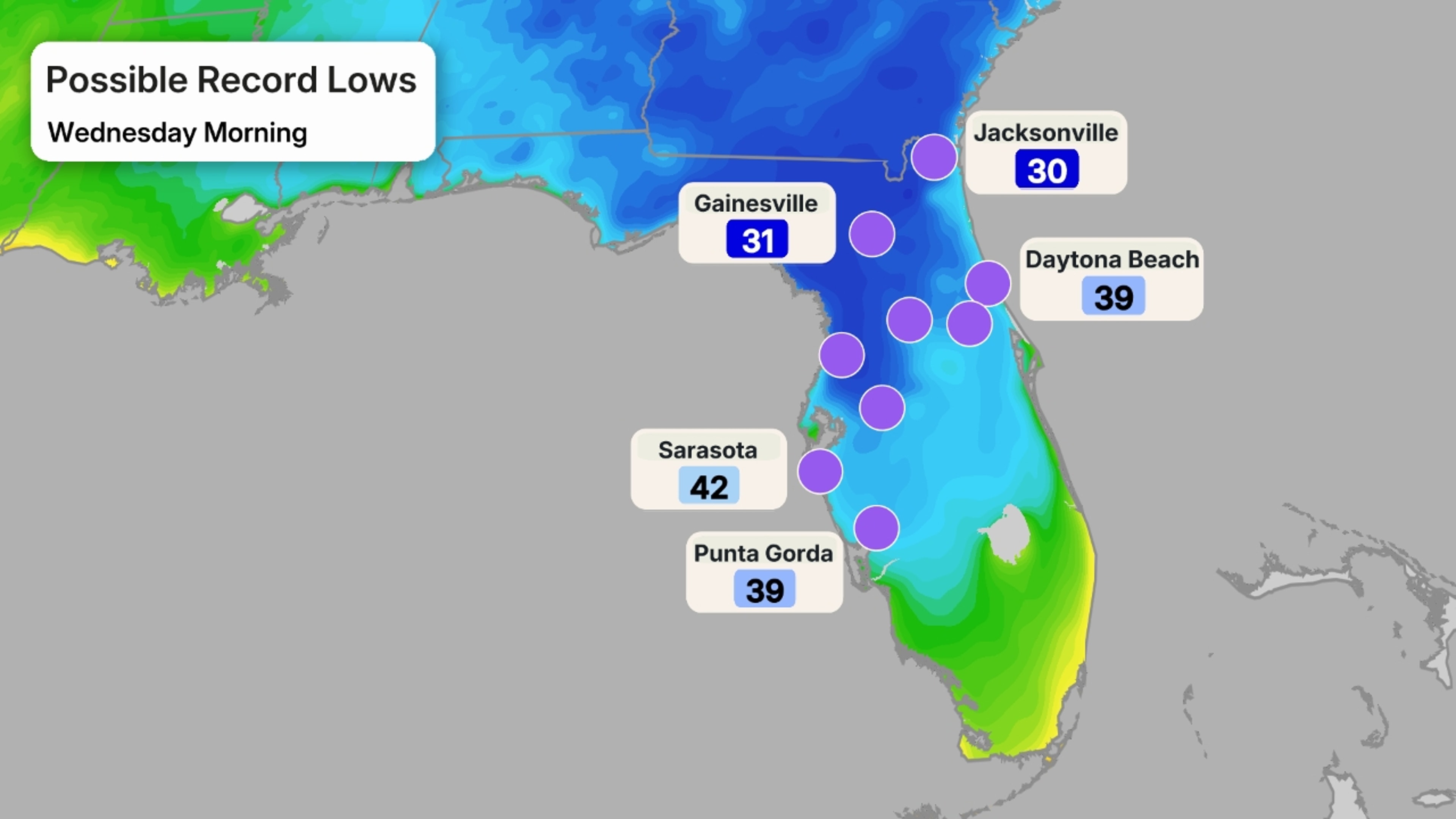
Another widespread freeze is possible across the Southeast from northern Florida to the Carolinas and Virginia Wednesday morning. Make sure to cover or bring inside any plants and tender vegetation.
And that could flirt with daily record lows once again Wednesday morning in about 10 locations in the Florida Peninsula, from Jacksonville to Charlotte Harbor, as shown in the dot map below.
 Cold Days, Too
In most of the Midwest, South and East, these will be the coldest daytime temperatures of fall, so far.
On Tuesday, highs may not reach 50 degrees in the coastal Carolinas, which could set record cold Veterans Day highs. Average highs in Charleston, South Carolina, this time of year are in the low 70s. The Florida Peninsula will shiver, with highs stuck in the 50s as far south as Central Florida, and 60s will be as warm as it gets in South Florida, all likely to set daily records for cold high temperatures.
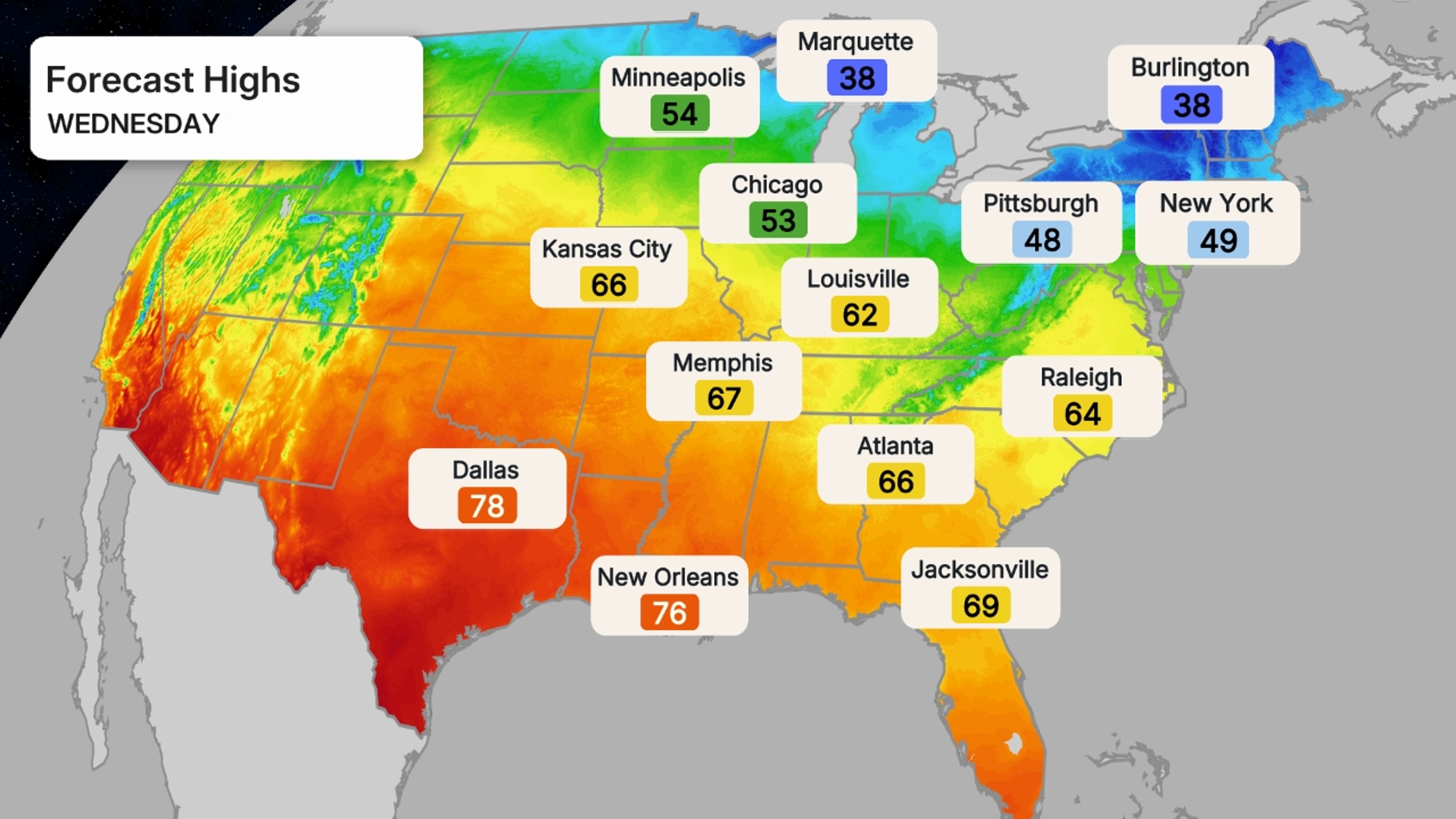
Fortunately, the warm up in the Southeast arrives Wednesday, with highs generally in the 60s and 70s.
(MAPS: 10-Day US Forecast Highs/Lows)
 Some Fall Cold Tips
Given this abrupt cold change after the recent fall warmth, here are some things you may want to keep in mind.
– Pull your winter jacket, hat and gloves from the back of the closet. You’ll need them in this cold blast.
– Make sure the kids are dressed for the cold at any outdoor sports events or just going to school, especially waiting at the bus stop.
– Shut off your outside faucets and drain any garden hoses to avoid any freezing.
(MORE: What November Weather Is Typically Like)
Fleeting Cold
For most, this cold won’t last long.
Milder air will already return to the nation’s mid-section Tuesday. And that milder air will spread through much of the South, then Midwest the rest of this week.
However, the chilly air may be a bit more stubborn to leave the Northeast, as another reinforcing cold front sweeps out of Canada.
(MORE: November Outlook)
Jonathan Erdman is a senior meteorologist at weather.com and has been covering national and international weather since 1996. Extreme and bizarre weather are his favorite topics. Reach out to him on Bluesky, X (formerly Twitter) and Facebook.