
Flash-flooding risk continues with Isaias as it moves toward Tennessee

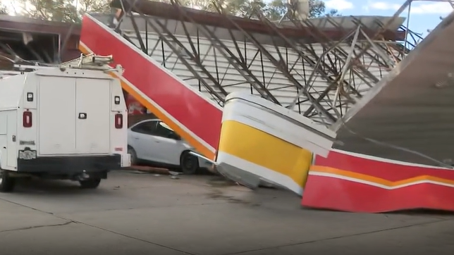
Post-tropical cyclone Isaias continued moving north across the Southeast on Saturday, bringing the threat of heavy rainfall and flooding to parts of the region, according to the National Hurricane Center.
Isaias made landfall near Destin, Florida, as a Category 2 hurricane at 9:30 p.m. on Friday.
It weakened overnight to a post-tropical cyclone as it moved inland, but it continued to bring heavy rain to the Florida Panhandle.
This content is imported from x. You may be able to find the same content in another format, or you may be able to find more information, at their web site.
Where did Hurricane Isaias make landfall?
Hurricane Isaias made landfall near Destin, Florida, at 9:30 p.m. on Friday.
Where is Isaias headed?
As of 11 p.m. Saturday, Isaias’s center was about 75 miles south of Nashville.
The system was moving northeast at 16 mph with maximum sustained winds of 25 mph. That motion is expected to continue on Sunday, according to the NHC.
Little change in strength is forecast during the next 24-36 hours before the cyclone is absorbed by another low pressure system to its east, NHC forecasters said.
How much rain is expected?
Additional Rainfall totals of 2 to 5 inches with localized maximum amounts of 10 inches are possible across the Southern Appalachians from the western Carolinas into western Virginia, according to the NHC.
Additional rainfall totals of 1 to 2 inches possible across the Florida Big Bend and northwest Florida bringing storm totals towards 12 inches, NHC forecasters said.
Rainfall amounts of 2 to 4 inches with localized maximum amounts to 6 inches are possible near the coasts of the Carolinas. Flash, urban, and river flooding is possible across the region, with considerable impacts, including landslides, possible across the southern Appalachians, the NHC’s website states.
Significant river flooding across the western Florida Panhandle will crest Saturday through Sunday, according to the NHC.
Flood watches in effect for:
Portions of the Southeast United StatesSouthern Appalachians
High wind warning in effect for:
Portions of the Southern Appalachians
Wind advisory in effect for:
Portions of the Southeast and Southern AppalachiansGov. DeSantis gives post-hurricane updatesRadar
>> Videos below: Winds slam Pensacola
>> Download the WESH 2 app to stay up-to-date on breaking news and weather
Tony Mainolfi in Pensacola
First Warning Chief Meteorologist Tony Mainolfi is in Pensacola covering the storm.
RESOURCES | HURRICANE SEASON SPECIAL | WESH LONG-RANGE FORECAST | WHAT TO KNOW ABOUT INSURANCE | GENERATOR SETUP | TESTING CHAINSAWS | POST-STORM RESOURCES | DOWNLOAD WESH 2 APP | HURRICANE SUPPLIES | SURVIVAL GUIDE
Tracking the Tropics
Stay with WESH 2 online and on-air for the most accurate Central Florida weather forecast.
Download the WESH 2 News app to get the most up-to-date weather alerts.
The First Warning Weather team includes First Warning Chief Meteorologist Tony Mainolfi, Eric Burris, Cam Tran, Victoria Wisniewski and Luke Vickery.
>> 2026 hurricane season | WESH long-range forecast
>> Download Very Local | Stream Central Florida news and weather from WESH 2