
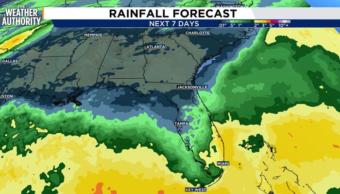
JACKSONVILLE, Fla. – High pressure will remain in control today, which means we will see plenty of sunshine and comfortable temperatures.
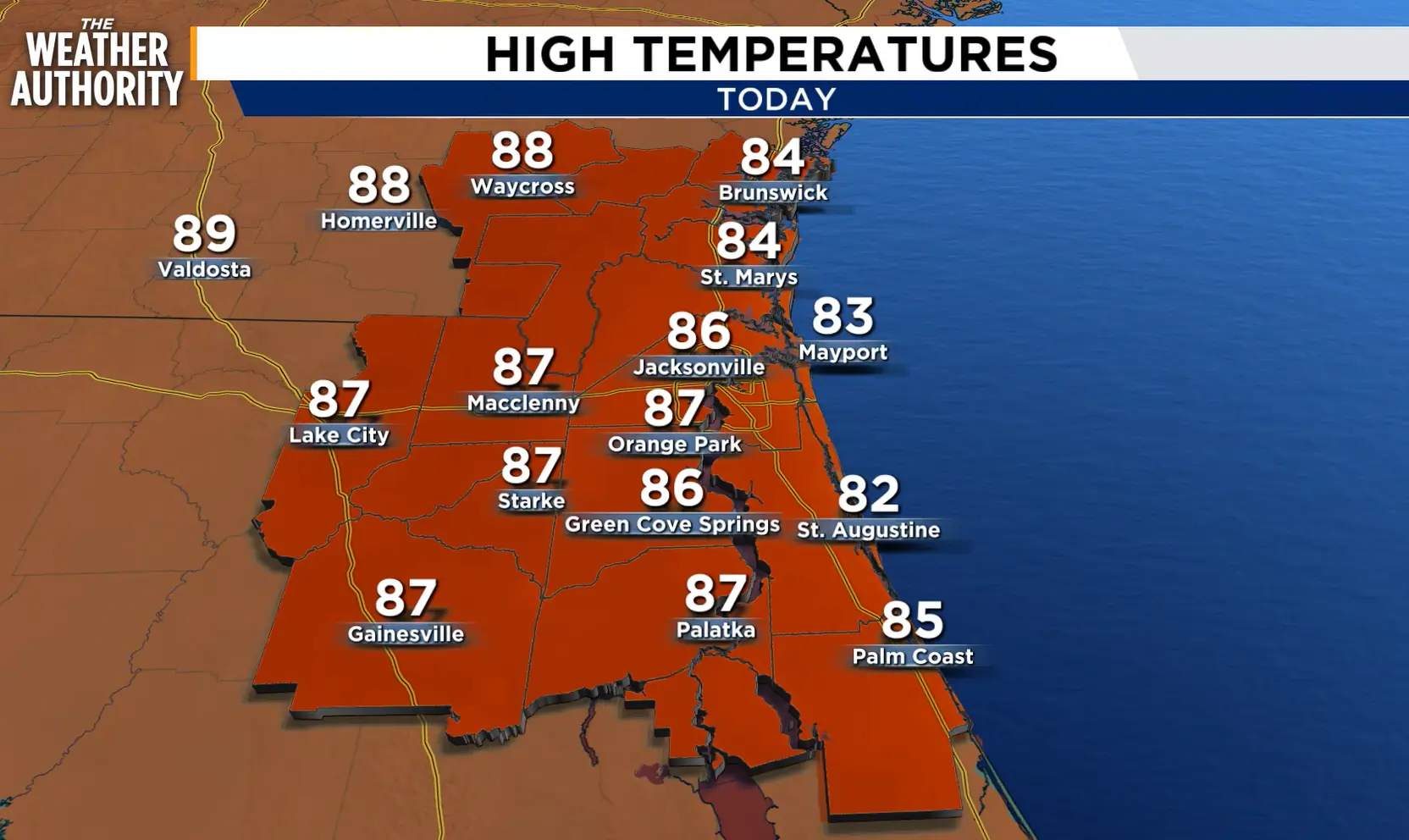 Today’s forecast.
Highs for the day will be in the 80s. The humidity will remain comfortable thanks to the northeasterly wind. With drier air overhead, we are not expecting any rain or storms.
High pressure will remain overhead through Friday, which will keep our area generally sunny and dry. Highs each day will be in the 80s.
 This weekend’s forecast.
A front will cross our area on Friday and stall to our south over the weekend. This front will usher in cooler temperatures this weekend into next week with highs in the 70s.
A few isolated showers and storms are possible as an area of low pressure develops off our coast.
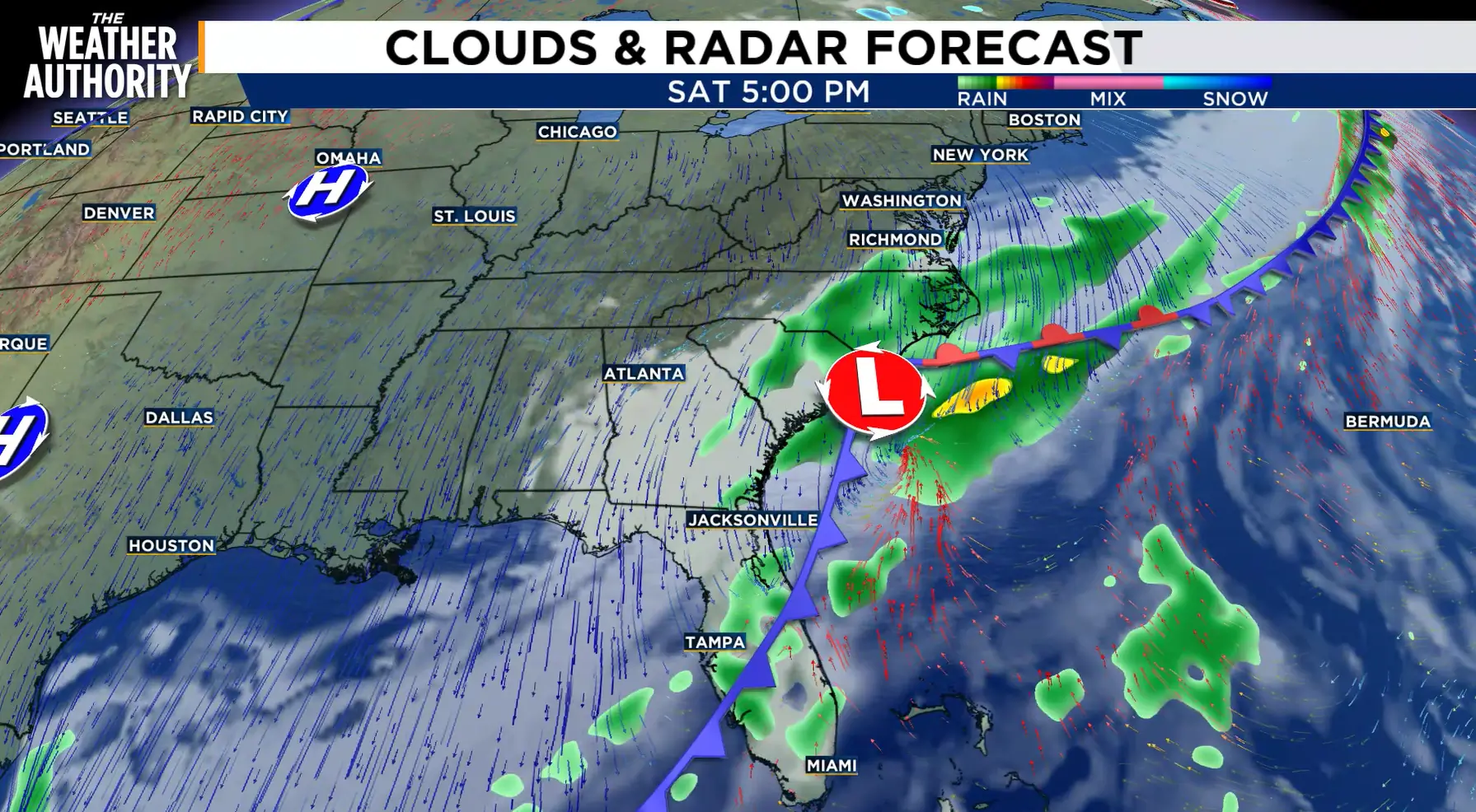 This weekend’s surface map.
Due to an area of high pressure to our north and the area of low pressure nearby, it will turn windy during this timeframe. Winds could gust up to 40 mph at times.
The stronger northeasterly wind will bring coastal hazards to our area. These include tidal flooding, rough surf and a higher risk for rip currents.
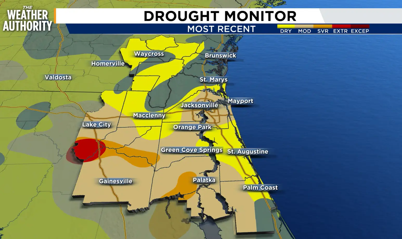 The latest drought monitor.
Regarding the drought, the latest drought monitor reflects improvement across our area. Several areas have been removed from a drought category, which reflects the significant amount of rainfall we saw over the past week.
TODAY: Mostly Sunny. High 86, Low 68.
FRIDAY: Sun & Clouds. Breezy. High 87, Low 68.
SATURDAY: Mostly Cloudy. Mainly Dry. Windy. High 75, Low 62.
SUNDAY: Mostly Cloudy. Isolated Rain & Storms. Windy. High 73, Low 63.
MONDAY: Partly Cloudy. Isolated Rain & Storms. Windy. High 77, Low 65.
Copyright 2026 by WJXT News4JAX – All rights reserved.