
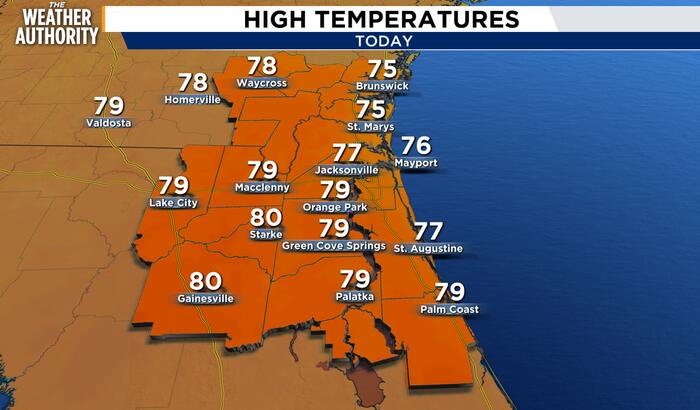
Sunshine and comfortable temperatures headline our Wednesday forecast, but coastal hazards remain a big part of the weather story. Highs will reach around 77° with northeast winds at 9–14 mph, gusting to 20 mph. Tonight will be clear and cool, with temperatures falling to around 56° as winds ease.
A high risk of rip currents continues along Northeast Florida and Southeast Georgia beaches, with breakers of 3–5 feet, rough surf and some beach erosion possible. This includes St. Simons Island, Fernandina Beach, Jacksonville Beach, St. Augustine Beach and Flagler Beach. Despite the sunshine, swimming conditions remain dangerous, and the safest advice is to stay out of the ocean.
Minor tidal flooding is also a concern around high tide, mainly within the St. Johns River Basin, the Intracoastal Waterway and portions of the Northeast Florida coast, including Flagler County. A Coastal Flood Advisory is in effect for the highlighted areas, with inundation of 1.5–1.8 feet above normally dry ground possible in vulnerable locations. Low-lying roads, parking lots and parks may flood, with isolated road closures possible. This concern may persist into late week, with coastal flooding impacts expected to increase this weekend as another surge of onshore winds coincides with higher tides near the full moon.
Thursday stays sunny with a high near 76°, northeast winds at 6–11 mph and gusts to 16 mph. Thursday night will be clear with a low around 58°. Friday remains sunny with a high near 75°, but breezy conditions return. A slight chance of showers develops late Friday night, with rain chances at 20% and a milder low near 65°.
Saturday brings the greatest rain chances in the forecast, along with windy conditions. Showers become likely, with a possible thunderstorm during the afternoon and a high near 73°. Rain chances increase to 70% Saturday and remain at 60% Saturday night, with the greater coverage favored into the evening before tapering overnight. Sunday stays windy with a 40% chance of showers, some sunshine and a high near 74°.
Looking ahead to early next week, rain chances decrease to 20% Monday and Tuesday, with mostly sunny skies and highs in the mid-70s. Winds remain elevated, with windy conditions Monday becoming breezy Tuesday. Our main messaging: enjoy the dry, mild weather through Friday, keep coastal safety front and center, and plan for a windy weekend with the best chance of rain Saturday.
Copyright 2026 by WJXT News4JAX – All rights reserved.