
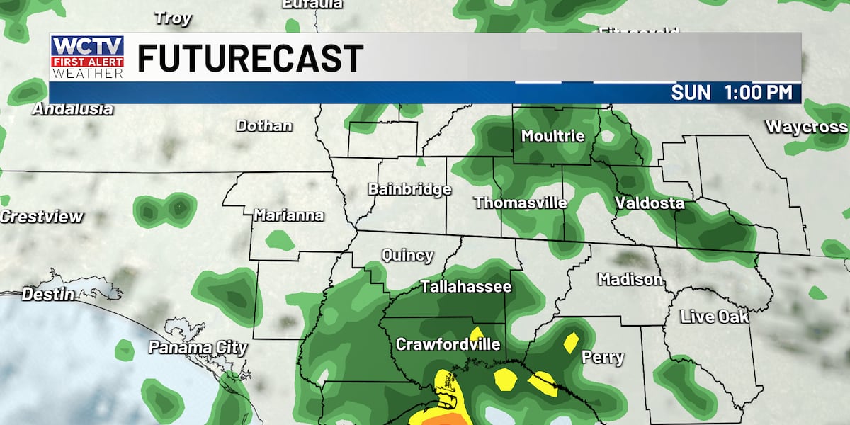
TALLAHASSEE, Fla. (WCTV) – Radar is looking active this morning, with showers slowly drifting into the area. Plan on occasional showers throughout your Sunday, but not a washout.
Breezy with showers
Grab the raincoat as you head out the door this morning. The best chance of rain will be between mid-morning and mid-afternoon. If you plan to be out and about, you will probably need to dodge a few showers and some downpours.
There will definitely be a break, even if you end up underneath a shower for longer than 30 or 40 minutes! While it is not necessary to cancel outdoor plans, I would definitely have a backup plan in case you need to bring activities inside.
Rain totals should be under 0.50″ for most spots. A few spots could get 1.0″ or more. However, that should be isolated. No severe weather risk.
Outside of rain, today is looking mostly cloudy with highs in the mid-70s, not changing much throughout the day. Breezy with east winds 8 to 18 mph. Gusts to 25 mph.
Eyeing midweek
High pressure will build in by Tuesday, keeping the rain chances more hit or miss Monday afternoon and Tuesday. Highs will get into the low 80s again with a mix of sun and clouds.
Rain and thunderstorms return midweek. Warm and humid with highs in the low 80s. Most of Wednesday and Thursday should be dry with some sunshine. The risk of rain is late in the day on Wednesday into the overnight through Thursday morning.
Friday and next weekend, drier air will push in, which should give us a much better weekend, weather-wise. Highs in the upper 70s and lows in the 50s.
Beach and Boating
Water temperature: 74
Sunday: Occasional showers likely. An isolated thunderstorm is possible. East winds 20 to 30 knots. Waves 4 to 6 feet. Choppy to rough on the bays and protected waters.
Monday: A few morning showers. East winds 20 to 30 knots. Waves 4 to 6 feet. Choppy to rough on the bays and protected waters.
Tuesday: Not as breezy with an isolated shower. East winds 15 to 20 knots, diminishing to 10 to 15 knots in the afternoon. Still choppy on the bays and protected waters.
To stay updated on all the latest forecasts and weather, follow WCTV First Alert Weather on Facebook and X (Twitter).
Click here to see all the latest weather headlines and here to view the First Alert Radar. Receive push alerts and watch the latest forecast anytime on the free WCTV First Alert Weather app. Click here to download it now.
Interested in becoming a WCTV First Alert Weather Watcher? Click here to join the team!
Copyright 2026 WCTV. All rights reserved.