
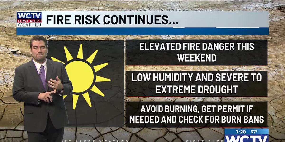
TALLAHASSEE, Fla. (WCTV) – The mostly dry weather that we love so much in the Sunshine and Peach State has been going on for a bit too long. The drought is persisting, and the lack of rain continues to impact crops. In addition, fire danger is on the rise with the lower humidity to start the weekend.
Fire danger this weekend
For Saturday, fire danger will be moderate for the coast, and inland Florida communities will have moderate to high fire danger. In South Georgia, very high to extreme fire danger is forecast today. A piece of good news, the winds will not be strong, so fires will not spread quickly if they are started today. Try to avoid burning if you can; otherwise, obtain a permit.
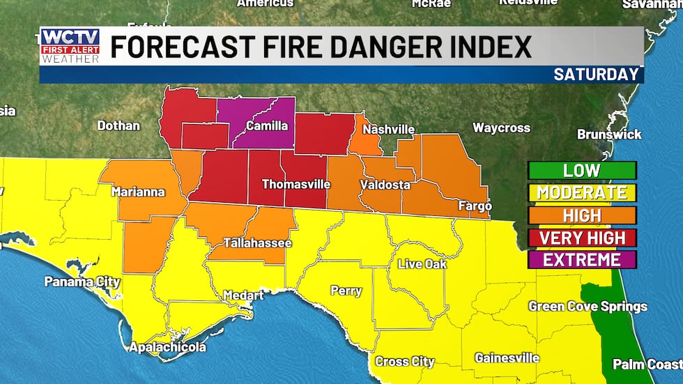 A high to very high fire danger risk for the area on Saturday due to lack of rainfall.(WCTV)
Sunday afternoon winds will start to pick up, but the humidity will also start to increase. That being said, there will still be an elevated fire risk due to the lack of significant rainfall for much of the area.
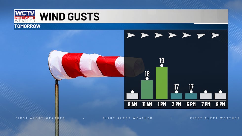 Breezy at times Sunday afternoon as a cold front approaches from the north.(WCTV)A nice Saturday ahead
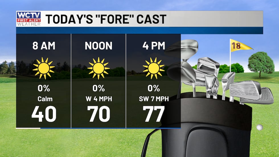
Now, to the good part of the forecast. Temperatures will reach the upper 70s this afternoon with sunny skies. Winds out of the south around 5 mph. Saturday should be a good day for boaters to hit the Gulf waters or inland rivers. Temperatures will fall into the 40s overnight, still cool but not as chilly as recent nights.
 Plenty of sun this afternoon with highs near 80 degrees.(WCTV)A backdoor front on Sunday
A cold front will approach the area on Sunday evening, increasing clouds for the second half of your day. Otherwise, mostly to partly sunny skies. A high temperature of around 80 degrees. Breezy at times with winds 8 to 18 mph, gusts to 25 mph. A moderate chop on the protected waters. Gulf waves 1 foot or less.
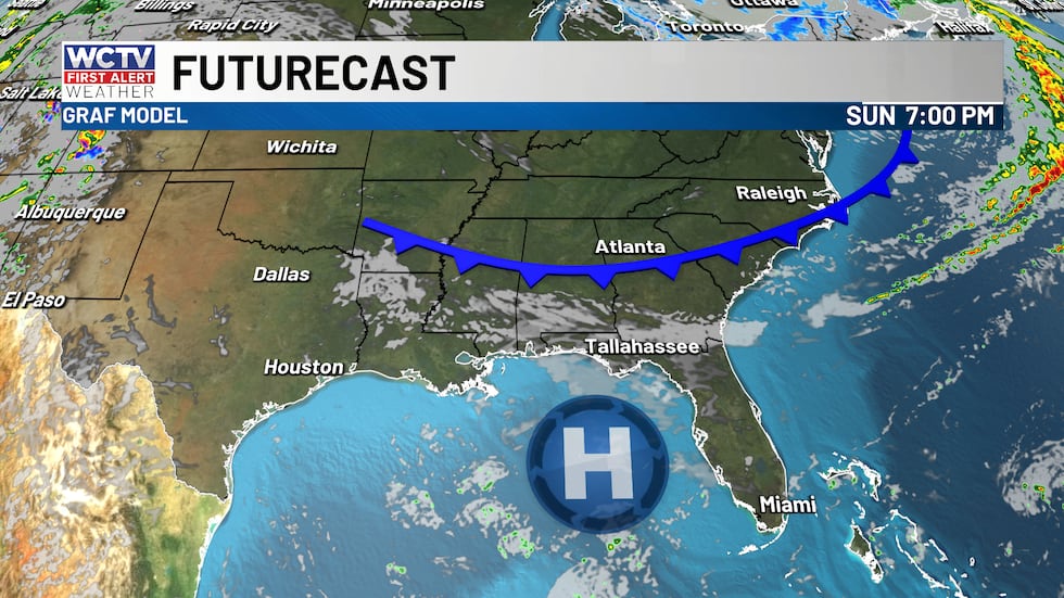 A cold front will approach the area on Sunday. No rain is expected from it, just afternoon clouds and breezy conditions.(WCTV)Staying warm next week
Above average and dry next week with highs in the low 80s. Lows in the 40s and 50s. Rain chances look a little more promising next weekend as a cold front approaches the area. It is too early to get specific on impacts and amounts, but I do not see this being a big-time rain. But we will take whatever drop of rain we can.
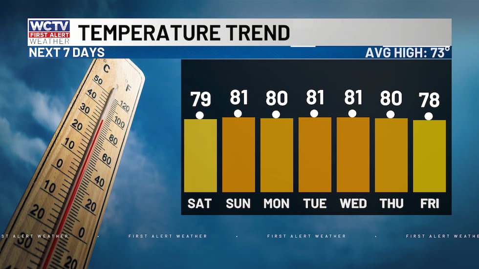 High temperatures will be staying above average for the next week.(WCTV)
⬇️You can watch First Alert Daily above. If you want to stay updated with the weather 24/7, check out First Alert Weather Now.⬇️
To stay updated on all the latest forecasts and weather, follow WCTV First Alert Weather on Facebook and X (Twitter).
Click here to see all the latest weather headlines, and here to view the First Alert Radar. Receive push alerts and watch the latest forecast anytime on the free WCTV First Alert Weather app. Click here to download it now.
Interested in becoming a WCTV First Alert Weather Watcher? Click here to join the team!
Copyright 2025 WCTV. All rights reserved.