
TALLAHASSEE, Fla. (WCTV) – Staying calm over the next several days.
Tonight and tomorrow:
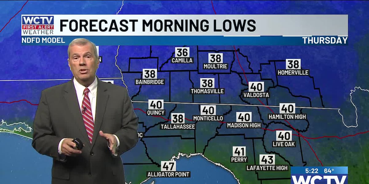
Another chilly night is expected across the Big Bend and South Georgia, with morning temperatures falling into the low to mid-30s. Mostly clear skies with some passing clouds overnight. A few areas of patchy frost are possible.
A cold front will slide by early tomorrow morning. Temperatures will slowly rise in the afternoon and will be cool and sunny. Highs in the upper 50s to low 60s.
Friday and the weekend:
Temperatures will climb to above-average highs as we get ready for the weekend, as winds shift from north to south. Highs on Friday near 70 with mostly sunny skies.
70s on Saturday and Sunday with partly sunny skies as another cold front approaches the Big Bend and South Georgia. The front will likely NOT bring any rain with a lack of meaningful moisture, just a few clouds.
⬇️You can also keep track of the weather 24/7 with WCTV First Alert Weather Now:⬇️
To stay updated on all the latest forecasts and weather, follow WCTV First Alert Weather on Facebook and X (Twitter).
Click here to see all the latest weather headlines and here to view the First Alert Radar. Receive push alerts and watch the latest forecast anytime on the free WCTV First Alert Weather app. Click here to download it now.
Interested in becoming a WCTV First Alert Weather Watcher? Click here to join the team!
Copyright 2025 WCTV. All rights reserved.