
An approaching cold front will bring breezy conditions to Central Florida on Monday with a small chance for showers, according to the National Weather Service in Melbourne.
The cold front will slide across the Florida peninsula and offshore into the Atlantic by Tuesday with northeast winds from 10-15 mph and gusts from 20-25 mph possible, especially along the coast, the NWS stated.
The kicked-up winds will make beachgoing and boating rough through Tuesday.
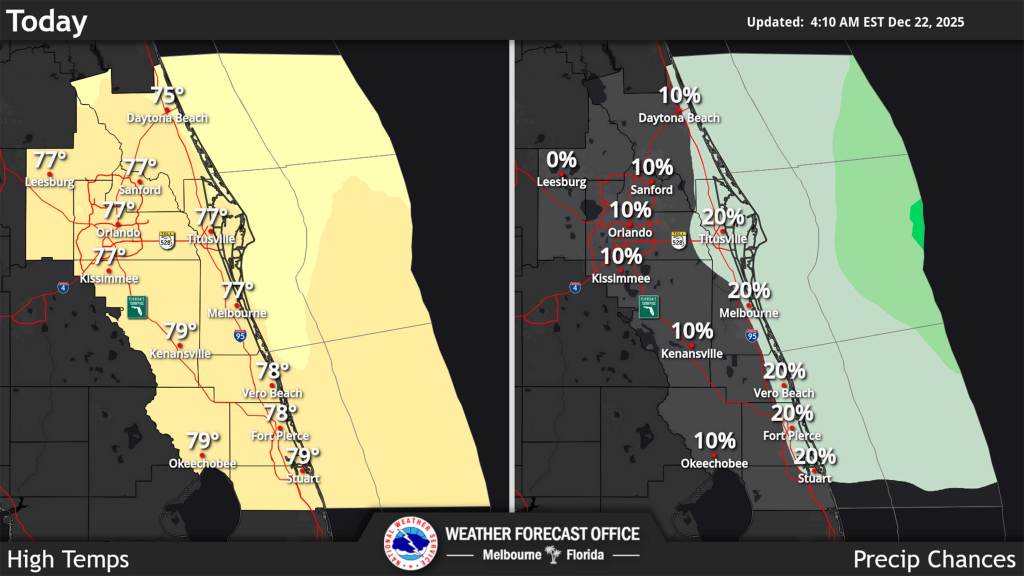
The front isn’t dropping temperatures significantly, though, on Monday as they remain slightly above normal with highs in the mid to upper 70s and overnight lows in the 60s for most of the region through Tuesday. Cooler air on Tuesday night will then drop temps into the 50s.
Some shower activity offshore could venture inland in the afternoon, but that activity will shift south with the front headed into South Florida by early Tuesday morning.
That will allow drier air to filter into Central Florida through Tuesday.