
TALLAHASSEE, Fla. (WCTV) – After some morning fog, skies clear and warm rapidly for Christmas Day. More warmth for the holiday weekend.
🎄A near-record warm Christmas:
Luckily any fog from this morning burned off rather quickly, leading to decent travel this morning for most of the Big Bend and South Georgia. Turning to this afternoon, no weather impacts are on the table, just a LOT of good food.
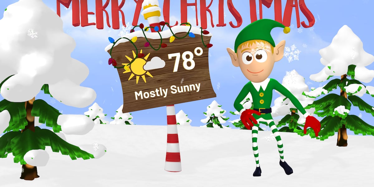
Do not forget the sunglasses as you head to your Christmas destination, as there will be plenty of sunshine. We are still looking like a very warm afternoon. The thermometers reach the upper 70s, some spots will be near 80.
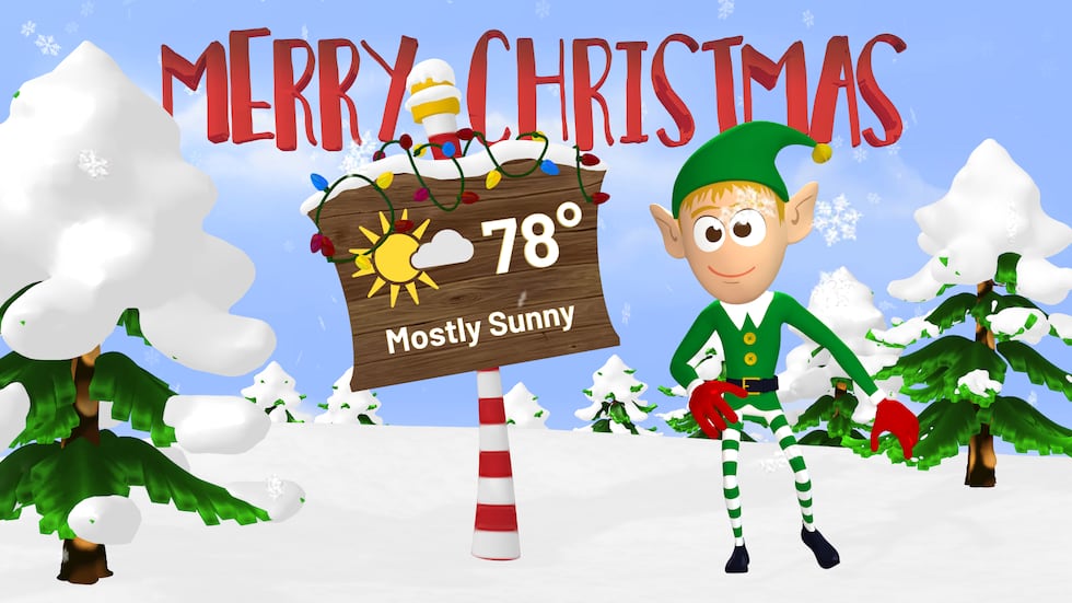 A warm and bright Christmas for North Florida and South Georgia.(WCTV)
The record high for Tallahassee of 82 degrees was set in 2016. Apalachicola’s record is 79, which was set in 1984.
Another fun Christmas fact is how the highs have fluctuated over the past 5 years. This year, the forecast is in the upper 70s. Every other year prior has been in the 70s with alternating colder years, including 2020 and 2022 in the 40s. Will next year be another cold one?
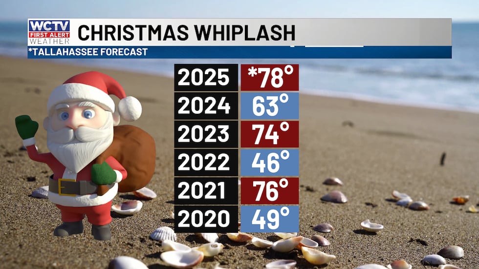 Alternating warm and cold days for the Christmas holiday over the last five years.(WCTV)🌫️Friday Fog:
For those traveling on Friday the weather will be good across most of the southern U.S. There is a chance that some thick fog sticks around for your morning drive or flight along I-10 and to the Gulf Coast.
Clouds and fog should break by midday at the latest, becoming mostly sunny in the afternoon. High temperatures should reach the mid to upper 70s for most. 60s near the coast.
🌥️Weekend Warmth:
More fog on Saturday and Sunday mornings as the Gulf high pressure scoots into a more favorable position for onshore flow. That should keep overnight temperatures rather mild for late December in the 50s. Fog and low clouds will develop and stick around a bit longer in the day.
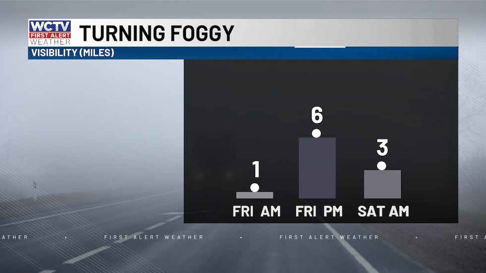 Fog will be thick tonight through the weekend.(WCTV)
I would prepare for mostly cloudy skies for the first half of the day, before some sun breaks out in the afternoon. Afternoon highs warm in the 70s.
🥶Winter whiplash:
A strong cold front will arrive on Monday which will bring a few showers (30% chance) to the Southeast and Gulf Coast. The front will knock temperatures back down to winter-like cold. Highs in the 50s and lows in the 20s and 30s early to middle of next week.
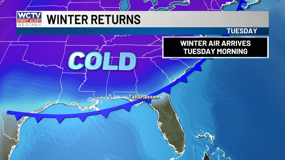 Next week a cold front will bring much cooler air back to the region.(WCTV)
Get weather updates 24/7 with WCTV First Alert Weather NOW while you enjoy the holiday music below. 🎶🎄
To stay updated on all the latest forecasts and weather, follow WCTV First Alert Weather on Facebook and X (Twitter).
Click here to see all the latest weather headlines and here to view the First Alert Radar. Receive push alerts and watch the latest forecast anytime on the free WCTV First Alert Weather app. Click here to download it now.
Interested in becoming a WCTV First Alert Weather Watcher? Click here to join the team!
Copyright 2025 WCTV. All rights reserved.